Gallia Mine River Access to Forks of Salmon Wild
Linked via: Proximity 98% confidence Synced 6mo ago
Gauge Conditions
Runnable: 3,200.0 – 5,500.0 CFS
The NF Canyon can be run below 3200 cfs on the Somes Bar gauge but becomes increasingly technical and rocky. Above 5500 cfs, the run gets pushier but pads out
Data from American Whitewater & USGS
Run Map
Put-in
Take-out
Rapids/Hazards
Wild
Recreational
Run Time Estimate
Select put-in and take-out to estimate time.
Unlock Advanced Trip Planning
See wind-adjusted speed maps, forecast planning, and detailed time estimates.
Sign in to generate an AI timing estimate for this run.
Whitewater timing varies with scouting, portages, and group pace. Use as a planning baseline.
Description
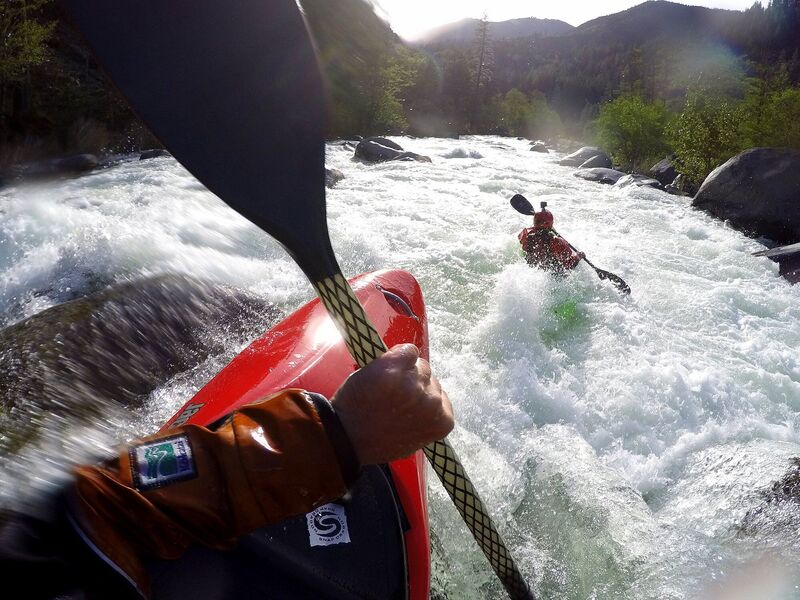
Advanced paddlers looking for a high-quality, under-the-radar Class IV(V) adventure will appreciate the 11-mile Canyon Run on the North Fork Salmon River (Karuk: Masúhsav), from the Gallia Mine access to Forks of Salmon. Though it sees less traffic than other runs in the watershed, it really shines when flows range from 4,500 to 7,000 cfs at the USGS Somes Bar gage. Comparable in difficulty to the more popular South Fork Gorge Run, this stretch is steeper, more continuous, and has a grweater diversity in its style of drops. Overall, it is defined by its silver granite boulder gardens and ledge drops. Most boaters take-out after 6.5 miles at Saw Pit Flat to avoid the Class V Indian Point Gorge downstream and keep the overall run difficulty in the Class IV range.
After a 3/4-mile-long warm-up below the Gallia Mine put-in, the river begins to drop and its pace is steady as the it flows through numerous granite boulder gardens and ledge drops for the next five miles. The abundance, diversity, and quality of the rapids in this reach is outstanding and although it is pool-drop, the main rapids keep coming without long sections of doldrums. At higher flows, the river really rallies along. Much of this reach can be boat-scouted by experienced paddlers, but if you don't know the run or if there have been recent high flows, be sure to scout Boulder Gulch and some of the other larger drops with blind horizon lines. Recent wildfires have resulted in an increase in wood moving down the North Fork Salmon and the river is small enough to catch and hold wood in places. Read the feature descriptions below and fully avoid the river left side channel below Kanaka Falls at Red Bank: it is full of strainers.
To get a good taste of this run without some of the larger rapids, put in at the Red Bank River Access using the short spur road just upstream of the campground (near road milemark 7.5). There ares still some great rapids--including some of the larger ones--but this takes out Boulder Gulch, Thomains, and Kanaka Falls to make the run a bit easier though still Class IV.
About five miles into the run the pace slows a little bit as the river swings a big bend around Long Point, but fun rapids continue within this stretch.
Six-and-a-half miles into the run, you'll reach Saw Pit Flat, a common mid-run take-out for boaters wishing to avoid the next two miles of Class II+ whitewater and the Class V Indian Point Gorge below that. If Saw Pit is your intended take-out, be sure you know how to recognize it from the river (the old swinging bridge landmark was removed in 2019). From Sawyers Bar Road, Saw Pit Flat is 3.8 miles upriver from Forks of Salmon (just downriver of the four-mile marker, but it is no longer marked by a river access sign).
For those that continue boating downstream from Saw Pit, the river eases up for about two miles of Class II+ rapids before passing beneath a swinging footbridge. This marks your last opportunity to take out before and entering the most difficult reach of whitewater in the watershed: the Class V Indian Point Gorge. Once the gorge walls close in, the only reasonable way out is downriver but, rest assured, it is possible to scout and portage all the drops in the gorge, albeit not easily.
There are seven rapids total in the gorge, one Class III, four Class IVs, and one rather chunky Class V known as Indian Point Falls (or Landslide Rapid, The Two-Mile, The Portage, among other names). These rapids are fairly well stacked upon one another, with a little bit of room separating the ones below Indian Point Falls. This is the steepest section of the North Fork Salmon and it is steeper section than found on any of the runs on the South Fork or mainstem Salmon. Anyone heading into the gorge should be a competent at Class V boating and prepared to do some scouting and possibly a portage.
After the gorge, the last mile and half of the North Fork Salmon down to Forks of Salmon is Class II+ and makes a good run for intermediate boaters. Local boaters call this the Wild Mile, and it was a mainstay run for the Otter Bar Lodge Kayak School's intermediate program, as an upriver addition to the Forks Run on the mainstem Salmon, all Class II+. To access just this part of the run, put-in about 1/4 mile upriver of the one-mile marker on Sawyers Bar Road where a short dirt road (54D0009) angles off to a small clearing with a trail to the river. Since it is just a mile until you reach the mainstem Salmon RIver in Forks of Salmon, consider continuing down the Salmon River to Nordheimer to make a five-mile-long Class II run.
You can finish the run at two places in Forks of Salmon, either at the take-out immediately upstream of the Cecilville Road bridge at the Forks of Salmon Community Park (next to the post office) or 1/2 mile downstream on the mainstem Salmon River at the sandy beach at the Forks of Salmon River Access.
Bike shuttling is easy and highly recommended. The road parallels the river, usually out of sight, for the entire run.
Flows & Season
This run typically flows in winter and spring on rain and/or snowmelt and, in good water years, may have good flows into late May or June.
This run is at medium flows between 4,500 and 6,500 cfs on the Somes Bar gage. It is boatable lower than 3,500 cfs but gets rocky. Between 5,500 and 7,000 cfs the run is juicy and fast, the preferred range for local boaters. Everything is sporty but runnable at higher flows with the possible exception of Indian Point Falls (the entire Indian Point Gorge becomes quite stout at higher flows and there is little margin for error so taking out at Saw Pit Flat to avoid the gorge is recommended at flows over an already exciting 6,500 cfs).
Once you're in the cell-free Salmon watershed, use the public phone at Idlewild Campground, the Forks of Salmon park, or Nordheimer Campground to get the latest flow reading from Waterline: 1-800-452-1737 and enter 063221 to get the Salmon River at Somes Bar gage reading. Flows from this run generally take about six hours to reach the gage, so factor this in if you're boating on spring runoff with dirunal swings or during rain events when water levels change quickly.
Salmon River Hazards Map
Be sure to check out the Salmon River hazards map. See the map's description for info on how to submit a hazard.
Logistics
*Put-in*
Put in at the Gallia Mine River Access located about 1/4 mile upriver from the 10-mile marker on Sawyers Bar Road (miles count up from Forks of Salmon). Take the dirt road toward the river that is marked with a *River Access / Engine Fill* sign. The sign is difficult to see when you're driving upriver due to a tree blocking its view, so be sure to pay attention to the road mile markers.
Note that nearly all print and online guides direct boaters to put in for this run at the Little North Fork, about one-mile upstream from the Gallia Mine River Access. This is bad beta: the Little North Fork is private property so accessing the river there requires trespassing. There's no loss of whitewater for putting in at Gallia Mine and the access to the river is easier.
*Take-out*
Although this run extends all the way to Forks of Salmon, most boaters take out at the unmarked Saw Pit Flat, 3.8 road miles upstream from Forks of Salmon. This is because most don't want to run the maligned but dangerous Indian Point Gorge (V) downstream. Take the dirt road towards the river and you can park within sight of the water.
For those that choose to do the full run, take out on river right immediately upstream of the Cecilville Road bridge in Forks of Salmon. Follow the path from the river up to the Forks of Salmon Community Park near the USFS restroom and US Post Office. There is a parking area and a public phone here too plus a large North Fork Salmon River sign along the road, making this an easy access point to find.
Boaters may also continue downstream to the mainstem Salmon River and go another 1/2 mile to take out at the large sandy beach on river right at the Forks of Salmon River Access: use the gravel road off Salmon River Road that is directly across from the white Community Club building at the 17-mile marker.
Camping & Amenities
There are no amenities or services in the Salmon River watershed so come prepared to be self-sufficient. That said, gas is sometimes available from a card lock in Cecilville, but its operation is not reliable so gas up fully before arriving. The Salmon River Outpost on Highway 96 in Somes Bar is the nearest store (no gas).
The free Red Bank Campground, near the seven-mile marker on Sawyers Bar Road along this run, is open all year and is adjacent to a river access point. Also on the North Fork Salmon but further upstream from this run, the Idlewild Campground has awesome riverside camping, a public phone, restroom, and water (in summer only). There is a fee to camp there. Idlewild is open year-round right now (2025) but has sometimes been closed for the winter in recent years.
Most boaters visiting the Salmon watershed choose to camp at Nordheimer Campground, about four miles downriver from Forks of Salmon. It's easy to extend this run to finish at the campground.
Additional Info
Salmon River Restoration Council's Whitewater Recreation Page - great overview and detail on the whitewater of the Salmon River drainage
Salmon River Hazard Map - map of known hazards in the river and tributaries
The best guidebook for this run in Dan Menten's 2016 classic, *The New School Guide to Northern California Whitewater* (p. 100).
Rapids in this Run (31)
Rapid
III
Getting Going
Rapid
III+
The Pinch
Rapid
IV+
Boulder Gulch
Rapid
IV
Thomains
Rapid
III
Kanaka Entrance
 Rapid
IV
Rapid
IV
Kanaka Falls
Rapid
Red Bank River Access
Rapid
III
Red Bank
Rapid
IV
Sagasers
Rapid
III
Lower Sagasers
 Rapid
III
Rapid
III
Unnamed Rapid
Rapid
III+
Upper Browns
 Rapid
III+
Rapid
III+
Lower Browns
Rapid
IV-
Three Holes
 Rapid
III
Rapid
III
Unnamed Rapid
Rapid
III+
China Point
 Rapid
IV-
Rapid
IV-
Cherry Tree
 Rapid
III+
Rapid
III+
Unnamed Rapid
Rapid
IV
Island
Rapid
IV-
Snaggletooth
Rapid
IV
Unnamed Rapid
Rapid
III
Unnamed Rapid
Rapid
III
Long Point
Rapid
II+
Saw Pit Rapid
Rapid
III
Entrance Rapid
Rapid
IV
Foreboding
Rapid
V
Indian Point Falls
Rapid
IV-
Looks Hard to Avoid
Rapid
IV-
Best Left
Rapid
IV-
Exit Rapid
Rapid
Wild Mile Put-in
Difficulty
Class III-V
Length
11.0 mi
Gradient
85 ft/mi
Rapids
31
Access Points
Difficulty Classes
I Easy
II Novice
III Intermediate
IV Advanced
V Expert/Extreme
VI Unrunnable
Current Conditions
5-Day Forecast
Whitewater data from
American Whitewater
American Whitewater