Indian Point Falls
Salmon, North Fork - Gallia Mine River Access to Forks of Salmon (CA)
Gauge Conditions
The NF Canyon can be run below 3200 cfs on the Somes Bar gauge but becomes increasingly technical and rocky. Above 5500 cfs, the run gets pushier but pads out
Description
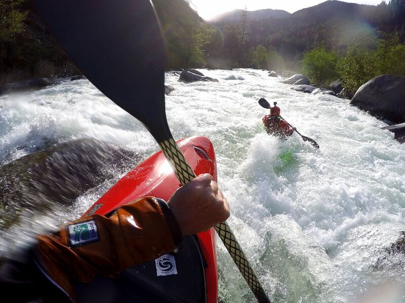
Also known as the the Landslide Rapid, Two-Mile, The Portage, and P-Word, this large drop is boulder-choked and steep. Lars Holbek's guidebook says it has a "villainous appearance." It is formed by large landslide debris that has rained down into the river from the road cut high up on river right and a natural landslide on river left.
The rapid can be scouted easiest on river right by walking downstream from the small pool separating it from Foreboding, the rapid above. But you won't be able to easily see into the crux section of the rapid because the boulders are large enough to block the view. Keep walking downstream and scramble out on the rocks to get a better look. For a full view, scout river left and take a long walk through the brush all the way to the bottom to see the whole thing. You also don't get a very good view from Sawyers Bar Road, even though you can see some of the drop from the pullout high above (mile mark 2).
Most paddlers portage this rapid (river left only), but there is a managable though tight line through it at all but very low flows. Those who run it usually begin from the river right eddy above the rapid, paddle out toward the middle and eddy out behind the first giant boulder that's above the steeper part of the rapid below. From here, move river left and bounce down the left slot into the faster current, adjust boat angle and very quickly get lined up for the slot in the middle. Missing this line can mean washing into the boulder sieve on the left (really not good). The slot is tight at low-medium levels and juicy at high-medium levels, so watch for the backender. Land the move, head far right, and follow the rocky line along the right bank to the bottom. The view back up from the bottom is impressive. Don't underestimate this drop. Some boaters will wheelchair down the far, far right from the top when flows allow for this (scout this sneak too!).
Location
Other Rapids on This Run (20)
 Rapid
IV
Rapid
IV
 Rapid
III
Rapid
III
 Rapid
III+
Rapid
III+
 Rapid
III
Rapid
III
 Rapid
IV-
Rapid
IV-
 Rapid
III+
Rapid
III+
Current Conditions
5-Day Forecast
American Whitewater