Headwaters to Richland Creek (3+2 miles)
Long Devil's Fork
Linked via: Unknown Synced 6mo ago
Gauge Conditions
Runnable: 5.0 – 7.0 FT
Data from American Whitewater & USGS
Run Map
Description
Note: The combination of Steep banks and lots of deadfalls tend to clog the creek with wood from time to time, so keep look out. _Best current option is to run Richland Creek and hike up the trail on creek right to the Falls._
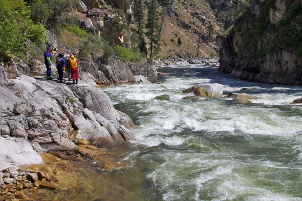
This is a very small creek. Tight slots, fast slides, waterfalls, undercuts. Highlight is Twin Devil's Falls. Last 2 miles are on Richland Creek at high water.
Put-in: Go South on Newton County Road 5050 from the Ketcherside Mtn intersection of Newton County Roads 5050 and 5070. Park near where USGS TOPO map shows road Elevation 2059 the Lurton 7.5 minute Quad. Follow faint remains of old logging road SE downhill then turning to NE and continuing down ridge to the creek junction just below Elevation 1600. Carry from main road is about 0.7 miles to put in, which is actually on the fork East of what is labeled Long Devil's on the topo map. Ketcherside Mountain can be accessed by taking Richland Creek Road North from Richland Creek Campground or by taking Hwy 123 East from Hwy 7 at Lurton and turning right on Newton County Road 5070.
Take-out: Continuing East on Hwy 16 from Ben Hur for 1.5 miles and turn onto Upper Falling Water Road and take a left on Falling Water Road to NFS Richland Creek Campground. This road will parallel Falling Water Creek most of the way. This can also be reached by taking Falling Water Road farther East off Hwy 16.
This run is very similar to Big Devils, but has generally cleaner drops, longer slides, and fewer undercuts. Just below the first waterfall (8 to 10 feet), you will encounter "The Devil's Playground" - look for the tight runnable channel down the river left side through the boulders. After this is the fast entrance to the Twin Falls. The highlight of the trip. Depending on water level, you may either run the Long Devil's, or access and run the Big Devil's side via a short carry. Be prepared for a "big water" creek run through some of Richland's most difficult rapids after the junction (IV+/V at these levels). All rapids have been run, although "The Devil's Playground" just below the first waterfall has been marginal for most water levels encountered to date.
Rapids in this Run (3)
Waterfalls (2)
Hazards & Portages (2)
Caution: The following locations may require scouting or portaging. Always check current conditions.
Difficulty
Class III-IV(V)
Length
5.0 mi
Gradient
155 ft/mi
max 200
Rapids
3
2 Hazards
Access Points
Shuttle Info
**Put-in:** Go South on CR 32 from the Ketcherside Mtn intersection of Newton County Roads 32 and 36. Park near where map shows road Elevation 2059 the Lurton 7.5 minute Quad. Follow faint remains of old logging road SE downhill then turning to NE and continuing down ridge to the creek junction just below Elevation 1600. Drag from main road is about 0.7 miles to put in, which is actually on the fork East of what is labeled Long Devil's on the map. Ketcherside Mountain can be accessed by taking NFS road 1205 North from Richland Creek Campground or By taking Hwy 123 East from Hwy 7 at Lurton and turning right on Newton County Road 36 (NFS road 1200).
**Take-out:** Continuing East on Hwy 16 from Ben Hur for 1.5 miles and turn onto Pope County Road 68 (NFS 1205) and follow to NFS Richland Creek Campground. This road will parallel Falling Water Creek most of the way. This can also be reached by taking Pope County Road 18 (Falling Water Road) farther East off Hwy 16.
Difficulty Classes
I Easy
II Novice
III Intermediate
IV Advanced
V Expert/Extreme
VI Unrunnable
Current Conditions
5-Day Forecast
Whitewater data from
American Whitewater
American Whitewater