Honey Creek Pkwy. to Menomonee R. (1.76+2.14 miles)
Linked via: Nhdplus discovery 90% confidence Synced 6mo ago
Gauge Conditions
Data from American Whitewater & USGS
Run Map
Run Time Estimate
Select put-in and take-out to estimate time.
Unlock Advanced Trip Planning
See wind-adjusted speed maps, forecast planning, and detailed time estimates.
Sign in to generate an AI timing estimate for this run.
Whitewater timing varies with scouting, portages, and group pace. Use as a planning baseline.
Description
NOTICE: MMSD has plans to remove virtually all of the cement on this run. Streambanks will be excavated to create a floodplain (wherever possible) and meander the stream. While cement may remain under road bridges, it's likely that rocky rubble will negate any remaining hyraulic jumps.
Their website now indicates the project *'has been pushed out several years, with construction unlikely to start before 2028.'* Post 'restoration', it will be boatable, but *likely* with *minimal* whitewater interest -- probably little more than a class I-II rock-dodge. It will likely take higher flows to become boatable (needing more water to cover rock they will place in the stream), and (what's worse) it will likely be far more dangerous with rock throughout the channel, making being upside-down or out of your boat quite brutal, with increased possibility of hard impacts, bruises, broken bones, and foot entrapments.
Quick Facts:
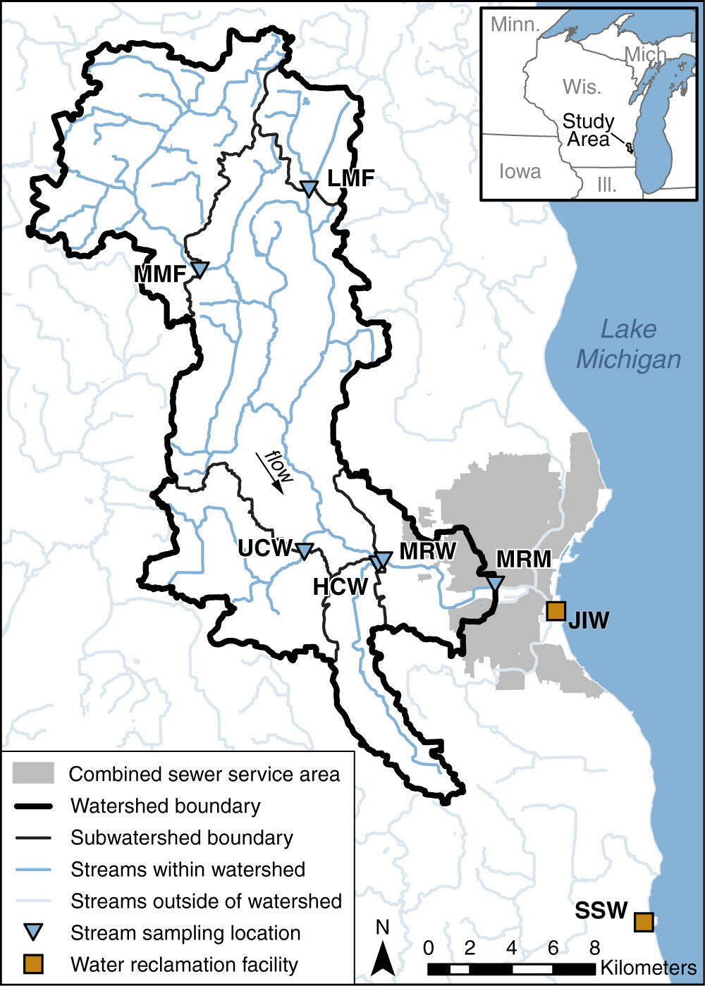
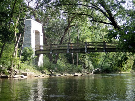
Location: Wauwatosa (Milwaukee, WI).
Put-in: 8354 W. Honey Creek Parkway, Milwaukee
Take-out: 7200 W. Honey Creek Parkway, Milwaukee *(for just Honey Creek, for the unusual circumstance you're not continuing down MenTosa).*
Take-out: 4014 W. Bluemound Rd, Milwaukee *(take-out for MenTosa, since virtually all boaters of Honey will proceed to enjoy that run).*
Shuttle Length: *3.8 miles/10 mins:* Shuttle Route\* (there are quicker, more direct routes, however, we recommend scouting numerous locations en route to put-in, so this link gives you that shuttle route.)
Class/rating and gradient are *never* enough to decide if you should run a river/rapids! Far more important should be other less-quantifiable 'character factors': continuous versus pool/drop, wide-open routes versus constricted technical rapids, wide-channel (with multiple routes) versus narrow channel (with essentially one route), gradual river banks versus rocky shores or steep-walled gorges, et cetera.
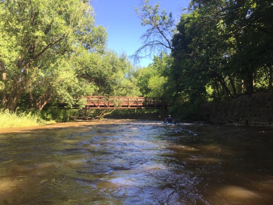
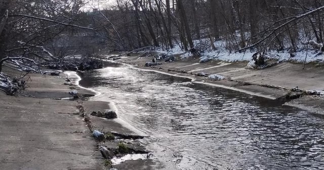
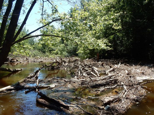
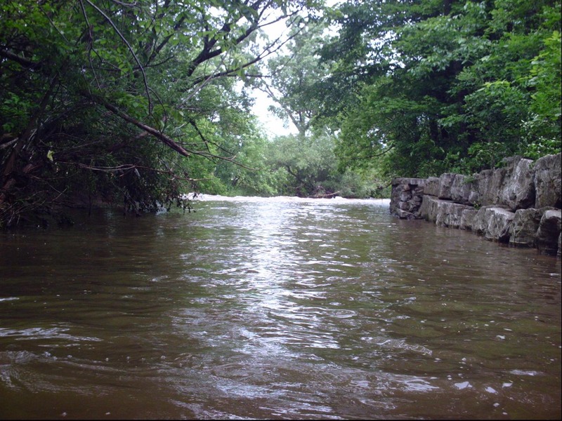
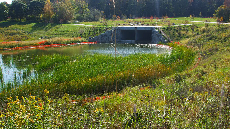
Character: A 'city cesspool creek' (water quality is horrendous!): Half cement ditch with 'hydraulic jumps' (cement ledges), half citified-'natural' channel with deadfall and a couple class II stretches.
Typical width: 10-50 ft. (NARROW!)
River banks: Cement (half the run), then steep slope, rocks, gabion baskets (chain-link baskets filled with stone), all lined with trees and overhanging shrubbery.
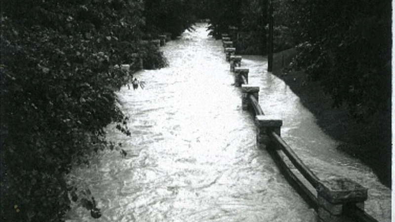
*DANGER*: *Do not put on if it is raining fairly heavy and creek could rise further!*
*Flow can easily rise by 100 cfs to 1000 cfs or more each fifteen minutes!*
Case in point (from a rather typical, moderately-heavy rain event, fifteen minute intervals, from 2:15-3:15pm):
1.4 cfs, 13 cfs, 575 cfs, 1580 cfs, 2000 cfs!
That's right, folks, this little creek (with only 10.3 square miles drainage) *increased 1005 cfs in just 15 minutes*, and peaked (that time around) at 2000 cfs!!! (It has peaked at over 3,000 cfs!)
This run is so flashy that *runnable occasions are seldom measured in days but in hours!* Nearly half the runnable occasions are 1.5 hrs or less, so *it is generally futile to rely on the gauge for this run!* And (having that short a 'window of opportunity') fully half the runnable occasions will happen during the night!
Keep in mind, USGS gauges are not truely 'real-time'. Online values are typically updated once an hour (at best), and there is a lag before values are posted. (Readings are typically 30 minutes old by the time they are posted!) If you are sitting at home watching to see a runnable level posted, by the time you can get there, gear up, set shuttle and get on, you'll be too late to catch the best flows!
For the best chance to catch the best flows, you have to watch weather radar, and plan to be there when the rains are about to finish. Even then you have to be prepared to be skunked on this run (willing to run something else less interesting) if the rains prove insufficient to bring it up ... and prepared to kill some time if rains bring it up too much!
The only way to know the actual conditions you'll encounter is to scout a few locations while setting shuttle. (SCOUTING IS ALWAYS RECOMMENDED!) But, again, it can change so quickly and dramatically that features will be different by the time you get to them in your boat! (I've watched features change from totally boily and keepy to totally SWEET in 5-minutes' time!)
For all the above reasons, IT IS STRONGLY RECOMMENDED THAT ANY 'FIRST TIMERS' SHOULD DO THIS RUN ACCOMPANIED BY SOMEONE WHO KNOWS THE RUN WELL, UNDERSTANDS THE FLOW PATTERNS AND HOW THE FEATURES CHANGE, AND KNOWS ALL THE PLACES TO SCOUT BEFORE PUTTING ON!
General Overview
This is an 'Urban Bandit' run, since the legality of boating it is highly debatable. To our understanding, there is no legal put-in due to a Milwaukee Ordinance which prohibits access from county parkland at any location other than designated launch/landing sites (unless one has written permission from the County Parks Director). County parkland flanks this entire reach, and no launch sites are designated hereupon.
Water quality is best characterized as urban sewer. While there are no known (permitted) MMSD sewer outfalls into the creek, the runoff from streets, parking lots, driveways, and yards is likely to contain such a high contaminant level as to be as bad as untreated sewage. Levels of E.Coli run almost a minimum of 1,000 MPN/ 100 mL (which is the level at which beaches are closed), and often run 10,000 to 100,000 and more! (This is especially true during and immediately after Wisconsin State Fair in early to mid August.)
Runnable flows most often occur when there are heavy rains, which are likely to cause Combined Sewer Overflow (CSO) affecting the Menomonee River (where you are likely to continue your run, down to it's normal take-out). We therefore mostly recommend this as a hike/scout to consider the possibilities, if it had been left in a more pristine state.
IF (in spite of all these warnings) you choose to do it, we would recommend a 'commando style' put-in: be fully geared-up (with boats inside your vehicle, if possible), ready to grab-and-go with a minimum of time spent in plain sight. We would recommend no flips, swims, or even face splashes, as well as wearing a dry-top/drysuit (as a 'full-body condom' to avoid contact with the water), and a shower/bath and clear-water rinse of all gear as soon as possible after the run. (And, while medical experts probably concur that it is of no real advantage, I always advise a little 'internal medicinal alcohol' be 'applied' (post-run) to kill whatever river germs you may have inadvertently ingested!)
Run Detail
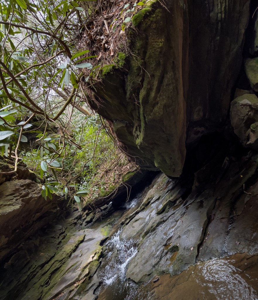
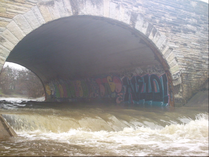
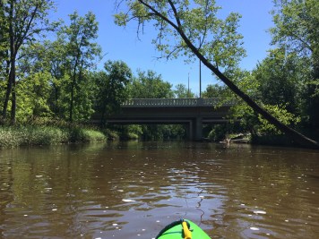
Four cement ledge 'pourovers' in a cement ditch precede a section of (semi-) natural riverbed with mini-canyons and one more cement ledge drop. Most bridges span or immediately precede drops. Some drops get very sticky at certain levels. Have good 'boof' technique, and be ready to PADDLE out of the base of each drop!
It is highly recommended to SCOUT AS MUCH OF THE RUN AS POSSIBLE BEFORE PUTTING ON. Almost any branches or trees in the river will be difficult (or impossible) to avoid or to get out and around! Almost the entire reach is either cement ditch or rock-wall and gabion reinforced banks, making for very few eddies, and making exit from the river nearly impossible most of the run. The lower half of the reach is tree lined and has highly eroded banks, regularly dropping whole trees across the river.
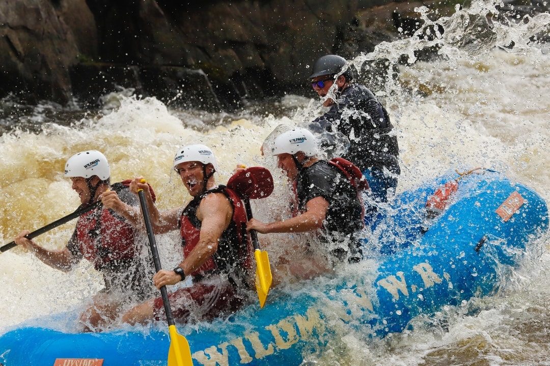
While the actual difficulty of the rapids generally does not exceed class II+ to III-, THIS IS NOT A PLACE FOR BEGINNERS, CASUAL CANOEISTS, OR 'RECREATIONAL KAYAK' PADDLERS! The requisite paddling ability should be more in the class III+ to IV territory! NO SWIMS ALLOWED! If you can't do an 'upstream ferry' or catch an eddy (or if don't know what either of those mean!), and if you can't roll your boat, you should not even consider getting on this stream! If you flip (or swamp your canoe or kayak) and cannot 'self-rescue' (roll), expect to lose your paddle, and possibly your boat!
Anyone doing this (again, most likely illegal) run will probably continue downstream to enjoy the final 2.14 miles (and the best gradient) of the 'MenTosa' run, utilizing it's take-out. That makes a total run of ~3.5 miles, with time on the water being roughly one hour ... or likely double that if your skills and interests and the water levels coincide to allow repeat play at any of the features (especially on MenTosa at Trenton Waves).
Rapids in this Run (8)

Playspots (3)
Hazards & Portages (6)
Caution: The following locations may require scouting or portaging. Always check current conditions.
Difficulty
Class II-III+
Length
1.8 mi
Gradient
30 ft/mi
Rapids
8
6 Hazards
Access Points
Shuttle Info
If/when this bandit-run is done, it is highly likely it will be combined with the final/best ~2 miles of the 'MenTosa' section (Menomonee River in Wauwatosa), thereby using its take-out. This makes a shuttle of 3.1 miles.
Coordinates for that take-out are: 43.03860 -87.96677
Difficulty Classes
I Easy
II Novice
III Intermediate
IV Advanced
V Expert/Extreme
VI Unrunnable
Current Conditions
5-Day Forecast
Whitewater data from
American Whitewater
American Whitewater