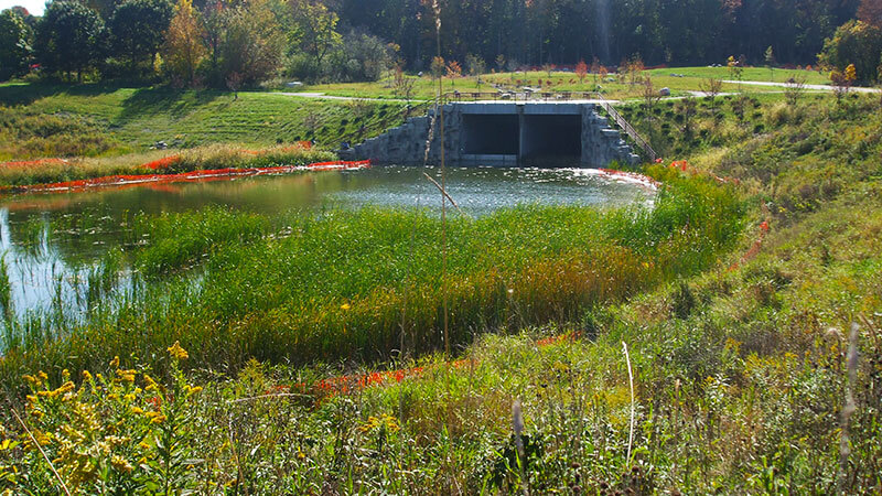
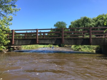
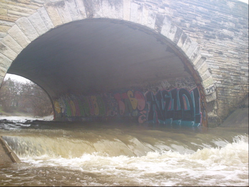
Fifth Pourover (PAJ: Portland Avenue Jump)
Honey Creek (Menomonee Trib) - Honey Creek Pkwy. to Menomonee R. (1.76+2.14 miles) (WI)
Gauge Conditions
Photo
Description
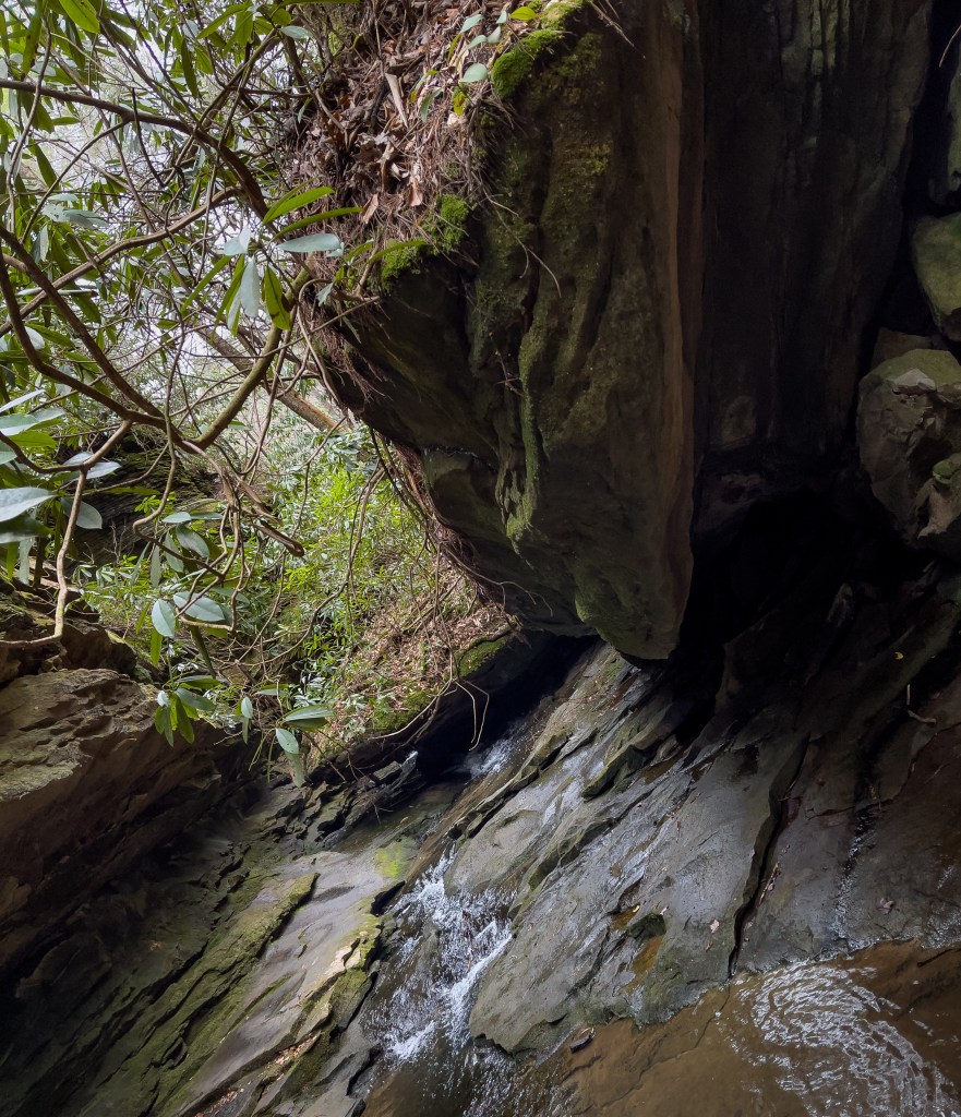
The final ledge/jump lies under Portland Avenue (second bridge after leaving cement ditch). Water sheets shallow on the approach at most runnable levels, making it difficult to maneuver. The reversal at the base of this ledge can be significant at some flows, so be prepared to boof and paddle strongly away.
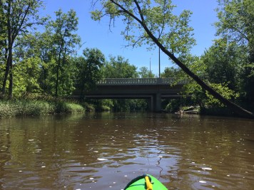
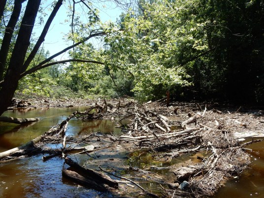
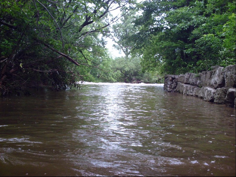
The riverbed becomes more natural (gravel, cobble, and random large rock and rubble). Riverbanks vary from rock walls to gabions (rock filled wire baskets) to boulders to dirt/mud banks. There is increased risk of deadfall, since river banks are highly eroded in places, and trees are at water's edge.
ALWAYS SCOUT AS MUCH OF THE RUN AS POSSIBLE BEFORE PUTTING ON, TO BE AWARE OF SNAGS AND WHETHER THEY ARE AVOIDABLE THAT DAY!
If you looked at it a year, a month, a week, or sometimes even just a day before, do NOT assume the situation did not change! If it has rained enough for this to be up more than one day, the soil is saturated and trees may topple!
Location
Other Rapids on This Run (17)
 Rapid
N/A
Rapid
N/A
 Rapid
N/A
Rapid
N/A
 Waterfall
N/A
Waterfall
N/A
 Rapid
N/A
Rapid
N/A
 Hazard
II+
Hazard
II+
 Hazard
II+
Hazard
II+
 Hazard
II+
Hazard
II+
 Hazard
II+
Hazard
II+
 Hazard
N/A
Hazard
N/A
 Rapid
II+
Rapid
II+
 Playspot
N/A
Playspot
N/A
 Rapid
N/A
Rapid
N/A
 Hazard
N/A
Hazard
N/A
 Rapid
N/A
Rapid
N/A
 Rapid
N/A
Rapid
N/A
 Rapid
II+
Rapid
II+
 Rapid
N/A
Rapid
N/A
Current Conditions
5-Day Forecast
American Whitewater