Lucy Stone Park in Warren to Route 67
Linked via: Proximity 93% confidence Synced 6mo ago
Gauge Conditions
Runnable: 4.0 – 6.5 FT
Data from American Whitewater & USGS
Run Map
Run Time Estimate
Select put-in and take-out to estimate time.
Unlock Advanced Trip Planning
See wind-adjusted speed maps, forecast planning, and detailed time estimates.
Sign in to generate an AI timing estimate for this run.
Whitewater timing varies with scouting, portages, and group pace. Use as a planning baseline.
Description
The Quaboag starts at the Lucy Stone Park as a class II river for almost half of the run then turns into a class III pool drop river with one carry around a dam. This is often referred to as the "Class IV Portage", because it involves descending a steep bank lined with riprap to access the water below the dam.
Putting on at Lucy Stone Park, the first significant drop you come to is Mouse Hole, a short but abrupt III. It is located where Main St intersects with Cross Rd in Warren, and it is recommended to scout it for wood while you are driving by on your shuttle.
The next notable drop is after the portage, upstream of the Gilbert Rd bridge in Warren. This is Broken Dam, which presents itself as a somewhat intimidating river-wide horizon line. Paddling up to the lip, though, you find that it's boat-scoutable and not so bad. Most run just left of center.
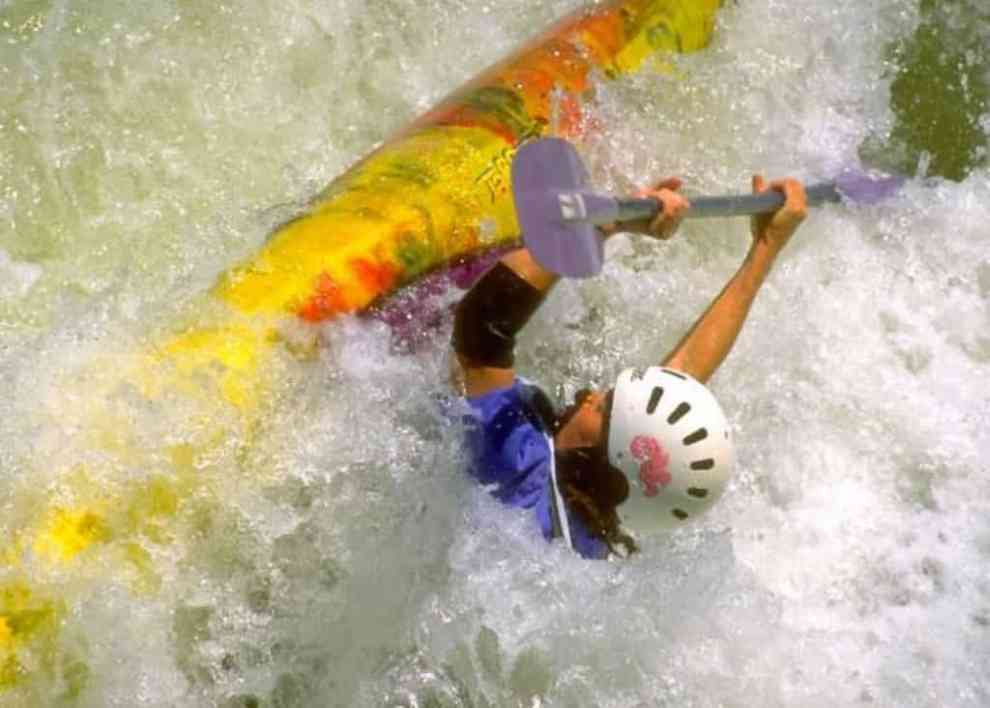
As you pass the wastewater treatment plant and the famous outhouse on river right, the next railroad bridge signals the start of Angel's Field, the rowdiest rapid on the river. It's a III+ with a hole at the bottom, into which the boater in the cover photo above is dropping into.
Further downstream you will enter Devil's Gorge, which despite its name is only a III. It does contain a 4-foot-tall river-wide ledge, which can be easily run on extreme river right if you just want to get past it, or you can be more adventurous and experiment with other lines.
Caution: Be on a constant lookout for downed trees. There are a lot of beavers in the area and they're all on steroids. They've been knocking down huge trees that have spanned the entire river. This video, recorded 3/22/2014, is one scary example.
For a complete description refer to the guidebook "Classic Northeastern Whitewater Guide" by Bruce Lessels.
Rapids in this Run (4)
Difficulty
Class II-III
Length
5.3 mi
Rapids
4
Access Points
Shuttle Info
Follow route 67 northeast to the town of Warren. Take the first left after crossing the Quaboag River onto North River Road. Lucy Stone Park is on the left just before crossing the next bridge. This is the put-in for the class II section.
For the take-out of the class II section and the put-in for the class III section follow route 67 southwest to a dirt pull-off a little ways before the traffic light in West Warren.
Difficulty Classes
I Easy
II Novice
III Intermediate
IV Advanced
V Expert/Extreme
VI Unrunnable
Current Conditions
5-Day Forecast
Whitewater data from
American Whitewater
American Whitewater