Patrick Creek Campground to Forks River Access Wild
Linked via: Proximity 100% confidence Synced 6mo ago
Gauge Conditions
Runnable: 1,000.0 – 6,000.0 CFS
Data from American Whitewater & USGS
Run Map
Put-in
Take-out
Rapids/Hazards
Wild
Scenic
Recreational
Run Time Estimate
Select put-in and take-out to estimate time.
Unlock Advanced Trip Planning
See wind-adjusted speed maps, forecast planning, and detailed time estimates.
Sign in to generate an AI timing estimate for this run.
Whitewater timing varies with scouting, portages, and group pace. Use as a planning baseline.
Description
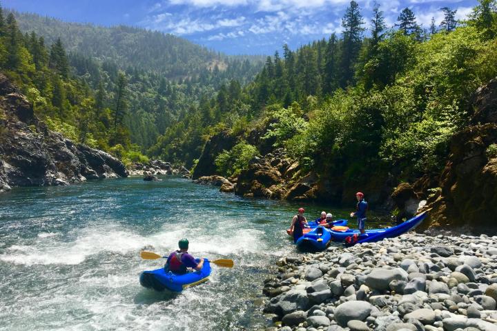
Depending on flows, you can find good whitewater within about 10 miles of the California-Oregon border and continuing all the way down to the confluence with the South Fork about 22 miles downstream near Hiouchi. The river is all roadside with multiple access points. The four runs below represent the standard options but multiple access points allow you to further customize your trip.
*1) Patrick Creek to Gasquet, 9.7 miles, class III(IV) (Patrick Creek Run)*
The run from Patrick Creek to Panther Flat is a class III/III+ classic. You will encounter somewhere between 15 to 20 class rapids in the stretch from Patrick Creek down to Panther Flat with consistent action from start to finish.
This section also includes one class IV rapid known as Highway Rapid. Shortly after the river passes under the highway from south to north, you will come to Highway Rapid where the river makes a sharp left hand turn. The rapid gets harder as flows rise, but can be scouted or portaged with some effort on river left.
Panther Flat Campground is the usual take out for this run but you can continue on downstream through Gasquet, past the confluence of the North Fork and take-out at Margie’s Access.
*2) Gasquet to Middle Fork Gorge, 4.3 miles, class II/III (Margie's Run)*
This is a great run that starts out as class II from Gasquet. If you want to cut out this first section, you can put in at the Mary Adams bridge. Below this point the whitewater action builds with some fun class III rapids including the named drops of Crotch, Cars, and Brent's Hole.
You can use this run as a fun prelude and warm-up to the gorge downstream or take out at Middle Fork Gorge access site if you are an intermediate paddler.
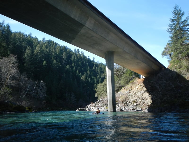
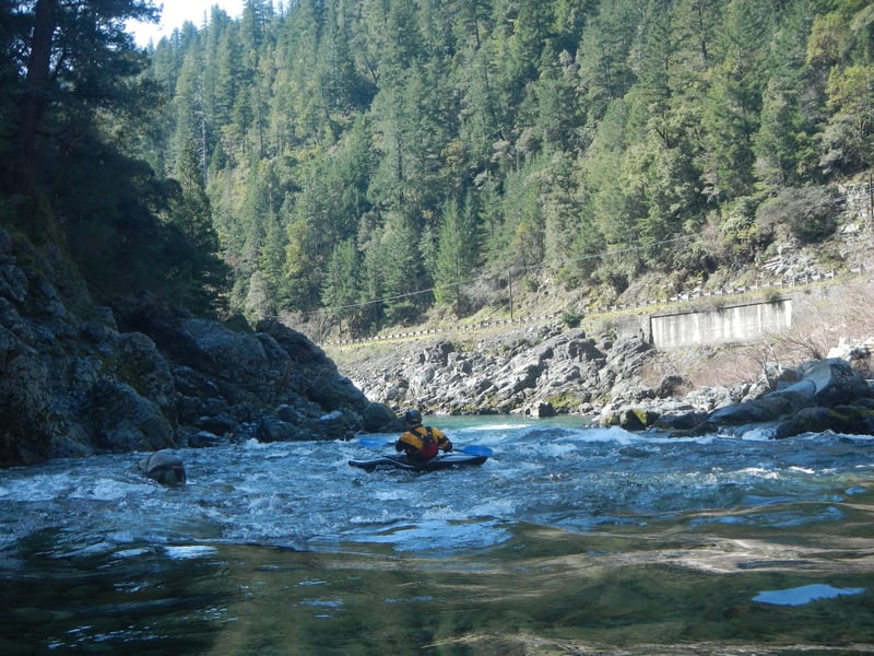
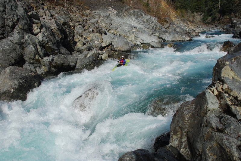
*3) Middle Fork Gorge, 2.2 miles, class IV/V (Oregon Hole Gorge Run)*
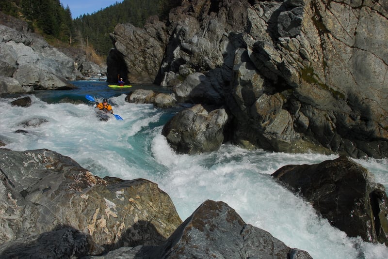
The short Middle Fork Gorge is often run by itself but you can start higher up for some warm-up. The run starts with some fun class III+ drops that build in intensity as you approach the Nozzle. This rapid is a long sequence that changes with flows and while you can get a good overview from the road it is wise to scout from river level. You can take out early on river left and scout the entrance and series of drops or boat scout through the entrance and grab an eddy on river right to hop out and pick the line through the main section.
Shortly downstream you will come to Hole in the Wall where the river flows along a dramatic cliff on river left. This rapid is visible from the road but as with the rapid above, you will want to hop out at river level on the right to scout your line and figure out how to best avoid the hole.
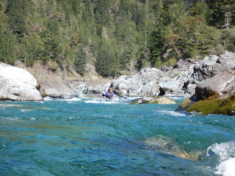
Just around the corner and out of site from the road, you will come to the Oregon Hole. This rapid is of little consequence at lower flows but can build to epic proportions at higher flows.
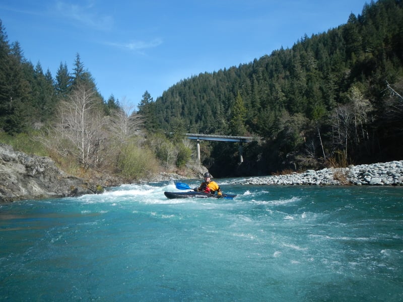
After Oregon Hole the run mellows out and you will soon pass under the bridge where you can take-out at Myrtle Beach on river right or Smith River Forks just downstream on river left.
Check out Oregon Kayaking River page for some descriptions of this gorge.
Logistics:
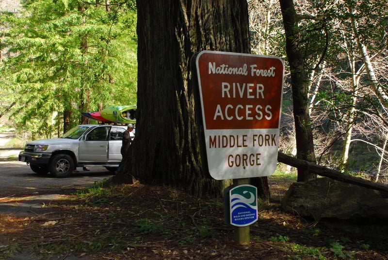
The Smith drainage is in the far northwest corner of California. From the coast, take highway 101 to Crescent City and then head up Highway 199 through Jedidiah Smith State Park and the community of Hiouchi which is near the confluence where the Middle Fork joins the South Fork. If you are coming in from Interstate 5, Highway 199 heads south from Grant’s Pass. Once you pass the California border, it’s only about 10 miles until you start driving along the river. Highway 199 parallels the river providing many options for access points.
Access Sites:
Patrick Creek Picnic Area: Located at Highway 199 mile post 22.0 with a 350’ trail to the river, parking for 7 vehicles, and flush toilets. This is a take-out for the upper gorge or a put-in for the fun class III run downstream.
Sandy Beach: Located at Highway 199 mile post 20.9 with a 255’ trail to the river, parking for 10 vehicles, and vault toilet.
Madrona: Located at Highway 199 mile post 19.2 with parking for 10 vehicles, and vault toilet. You can drive right to the river at this access point which also has 3 designated sites for camping. This access is just downstream of Bridge Rapid and can be used as a put-in for a short trip down to Panther Flat or a longer trip down through Gasquet.
Panther Flat Picnic Area: Located at Highway 199 mile post 16.75 with a 90’ trail to the river, parking for 21 vehicles, and vault toilets. Camping is available at the Panther Flat Campground. This is a standard take-out for runs that begin upstream at Patrick Creek.
Gasquet Water Treatment Plant: This an informal access at the confluence of the North Fork with the Middle Fork. It is a standard take-out for kayakers running the North Fork. At Highway 199 mile post 14.3 in Gasquet, turn on to Middle Fork Gasquet Road. Follow this road 0.1 mile and turn right onto Gasquet Flat Road and follow it 0.1 mile to the bridge across the Middle Fork. If you park tight, you can get a few cars parked along the shoulder (please don't block driveways). To reach the confluence, you will need to carry your boat downstream river right of the bridge through the green gate, past the water treatment plant, and down to the confluence. It is a short walk for kayaks but not practical for rafts.
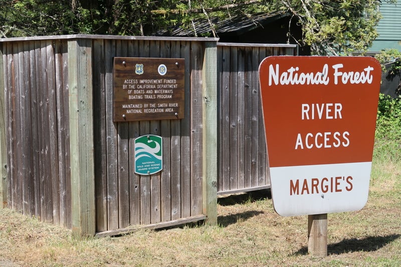
Margie’s (Sims Camp, Shady Bend): Located at Highway 199 mile post 12.86 at the downstream end of Gasquet (just as you pass the highway sign marking the entrance to Gasquet where the river heads away from the road). The river is accessed by a 370’ trail and the site includes parking for 10 vehicles, vault toilet, and screened clothes-changing area. Gentle trail slope affords easy access for rafts and kayaks. The access point is a small mud/sand beach and the river is a deep pool at this point. Adjacent to and in view of highway.
Mary Adams Peacock Bridge: Located at Highway 199 mile post 11.9 on west side of bridge with a 280’ trail to the river, parking for 20 vehicles, and vault toilet. This is a good put-in if you are looking for a short warm-up prior to running the Middle Fork Gorge.
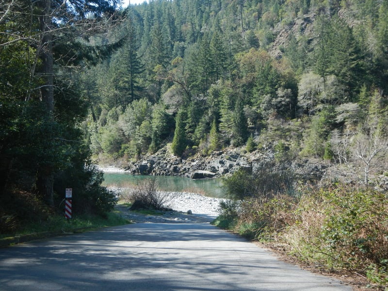
Middle Fork Gorge: Located at Highway 199 mile post 9.1 with a 55’ trail to the river and parking for 7 vehicles. This serves as a put-in for those who just want to run the Gorge or a take-out for those who are not up for it. If you want to take a look at the gorge, there is a small pull-out at Highway 199 mile 8.45. From this point, you can look upstream to see the Nozzle (although the view of the river right side of the drop is obstructed) and look down below you to see Hole in the Wall. Keep in mind that road scouts never give an accurate perspective on the gradient.
Myrtle Beach and Smith River Forks Access: A mile and a half upstream of Hiouchi at Highway 199 mile post 7.2 you will see the turn for South Fork Smith Road and the bridge across the Middle Fork. Myrtle Beach Access, the take-out, is right along Highway 199 on the downstream river right side of this bridge and provides access on river right via a 55’ trail. The site has parking for 20 cars and a vault toilet. A second access where you can drive down to the gravel bar is available on river left. To reach it, turn onto South Fork Road and cross the bridge. Continue down the road 0.2 mile to the Smith River Access. A parking area and restroom is at the top but you can drive down to the gravel bar to load up (a good option for rafts).
Rapids in this Run (17)
Rapid
Sisikyou Fork Road Bridge
Rapid
Sandy Beach River Access
Rapid
IV-
Highway Rapid
Rapid
Madrona River Access
Rapid
Panther Flat Campground
Rapid
NF Smith Confluence & Water Plant River Access
 Rapid
Rapid
Margie's River Access
 Rapid
Rapid
Mary Adams Peacock Bridge Access
 Rapid
III
Rapid
III
Crotch
 Rapid
III
Rapid
III
Cars
 Rapid
III
Rapid
III
Brent's Hole
 Rapid
Rapid
Middle Fork Gorge Access
 Rapid
V
Rapid
V
Nozzle
 Rapid
V
Rapid
V
Hole in the Wall
Rapid
IV+
Oregon Hole
 Rapid
Rapid
Myrtle Beach Access
 Rapid
Rapid
Forks River Access
Difficulty
Class II-V
Length
17.0 mi
Gradient
47 ft/mi
Rapids
17
Access Points
Difficulty Classes
I Easy
II Novice
III Intermediate
IV Advanced
V Expert/Extreme
VI Unrunnable
Current Conditions
5-Day Forecast
Whitewater data from
American Whitewater
American Whitewater