SR 73 to CR 676
Linked via: Proximity 98% confidence Synced 6mo ago
Gauge Conditions
Runnable: ? – ? CFS
Approximate reading: This gauge is 9.0 miles away on Lively Creek. Use as a general reference only.
Data from American Whitewater & USGS
Run Map
Run Time Estimate
Select put-in and take-out to estimate time.
Unlock Advanced Trip Planning
See wind-adjusted speed maps, forecast planning, and detailed time estimates.
Sign in to generate an AI timing estimate for this run.
Whitewater timing varies with scouting, portages, and group pace. Use as a planning baseline.
Description
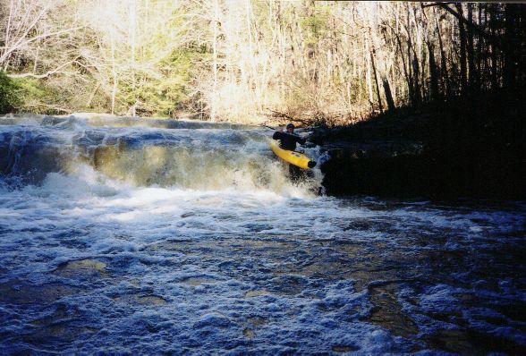
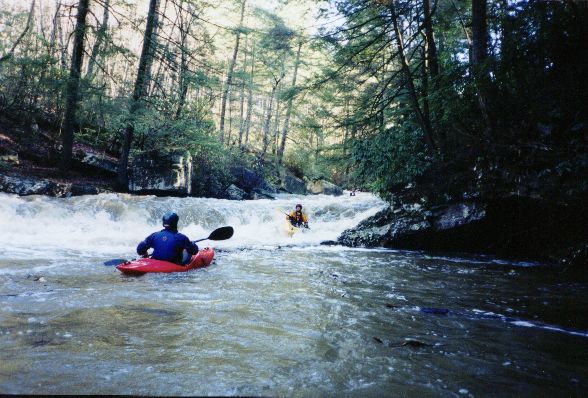
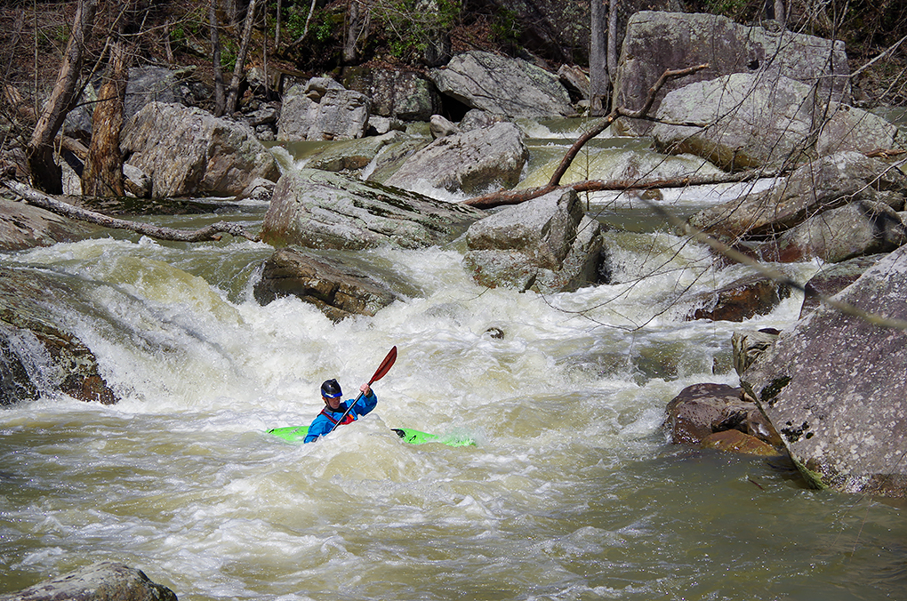
Lively Creek can make for an interesting exploratory day if you're on the north end of Sand Mountain and your first choice is blown out. With a watershed of 12 sq. mi. at the put-in, this micro creek takes a lot of rain to get going and won't hold long. To complicate matters, the streambed does not channelize well in many places so it can be very bumpy in the boogie sections even with good flow through the main rapids. However, it is worth crossing off the list to get a few good drops as well as an invigorating hike around the Enormotron jumble hidden down in the gorge. Make sure you get an early start - the run is quite long, and will require significant bank scouting even if a group member has run it before, as it features a number of blind drops that have a proclivity for collecting wood.
The run can be broken into two sections of differing character, divided by the confluence with Guest Creek. Above this confluence, the run features tight but easy rapids underneath a gorgeous evergreen canopy. Similar to the Tellico in scenery (without the road) and difficulty, these first few miles offer a good warmup before the steep section begins. After Guest Creek enters on the right, the difficulty begins to increase, and a few rapids later you will reach the mandatory portage known as the Enormotron. After reentering the water below, a mile of fun boulder gardens will lead to the confluence with Miller (below the hair), and then the lake, where you'll need to paddle through a swamp to find your vehicle. The stretch of boulder gardens below the portage is a class harder than runs like Short or Sauty, and not advised for those still getting a feel for creeking.
A gauge is painted on the downstream side of the bridge, on the river left piling. We ran it at 11'', which we felt was a good medium level in the main rapids but low in the boogie water. Alabama Whitewater says 4'' is doable, but I wouldn't go below 8 or 9''. If you run it much above 16'', you might not catch an eddy until you hit the lake.
There is no good online gauge or correlation for this run. It will take a significant rain event to get it going, so look for Town Creek to be flooding out before you can run this. There are several rain gauges surrounding the watershed which can be viewed on Rain Pursuit - we ran this after getting ~2.5'' of rain in 24 hours (but 0'' in the 12 hours before putting on), which gave us a level of 11'' when we put on and 7'' when we got the car back from the top, about 5 hours later.
For additional information and pictures, see the description on Alabama Whitewater:
http://www.alabamawhitewater.com/guide/guide\_files2/lively.htm
Rapids in this Run (7)


Waterfalls (1)
Hazards & Portages (3)
Caution: The following locations may require scouting or portaging. Always check current conditions.


Difficulty
Class III-IV(V+)
Length
6.4 mi
Gradient
100 ft/mi
max 170
Rapids
7
2 Hazards
1 Portage
Access Points
Difficulty Classes
I Easy
II Novice
III Intermediate
IV Advanced
V Expert/Extreme
VI Unrunnable
Current Conditions
5-Day Forecast
Whitewater data from
American Whitewater
American Whitewater