Take-out
MN
Confluence with Minnesota River
Sevenmile Creek - Sevenmile Park: Trail 8 to US169 (2.4-5.3 miles) (MN)
Gauge Conditions
Runnable: ? – ? CFS
Approximate - nearest available gauge. Use as general reference only.
Data from American Whitewater & USGS
Description
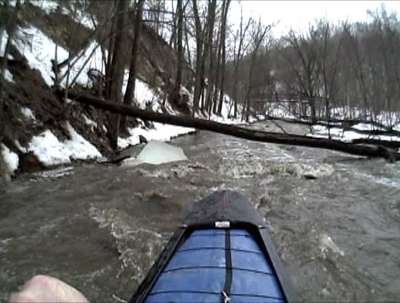
Because of trees blocking the creek (prior to Hwy.169/Sioux Trail), it is recommended to take out well upstream.
If/when those obstructions are gone (by natural or human remedy), boaters could continue to the confluence with the Minnesota River.
Since the majority of the gradient is upstream, it is doubtful how worthwhile the additional distance would be.
Location
View Full Run
Sevenmile Park: Trail 8 to US169 (2.4-5.3 miles)
Sevenmile Creek
I-II
5.3 mi
Current Conditions
5-Day Forecast
Whitewater data from
American Whitewater
American Whitewater