Rapid
OH
Drainage areas (as calculated by USGS StreamStats 4.0 Beta Software)
Eagle Creek, West Fork - Rt 353 to Rt 763 (OH)
Gauge Conditions
Runnable: ? – ? CFS
Approximate - nearest available gauge. Use as general reference only.
Data from American Whitewater & USGS
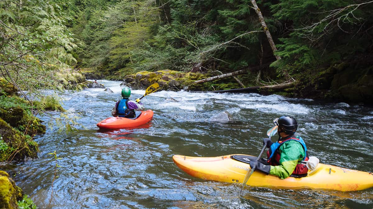
Photo
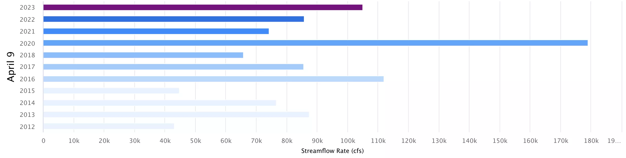
Photo courtesy of American Whitewater
Description
At an uppermost possible/likely put-in (Russelville-Winchester Road, about 0.3 mile SW of Juillerat Road, right about at the 900' elevation line) drainage area is ~3 square miles.
At our listed/recommended put-in, it is 54 square miles, and at the listed take-out (at Rt.763), it has doubled, to 108 square miles.
Location
Other Rapids on This Run (2)

View Full Run
Rt 353 to Rt 763
Eagle Creek, West Fork
I-II+(III)
2.8 mi
Current Conditions
5-Day Forecast
Whitewater data from
American Whitewater
American Whitewater