Gauge Conditions
Approximate - nearest available gauge. Use as general reference only.
Description
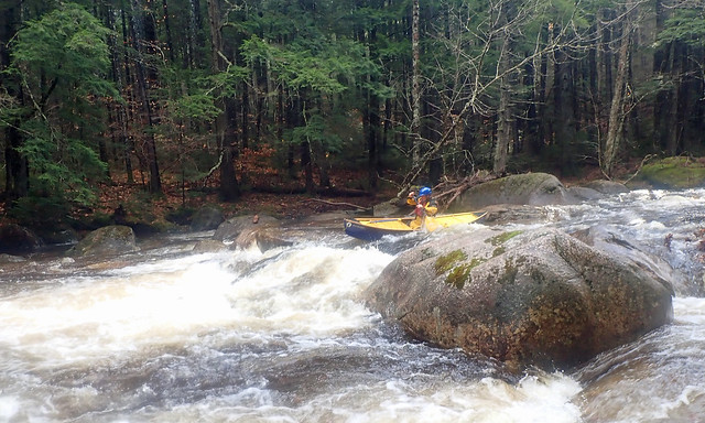
The Forest Run section of the river is the most changelling. Three-quarters mile of continuous class III rapids and drops. There is a slight break in the action one-third of the way down where the State Forest trail bridge crosses over the river. The bottom of the rapid is visible from the road about a quarter-mile south of the trailhead pull-off/parking; this is an excellent spot to scout the river if you are unsure of the water level or difficulity. If there is enough water here then the entire run from the lower put-in to Tamworth will be boatable. Additionally the rapids here are characteristic of the most difficult sections of the river and will allow the paddler to gage overall river conditions to their ability level.<br><br>
To scout the bottom of Forest Run, drive along Route 113A, one-quarter mile south of the State Forest trail-head pull off. There is a small pull off here where
you can walk down to the bottom of the rapid.
Location
Other Rapids on This Run (17)
 Rapid
N/A
Rapid
N/A
 Rapid
N/A
Rapid
N/A
Current Conditions
5-Day Forecast
American Whitewater