Gauge Conditions
Runnable: 350.0 – 2,000.0 CFS
Too low to scratchy low
Data from American Whitewater & USGS
Description
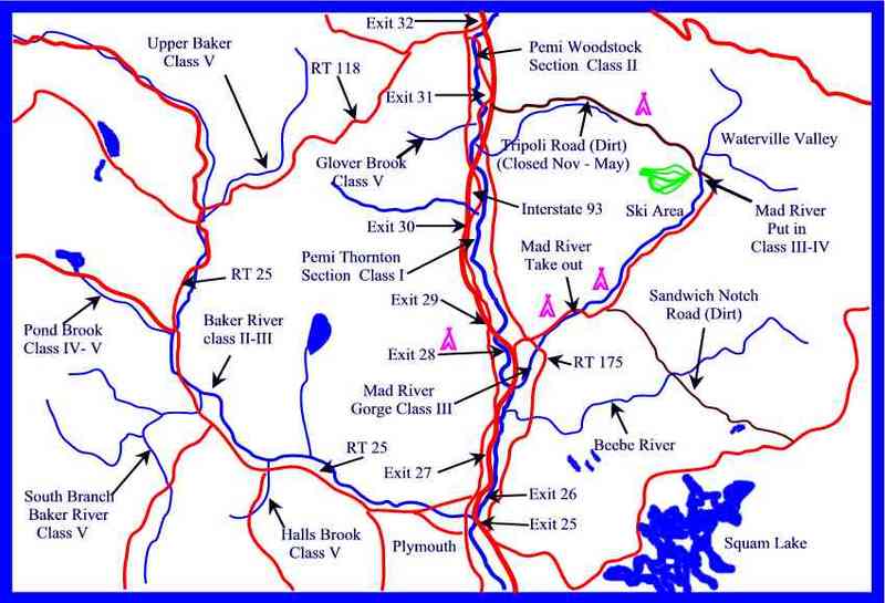
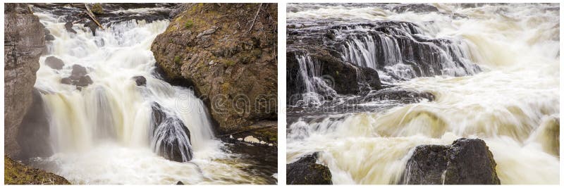
About 1/4 mile below a railroad bridge the river used to cut through a gravel pit. This gravel pit was used for the construction of Interstate 93 in the early 70's. A flood in the 80's rechannalized the river through the gravel pit for a number of years. Another flood in 1998 changed the course of the river again back to its traditional river bed. From a boating point of view the current river bed is more desirable. There are two class II drops in this section. The first one is a chute that heads straight into a bouldered bank. Avoid being slammed against the boulders by pulling hard to the right just after the river opens up wider. The second drop is another chute where the river takes a hard left. The lower part of this drop contains a fairly large hole/wave.
Location
Other Rapids on This Run (5)
View Full Run
3) North Woodstock–Woodstock
Pemigewasset
II
4.4 mi
Current Conditions
5-Day Forecast
Whitewater data from
American Whitewater
American Whitewater