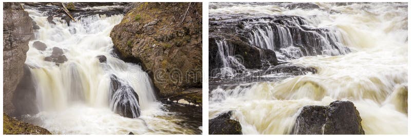
Gauge Conditions
Runnable: 350.0 – 2,000.0 CFS
Too low to scratchy low
Data from American Whitewater & USGS
View Full Run
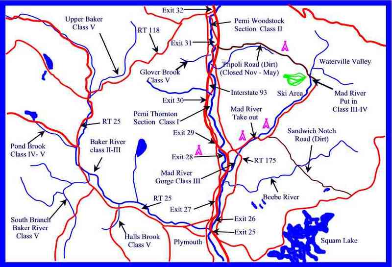
3) North Woodstock–Woodstock
Pemigewasset
II
4.4 mi
Current Conditions
5-Day Forecast
Whitewater data from
American Whitewater
American Whitewater