Gauge Conditions
Data from American Whitewater & USGS
Photo
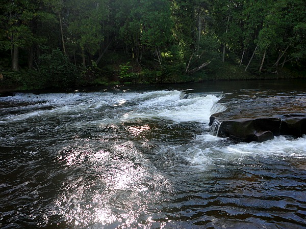
Photo courtesy of American Whitewater
Description
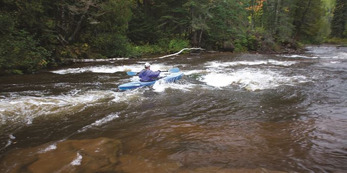
Lenroot Ledges is a technical section of the Bois Brule River characterized by a series of stair-step rock ledges that create unpredictable water flow and potential pinning hazards. Paddlers should carefully scout the rapid and select their line carefully, paying close attention to exposed rocks and potential hydraulic features that can develop at different water levels.
Location
Other Rapids on This Run (5)


View Full Run
B) Copper Range Campground to Hwy. 13 (9 miles)
Bois Brule
II
8.7 mi
Current Conditions
5-Day Forecast
Whitewater data from
American Whitewater
American Whitewater