Gauge Conditions
Data from American Whitewater & USGS

View Full Run
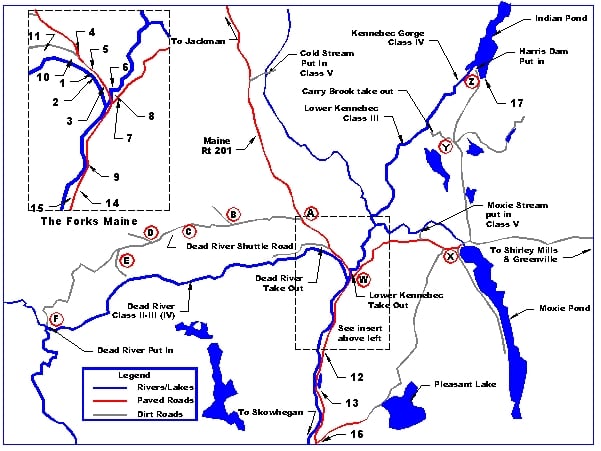
2) Lower Kennebec: Carry Brook to the Forks
Kennebec
II-III
8.1 mi
Current Conditions
5-Day Forecast
Whitewater data from
American Whitewater
American Whitewater