McKeldin Falls
Patapsco, South Branch - 2. Marriottsville Rd to Patapsco, N. Branch confluence "McKeldin Falls" (MD)
Gauge Conditions
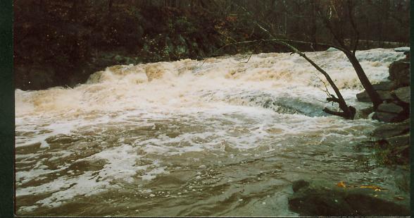
Photo
Description
McKeldin Falls is the largest single rapid on the Patapsco River. It's a solid class 4, quadruple ledge drop that falls a total of about 12 feet over 20 yards. When the hills on river left become high and canyonesque, listen for it, and get out (river left) to scout. The portage is a wickedly steep climb up the hill/cliff on the left, and then around to a large pool at the bottom. For the experienced, a variety of routes can be used depending on water level, but beware of small sieves against either shore, and a very wide, flat, mildly undercut rock (usually submerged and creating a strange looking hydraulic) at the dead center of the river near the bottom. It looks as if it would love to eat the nice flat bow of a playboat.
Lat/longitude coords are approximate, from online maps.
Location
Current Conditions
5-Day Forecast
American Whitewater