Gauge Conditions
Runnable: ? – ? CFS
Approximate - nearest available gauge. Use as general reference only.
Data from American Whitewater & USGS
Photo

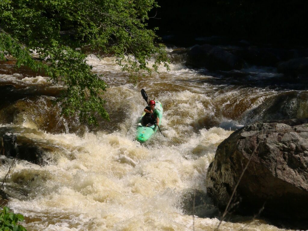
Photo courtesy of American Whitewater
Description
Put In rapid marks the entry point for the Lower Wells River section, offering a straightforward but quick introduction to the river's character. While specific details are limited, paddlers should be prepared for potential small hydraulics and navigational challenges typical of a river entry point, with attention to potential submerged rocks or irregular water flow.
Location
View Full Run
2.) Lower
Wells River
IV-V
1.1 mi
Current Conditions
5-Day Forecast
Whitewater data from
American Whitewater
American Whitewater