Gauge Conditions
Runnable: ? – ? CFS
Approximate - nearest available gauge. Use as general reference only.
Data from American Whitewater & USGS
Photo
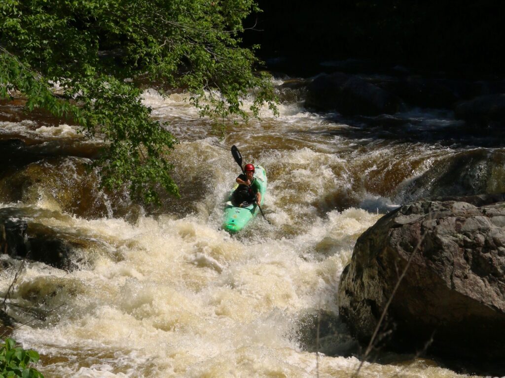
Photo courtesy of American Whitewater
Description
Take Out rapid marks the conclusion of the Lower Wells River section, featuring a tight, technical exit point with potential for pinning hazards on submerged rocks. Paddlers should carefully navigate the constricted channel, maintaining precise boat control to avoid obstacles and successfully transition to the takeout area.
Location

View Full Run
2.) Lower
Wells River
IV-V
1.1 mi
Current Conditions
5-Day Forecast
Whitewater data from
American Whitewater
American Whitewater