Gauge Conditions
Runnable: 300.0 – 1,000.0 CFS
Range for best boatability uncertain. Please help your fellow paddlers by providing a comment or report.
Data from American Whitewater & USGS
CDEC Flow Data California
Data from California Data Exchange Center (CDEC)
Photo
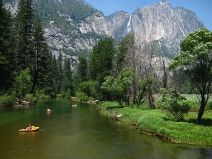
Photo courtesy of American Whitewater
Description
This rapid is located in the transition zone between the Routes 120-140 junction and Yosemite National Park's boundary on the Merced River. While specific details about the rapid's technical characteristics are limited, paddlers should be prepared for potential variable water conditions and potential hazards typical of mountain river sections. Local scouting and current flow information are recommended before attempting this section.
Location
Other Rapids on This Run (1)
View Full Run
3) Routes 120-140 Junction to Park Boundary
Merced
V
6.8 mi
Current Conditions
5-Day Forecast
Whitewater data from
American Whitewater
American Whitewater