Gauge Conditions
Runnable: 300.0 – 1,000.0 CFS
Range for best boatability uncertain. Please help your fellow paddlers by providing a comment or report.
Data from American Whitewater & USGS
CDEC Flow Data California
Data from California Data Exchange Center (CDEC)
Description
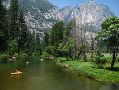
Take Out marks the conclusion of this river section with a complex approach requiring careful navigation through scattered boulders and potential shallow spots. Paddlers should be alert for potential pinning hazards and maintain precise boat control through the final stretch. While not a high-difficulty rapid, its positioning near the park boundary demands steady concentration and technical skill.
Location
Other Rapids on This Run (1)
View Full Run
3) Routes 120-140 Junction to Park Boundary
Merced
V
6.8 mi
Current Conditions
5-Day Forecast
Whitewater data from
American Whitewater
American Whitewater