Gauge Conditions
Runnable: ? – ? CFS
Approximate - nearest available gauge. Use as general reference only.
Data from American Whitewater & USGS
Photo
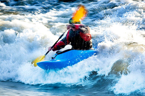
Photo courtesy of American Whitewater
Description
Put In rapid presents an unmarked entry point with potential submerged debris and variable water levels that can quickly change navigability. Paddlers should carefully scout the put-in zone, assess current flow conditions, and be prepared for potential rocky transition zones near the river's initial descent. Local knowledge is recommended due to limited information about specific hazard characteristics in this section of White Deer Creek.
Location
Other Rapids on This Run (2)
View Full Run
Forest Road to Forest Highway 360 (4.26 miles)
White Deer Creek
I-II(IV)
4.4 mi
Current Conditions
5-Day Forecast
Whitewater data from
American Whitewater
American Whitewater