Put-in
MD
Put In - Rocks State Park
Deer Creek - 3. Rocks State Park to Walters Mill River Access (MD)
Gauge Conditions
Runnable: 2.5 – 10.0 FT
2.6' is minimum for Rocks State Park to Walters Mill river access section; 2.5' is minimum for Walters Mill river access to Sandy Hook Rd./Deer Creek Conservat
Data from American Whitewater & USGS
Photo
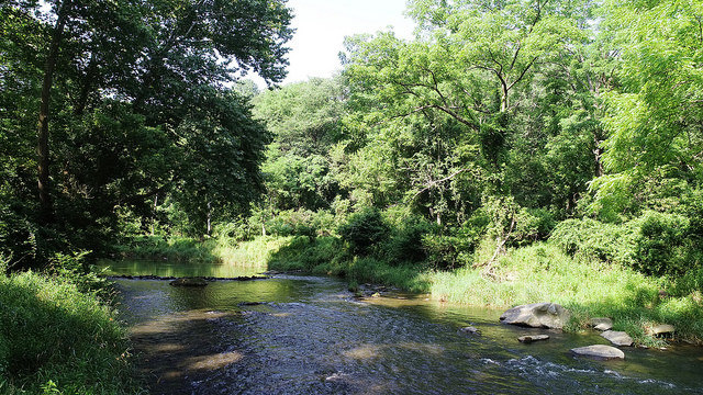
Photo courtesy of American Whitewater
Description
Put-in - Rocks State Park. The put-in is below the "Deer Creek @ Rocks" rapid, at the Rocks State Park lower parking area.
Location
Other Rapids on This Run (1)

View Full Run
3. Rocks State Park to Walters Mill River Access
Deer Creek
I-II(III)
6.4 mi
Current Conditions
5-Day Forecast
Whitewater data from
American Whitewater
American Whitewater