Take-out
MO
Take Out
Stouts Creek - 1. (Upper Stouts) Off of Highway M west of Ironton (0.6 mile) (MO)
Gauge Conditions
Runnable: 2.5 – 10.0 FT
Help us out! Add a comment regarding best levels.
Data from American Whitewater & USGS
Photo
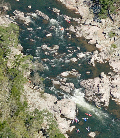
Photo courtesy of American Whitewater
Description
Take Out is the terminal rapid on the upper Stouts Creek section, marking the end of the run where paddlers exit the river. While specific details are limited, the rapid likely presents typical takeout challenges such as potential shallow water, debris, or complex shoreline access that require careful navigation at the end of the run.
Location
Other Rapids on This Run (1)
View Full Run
1. (Upper Stouts) Off of Highway M west of Ironton (0.6 mile)
Stouts Creek
III+
0.6 mi
Current Conditions
5-Day Forecast
Whitewater data from
American Whitewater
American Whitewater