Gauge Conditions
Runnable: 1,000.0 – 10,000.0 CFS
Data from American Whitewater & USGS
Photo

Photo courtesy of American Whitewater
Description
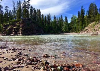
Upper Twin Creek enters on river left and marks the last take-out before the reservoir.
Location
Other Rapids on This Run (3)


View Full Run
3. Cedar Flats to Upper Twin Creek
Flathead, South Fork
II
14.9 mi
Current Conditions
5-Day Forecast
Whitewater data from
American Whitewater
American Whitewater