Gauge Conditions
Runnable: ? – ? CFS
Approximate - nearest available gauge. Use as general reference only.
Data from American Whitewater & USGS
Photo
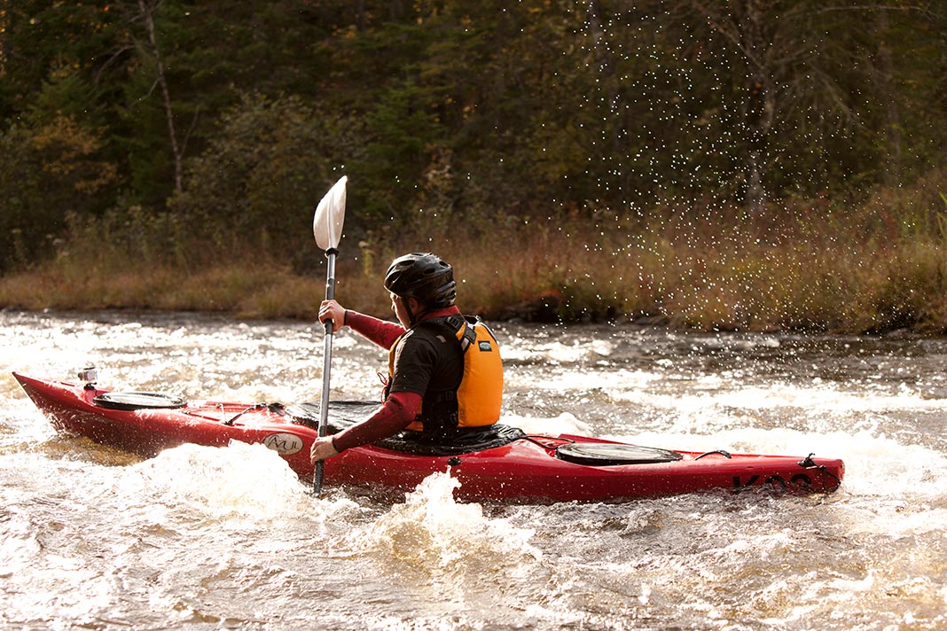
Photo courtesy of American Whitewater
Description
Take Out is a transition point between challenging river segments, marked by potential shallow water and scattered rock gardens that require precise navigation. Paddlers should be prepared for potential strainers or submerged debris, and carefully assess water levels and flow conditions before attempting this section of the Montreal River.
Location
Other Rapids on This Run (11)
 Rapid
N/A
Rapid
N/A
Put In
Rapid
N/A
General Comment:
Rapid
N/A
Confluence, Welch Creek
Rapid
N/A
Braided Channel
Rapid
N/A
USGS site
Rapid
N/A
Confluence, Spring Creek
Rapid
N/A
Hwy.2 Alternate Put-in
Rapid
N/A
Confluence, W.Fk.
Rapid
N/A
Possible egress
 Rapid
N/A
Rapid
N/A
Confluence, Boomer Creek
Rapid
N/A
Confluence, Mud Creek
View Full Run
B) Nylund Road to Saxon Falls Dam (17.9 miles)
Montreal
I-II
16.8 mi
Current Conditions
5-Day Forecast
Whitewater data from
American Whitewater
American Whitewater