Gauge Conditions
Runnable: ? – ? CFS
Approximate - nearest available gauge. Use as general reference only.
Data from American Whitewater & USGS
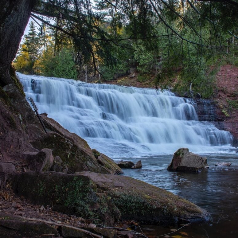
Photo

Photo courtesy of American Whitewater
Description
Take Out rapid marks the end of this long river section, typically signaling the conclusion of a challenging run through the Middle Branch Ontonagon. While specific details about this rapid are limited, paddlers should be prepared for potential class-appropriate features and potential hazards typical of Michigan rivers, with careful attention to water levels and potential strainers or submerged obstacles.
Location
Other Rapids on This Run (20)
Rapid
N/A
USGS samping site
Rapid
N/A
Hwy.28 Wayside
 Waterfall
N/A
Waterfall
N/A
Agate Falls
 Rapid
N/A
Rapid
N/A
Put In
Rapid
N/A
Log Jam
Rapid
II+
Wave/hole
 Rapid
N/A
Rapid
N/A
Confluence, Payne Creek
Rapid
N/A
Ledge/wave?
 Rapid
N/A
Rapid
N/A
Confluence, Tom Creek
Rapid
N/A
Log Jam 2 / Meto Creek
Rapid
N/A
Possible access/egress?
Rapid
N/A
Log Jam Concern #3
Rapid
N/A
Log Jam Concern #4
Rapid
N/A
Log Jam Concern #5
Rapid
N/A
Confluence Trout Creek
Rapid
N/A
Powerline Clearing
Rapid
N/A
Rapids
Rapid
N/A
Possible/apparent set of ledges/waves/holes
 Rapid
N/A
Rapid
N/A
Apparent rapids
 Rapid
N/A
Rapid
N/A
Confluence, Longtime Creek
View Full Run
C) below Agate Falls (Hwy.28) to Hwy.45 (28.7 miles)
Ontonagon, M.Br.
I-III
25.7 mi
Current Conditions
5-Day Forecast
Whitewater data from
American Whitewater
American Whitewater