Gauge Conditions
Data from American Whitewater & USGS
Photo
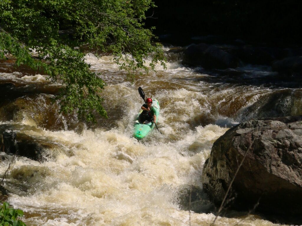
Photo courtesy of American Whitewater
Description
Take Out rapid marks the end of the Mountaintown Creek run, requiring paddlers to carefully navigate a congested exit point with potential for pinning and entrapment. The rapid features scattered rocks and a narrow channel that demands precise boat placement, with potential hazards including undercut boulders and shifting debris near the takeout point.
Location
Other Rapids on This Run (2)

View Full Run
Hwy 52w to Hwy 282/76w
Mountaintown Creek
I-II
5.4 mi
Current Conditions
5-Day Forecast
Whitewater data from
American Whitewater
American Whitewater