03. Crystal Dam to Chukar Trail
Linked via: Proximity 91% confidence Synced 6mo ago
Gauge Conditions
Runnable: 600.0 – 3,000.0 CFS
Data from American Whitewater & USGS
Run Map
Run Time Estimate
Select put-in and take-out to estimate time.
Unlock Advanced Trip Planning
See wind-adjusted speed maps, forecast planning, and detailed time estimates.
Sign in to generate an AI timing estimate for this run.
Whitewater timing varies with scouting, portages, and group pace. Use as a planning baseline.
Description
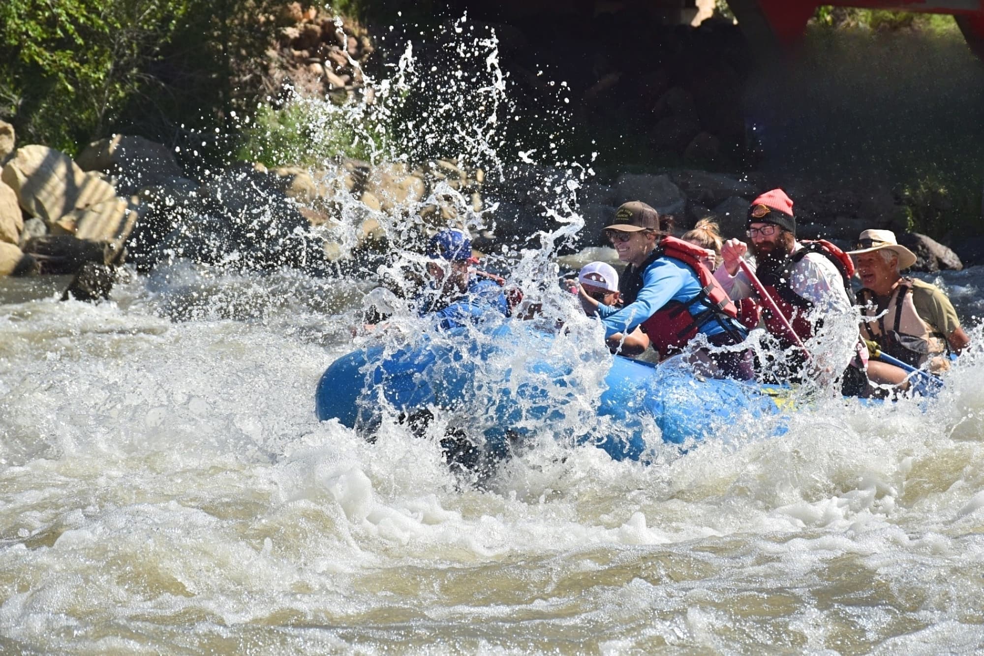
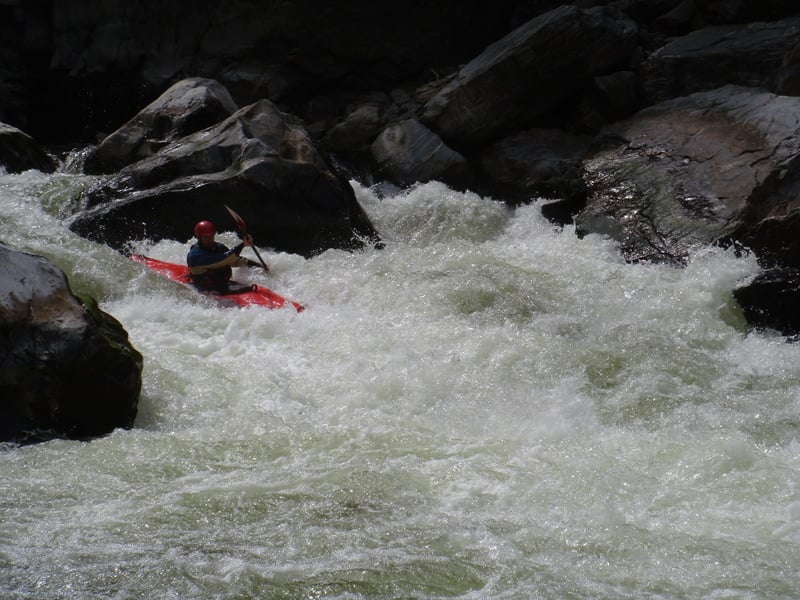
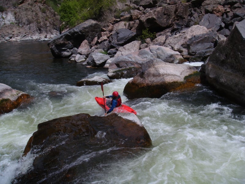
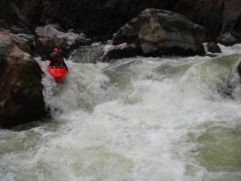
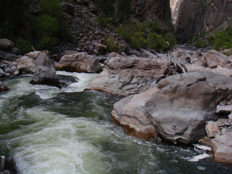
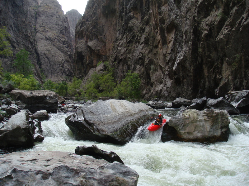
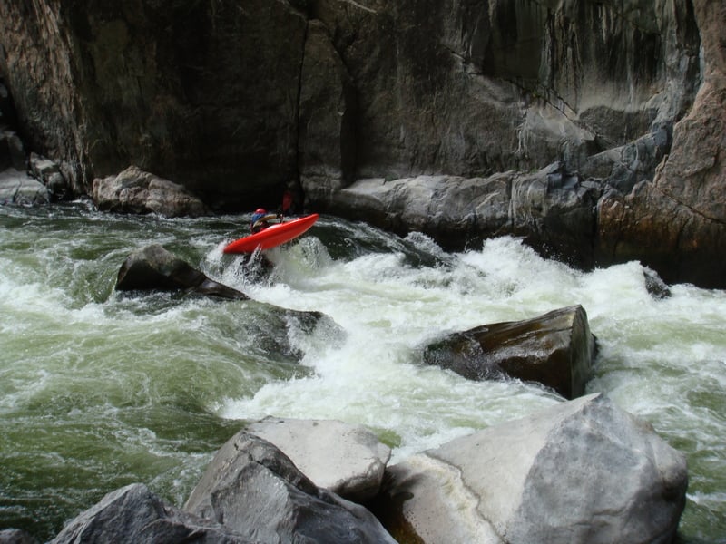
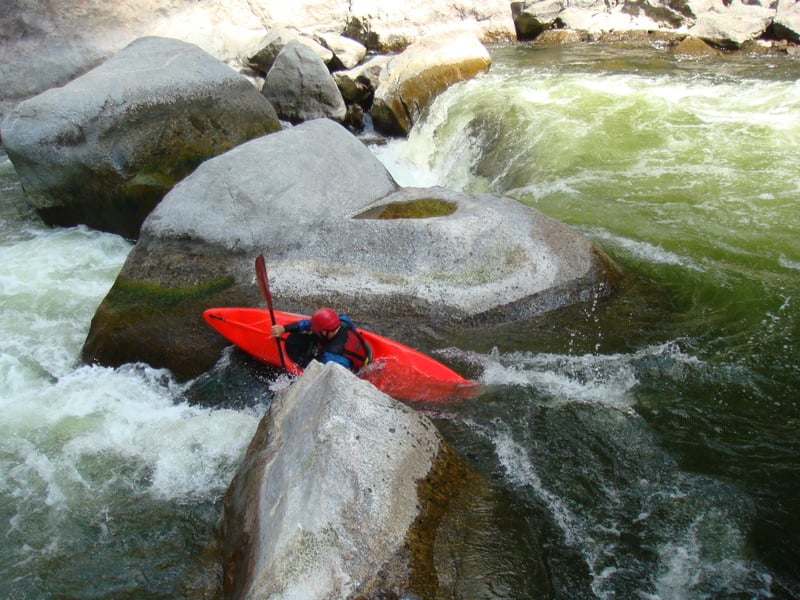
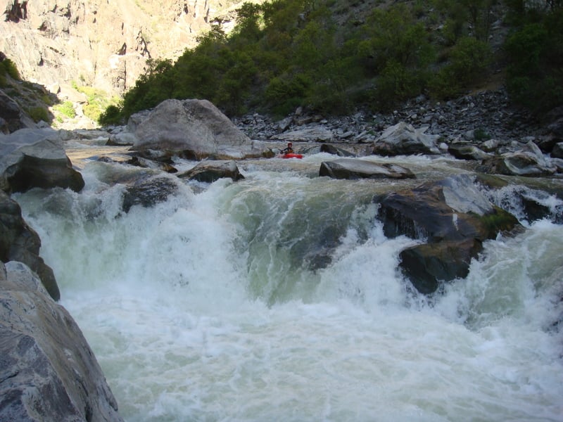
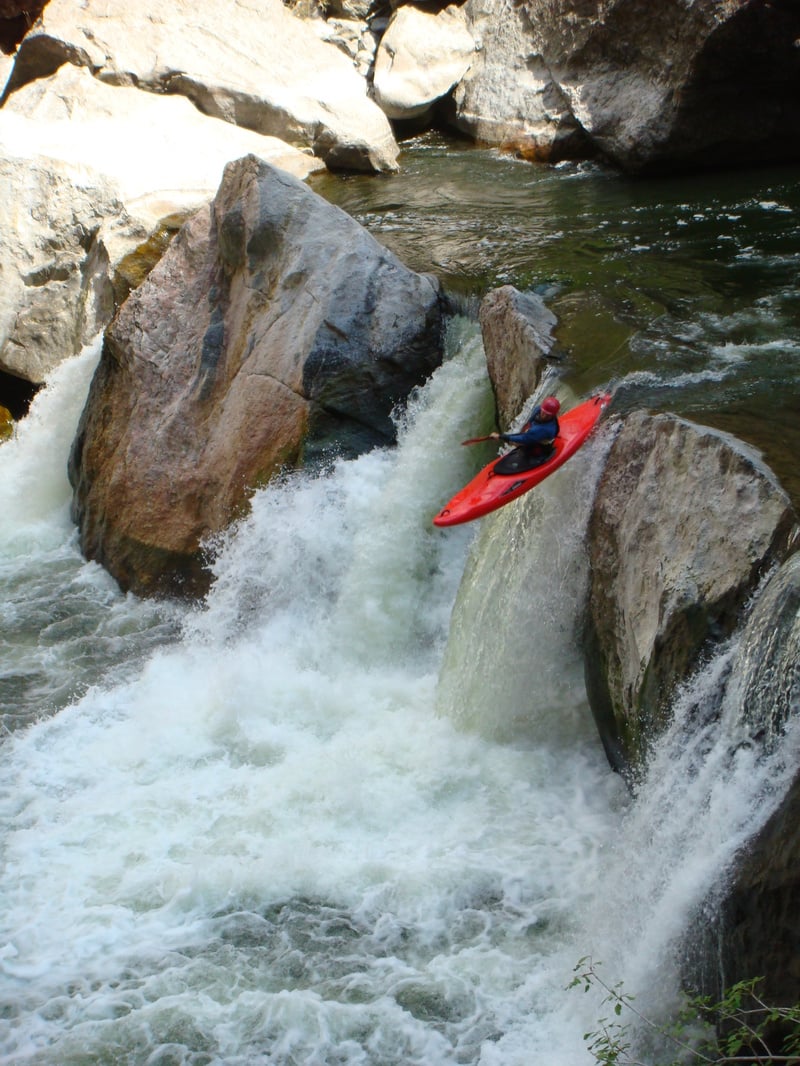
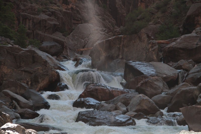
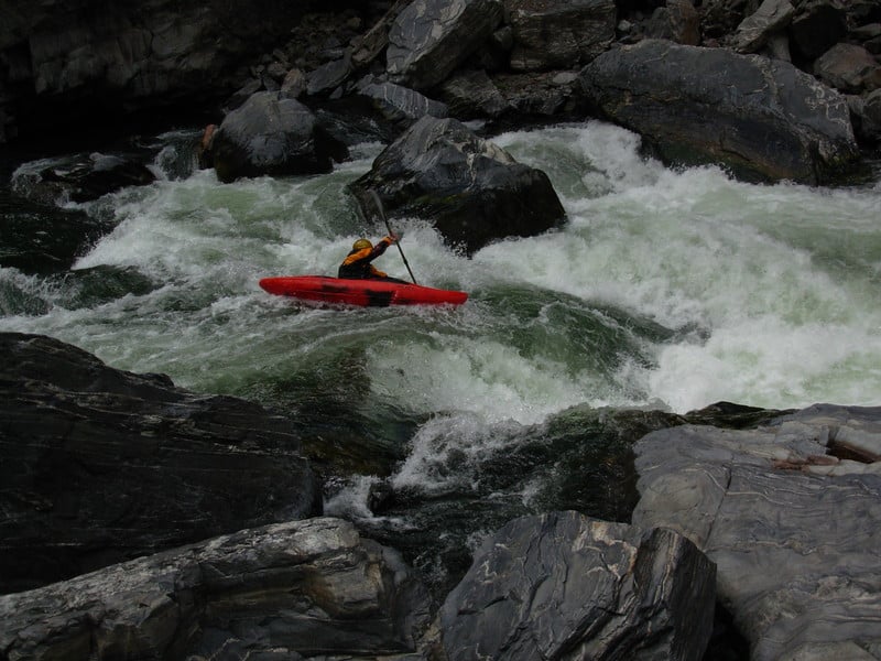
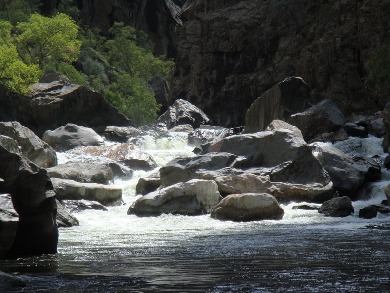
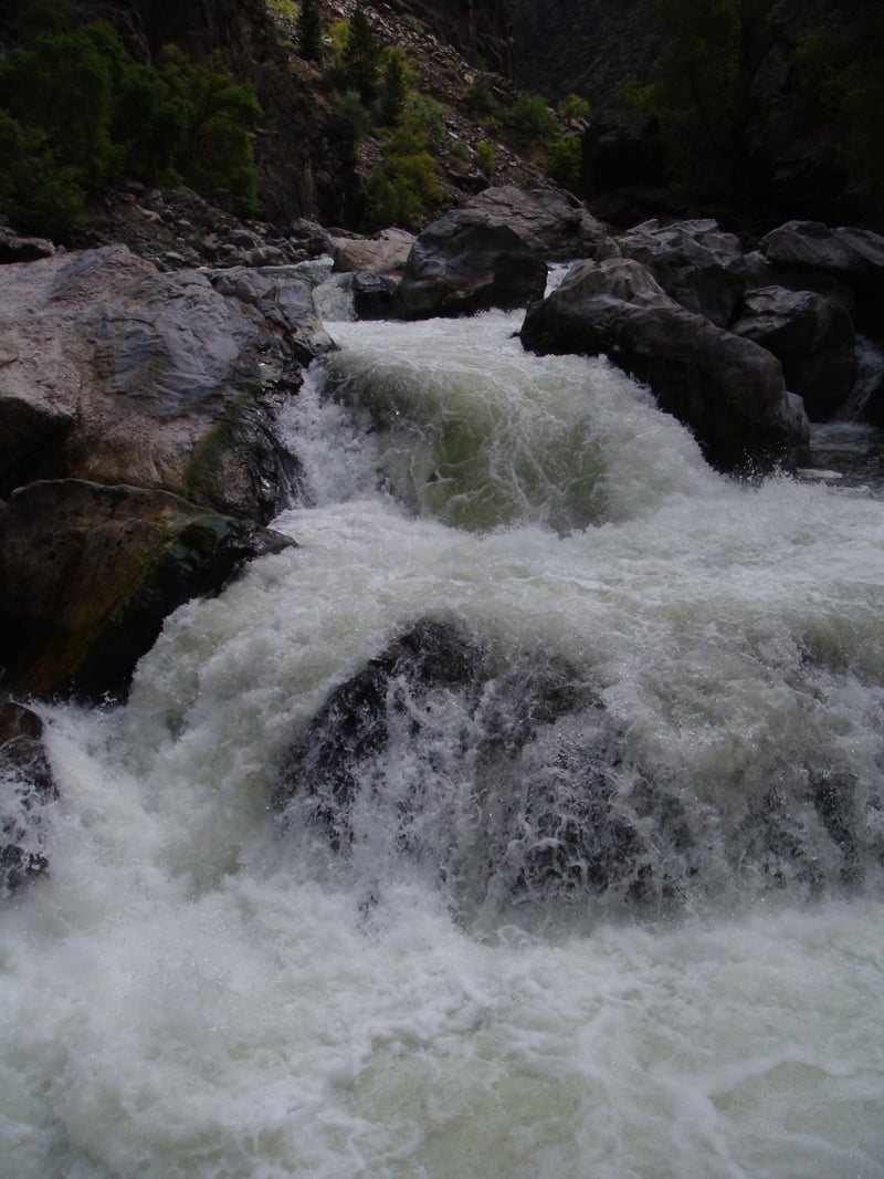
The Black Canyon is a classic Colorado run through a spectacular chasm. The technical difficulty is dependent on the amount of portaging you plan to do. Class V+ drops are there for 'The Next Generation' . Fit mortals with strong shoulders can tone it down to V-. Make no mistake, the run has a solid class V adventure factor, so go in prepared. The canyon is very deep and committing with strenuous portaging and Prehistoric Level poison ivy; don't forget about the poison ivy. For a place that gets about an hour of sunlight a day, it has produced some of the healthiest poison ivy on the planet. At any rate, if you like being in deep remote canyons and enjoy high adventure, then this run is for you. Most of the drops are boulder-style and of the highest quality, at least the ones that are runnable. Many rapids in the canyon completely sieve out and require strenuous portaging. In 1997, Chuck Kern, a world-class paddler, drowned in an unseen undercut while attempting to run part of the section that's commonly portaged. A short description of the accident can be read here. Luckily, most of the portages are no-brainers; it's either a sweet drop or certain death. This run is usually done in two days but can easily be done in one long day if you know what you are doing, and if you are training for the Iron Man. A person spending the night in the canyon will be rewarded with a beautiful sandy beach and one of the best camping experiences ever. Day 1 Shortly after the put-in, the river moves through class III boulder-slalom type rapids. Be on the lookout for the first major drop Day Wrecker, which can sneak up on a paddler. This drop comes just after a sharp right-hand turn and is one of the few drops that will require careful consideration. The line is down a thin slot on the far left and into a powerful hole (this hole can't be seen from the scout on the right bank). Next, whether you are still looking at the sky or not, you must go through door Number 1, 2, 3, or 4. Door Number 1 = sieve, Door Number 2 = sieve, Door Number 3 = freedom, Door Number 4 = piton, jacking, then freedom. The portage is on the right. The river continues with a class III/IV nature and an occasional class V- drop or portage for several miles. As a general rule, if the river looks like it is dropping off the face of the earth, it probably is. Just paddle to the right bank, pick up your boat, and start walking. Almost all of the portages on day one are on the right. Eventually the canyon will really start to close in. This is the Narrows, and this is where some of the best class V drops can be found. Be sure to note the 1500-foot vertical walls that extend out of the water on both sides. Don't get hurt here! The last treat of the Narrows is the 18-footer. A totally calm pool spills through a perfect U-shaped spout. Boof left through the center spout with left angle, and keep your nose up. The landing is deeper than it appears, but no need to take a chance. Now for the mile-long portage over VW Beetles. This portage can either be 45-minute grunt if you take the right path or a 3-hour nightmare if you don't, and totally avoiding the poison ivy is impossible-yes impossible! The Portage Pull over on the right bank about 100 yards past the 18-footer. Don't bother trying to run some of the drops in the portage; the river is under boulders more than it is exposed to the air. Stay close to the right wall and high above the river. Continue on the right until the right wall angles down to the river, forcing a decent (don't be surprised if this takes more than 30 minutes or so, and don't descend prematurely). Descend down large boulders aiming for a large calm pool with a rope across it. This spot is a good alternate camp in rainy weather, because of a natural cave that exists there. Next, ferry across the pool to the river left bank. Climb directly up to the left wall and continue along it for 100 yards or so, until you are forced down to the river again. This time the descent is on steep loose dirt, so lowering boats with a rope may be a good idea. Run one small drop and then ferry to the right bank fast. Get out (itÂs almost over) and carry 50 yards down the right bank past a cool looking waterfall, and put in when things look reasonable. At this point you are at the base of S.O.B. gully, which is a possible, yet grueling escape from the canyon. After one long rapid, beach camp is reached on the right. Day 2 Immediately after beach camp things get interesting. Class III+ boulder slalom leads to a ledge-type drop. The best line seems to be down right of center and angling left. Scout river right. Closet Rapid comes soon after the ledge and is composed of a long tight boulder maze. Eddy hop, go slow, and choose your line carefully, because a wrong turn could lead to a dead end with a sieve. The general path starts left, works right, and then back left again. Be careful not to get lured right at the end, or you will loose the main current and will be forced to portage. Some more boogie water leads to a calm pool backed up by the end of the earth. There is no mistaking this thing... ever gotten vertigo in your boat before? There looks to be a possible line down the right, but this is usually a portage. If you are thinking of running this thing scout on river right, but first look up and try to figure out how your buddies are going to get your broken body out of there. The portage is on the left and getting out of your boat involves some creativity. Once at the base of this monster, the only thing left is a short, fun, class IV drop and a long paddle out. If you opted for the Chukar Trail take out, paddle for several miles while watching for an obvious beach and trail on the left. This is where you will burden your shoulder one last time for the uphill slog to the parking lot. For the Confluence takeout, continue paddling down the never-ending Gunny Gorge until the North Fork is reached. Shuttle _Take-out:_ To get out of the canyon, one must either paddle the never-ending Gunny Gorge to the confluence with the North Fork, or carry up the mile long Chukar Trail (think about how sore your shoulder will be by the time you get there). The road to Chukar Trail will require a vehicle with good ground clearance. The confluence take-out is located at Forks of the Gunnison, which is 1 mile south down a dirt road located 6.2 miles west of Hotchkiss and 14 miles east of Delta on Rout 92. To get to Chukar Trail, head east on Falcon Rd., which is located just south of Olathe on Hwy. 50. Follow the signs to Chukar Trail. _Put-in:_ Take Hwy. 50 east out of Montrose. Turn left (north) on to Rout 347 following the signs to the national park. Just after the entrance station (and a fee) turn right following signs to East Portal. Once at the bottom of the canyon, turn left into the campground and park by the river. Before launching, a permit must be obtained from the visitors center. Permits are available upon request and should be obtained before descending to East Portal.
Rapids in this Run (10)

Waterfalls (2)
Hazards & Portages (6)
Caution: The following locations may require scouting or portaging. Always check current conditions.
Difficulty
Class IV-V(V+)
Length
14.4 mi
Gradient
51 ft/mi
max 210
Rapids
10
5 Hazards
1 Portage
Access Points
Difficulty Classes
I Easy
II Novice
III Intermediate
IV Advanced
V Expert/Extreme
VI Unrunnable
Current Conditions
5-Day Forecast
Whitewater data from
American Whitewater
American Whitewater