1. Middle, S. Fork confluence to Garnet Dike Campground Wild
Linked via: Proximity 98% confidence Synced 6mo ago
Gauge Conditions
Runnable: ? – ? CFS
Approximate reading: This gauge is 18.3 miles away on Kings. Use as a general reference only.
Data from American Whitewater & USGS
CDEC Flow Data California
Data from California Data Exchange Center (CDEC)
Run Map
Put-in
Take-out
Rapids/Hazards
Wild
Run Time Estimate
Select put-in and take-out to estimate time.
Unlock Advanced Trip Planning
See wind-adjusted speed maps, forecast planning, and detailed time estimates.
Sign in to generate an AI timing estimate for this run.
Whitewater timing varies with scouting, portages, and group pace. Use as a planning baseline.
Description
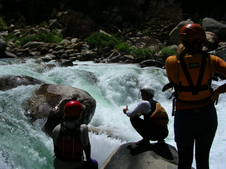
Overview: This is a great run with about 10 big class 5 drops and numerous class 4 rapids. It is usually run in one day, but makes a good overnight trip also. It is more often run by kayaks, but has had many raft descents. There have been a few descents by inflatable kayaks and at least one descent by open canoes. Fishermen and adventerous hikers have explored and traversed this canyon for many decades. One old timer reported that traffic through the canyon had dropped off considerably after the 1940's. Fishermen will usually wait till flows are less than 300 before venturing far into the canyon.
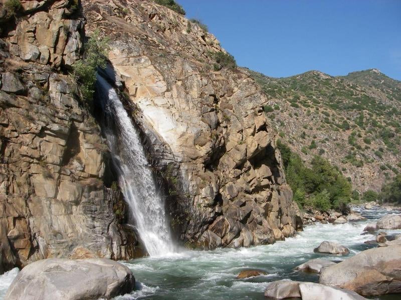
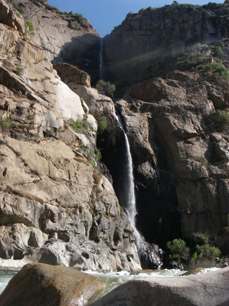
Most river runners probably neglect sidehiking in this canyon, but there are several worthy sidehikes. Exploring 10 mile creek, Spring Creek, Rough Creek and Garlic Creek Falls are all worthwile adventures.
There are several spots where the remains of the Hume to Sanger Lumber flume are still visible. This Flume was built in the 1890's to carry rough cut planks from a lumber mill at Hume Lake to a finish mill in Sanger. The lumber was from the many Sequoia Gigantea (Giant Redwoods) in the area. The loggers decimated groves of redwoods and lost money in the process. Now the whole area is dedicated to the preservation of the Giant Sequoias. The remains of the flume are a tribute to both Man's resourcefullnes and his stupidity. (Kind of like kayaking!) Shortly before Rough Creek look for apple trees on river left. Piles of lumber from the flume and a collapsed cabin can be found on the hillside above the apple trees. In 1985 I scavanged through the pile to find a rotting piece of lumber which I used as a paddle after mine was lost to a sieve just upstream! Look for cables hanging from bolts in the river left wall opposite Garlic Falls.
In nearly 20 years of paddling this reach, it has been very interesting to see the changes in the rapids. Though most paddlers do not notice, even the biggest rapids often have subtle changes from year to year. Some lines change, some dissappear, while other lines open up. The flood of January '97 created major changes when it obliterated every rapid except the class 5s with the biggest boulders. All rapids of class 4 difficulty or less were destroyed and moved somewhere else, or completely rearranged.
Put in: From Fresno, take highway 180 through Grants Grove, over Cherry Gap and down into Kings Canyon. Highway 180 is gated in the winter at the Hume Lake Rd turnoff or just past Kings Canon Lodge. See: CalTrans information about Highway 180 outside Kings Canyon. About a mile past Kings Canyon Lodge, look for the Yucca Point trailhead on the left. There is a small turnout with enough room for a few cars. The trail (complete with poison oak in spots) is about 2 miles of gradually descending switchbacks to the river. Most of this trail catches full sun early in the morning and throughout the day, so it can be very hot.
Take out: Garnet Dike is at the end of an 8 mile dirt road and the put in for the Kings— Garnet Dike to Kirch Flat section. If you have enough energy it makes some sense to keep floating downstream till you come to paved road. This saves a bit of shuttle hassle. If you have a driver, it is nice to see them waiting at Garnet Dike instead of 8 further miles downstream.
Shuttle: Get a driver! Have the driver drop you off in the canyon and pick you up at Garnet Dike. Pay them money! Have them bring supper! It is worth it. Repeat after me, "I will get a shuttle driver!" If you do not get a driver out in Fresno or other parts of the valley, you might find someone willing at the commercial rafting companies (iffy). If you are at the Garnet Dike area already and have to drive to Yucca Point, you should drive back out around Pine Flat Reservoir, which is a long, yucco, tiring, but paved road.
Holbeck and Stanley recommended that you you brave Mill Flat Rd, (not paved, long, tiring and yucco) which starts on the south side of the river and provides a much shorter distance but not a shorter time to highway 180. Mill Flat Rd is only 16 miles from the river to highway 180 but is in terrible condition as of 2006, so allow around an hour and 40 minutes to drive that short distance. Take a high clearance vehicle that you do not mind scratching the paint and don't try it at night. On the plus side there are great views from this road and it can be recommended as a mountain bike ride.
Wild & Scenic River Status:
Wild from the put in to about mile 6. Below mile 6 the river is protected in a Special Management area with the same protections as if it was in the Wild & Scenic System.
Federal legislation that entered part of the Kings River into the National Wild & Scenic Rivers system and a lower section into a Special Management Area was introduced and carried by then Congressman Rick Lehman in 1987.
Text of the act.
Paul Martzen
Fresno, CA 2003
Other Information Sources:
Cassady & Calhoun, Holbek & Stanley, Martin, Penny
Bill Tuthill's California Creekin.
Preston Holms has some nice pictures at Kayak Pictures.
Photos at Dreamflows.com
----------------------------------------------------------------
2007 High Water Trip with 3200 cfs
by Eric Henrickson
This was our final run of a two week trip last May. We had considered heading back to the Middle Fork Feather for another trip, but decided we would like to look for something new. Eric Nies was well versed in California boating and seemed to think that the stars would align for the Kings after studying flow gauges. We arrived in the wee morning hours and got up early to try to find a shuttle. Being midweek, we were able to find some raft guides who were interested in extra cash, and for the sum of $100 we had a shuttle. Eighty-Five miles one way is a pretty hefty shuttle. The folks at the raft base were pretty surprised that we were heading up with so much water. Ignorance was bliss, and we figured that if Holbeck did it at 2500cfs, we could get through. Did I mention something about ignorance?
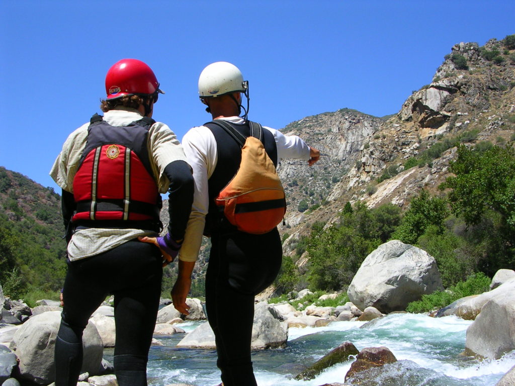
From the road at Yucca Point, it was obvious that the wave trains we could see had pulsatile qualities equating to big water. Still we bid our drivers farewell and sallied forth down the trail. Deciding to sneak very first rapid was an ominous sign. We soon came to a sizeable drop which may have been Entrance Exam. A powerful flume down the left with a really large hole on the bottom right. After scouting and recognizing a sizeable stretch of water for recovery we decided to run blue angel. Bracing into the breaking wave, that formed the first feature, I was completely unprepared for the power and speed of the water, and inhaled a good amount of water on the way over. Several roll attempts later, I was swimming and came up just in time to witness my line through the bottom of the huge hole. Getting to shore was quite a bit of work. I noticed that there was a boil lining the shore that readily rejected me from crossing the last five feet or so to the bank. Fortunately no gear was lost and we headed on with a new respect for what we were up against.
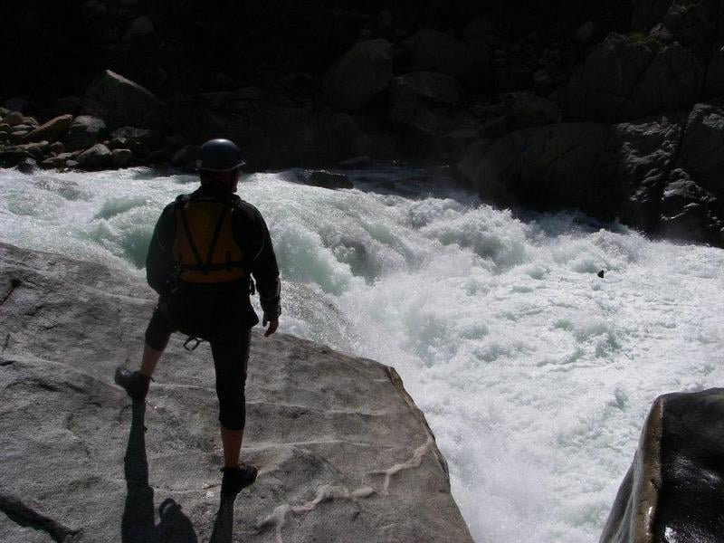
One of the properties of big water is for the water to boil off the shores and funnel towards the center of the streambed. This was very apparent throughout this run. We basically sneaked and portaged our way downstream. Once the gradient picked up, there were no gaps between rapids at all. The character of the run was continuous class five interrupted only by huge holes and really violent features. What pools there were had strong currents jetting through them and into the next drop. While many of these drops would have been good to go by themselves, the aspect of being flushed immediately into the next drop would have guaranteed the almost certainty of drowning should there have been even the slightest mistake.
We would basically stick to one side of the river until it cliffed out and then scout for a ferry to the other side. Ferrying by itself was a formidable task. On one occasion we had gotten our ferry line figured out and Eric N. was getting ito his boat. He looked up and said, "I'm only feeling about 90% sure about this one." With that we continued on our portage until something better presented itself. Even running sneak lines was intense. Basically we were running mostly class III-IV lines that would venture briefly into the main flow with the constant tendency of being surfed out and engulfed in the main rapids. Several times I got spun on boils and would have to commit to ferrying to small boiling eddies out in the main flow and then back. It's pretty intense to be treading water above a horrendous drop and realize that you are losing ground.
I don't know if I could relate the rapids we saw to the descriptions on the AW site. I think I may have taken pictures of The Wall and Warp 2 as well. One of the most impressive aside from Cassady Falls was the one that I think is Warp 2, a pointed smooth spout of water with 90 percent of the river's volume dropping probably fifteen feet into a huge hole. The scale of the whole river at that flow was rather overwhelming, considering we were committed to the run.
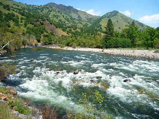
We camped on river right between Rough Creek and Garlic Falls, which is an excellent site. We were prepared for another full day of portages and sneaking, but the river mellowed out quite soon, with only a few portages. At this point we were able to relax a bit and take in our surroundings. We finished the run by floating down to the rafting base where our vehicle would be. This was preferable in my mind to setting shuttle from the earliest takeout (Mill Flats, I think). The scenery was great.
The folks at the rafting base gave us a round of applause as we walked in. They were keen to know what it had been like, and were surprised that we had gotten through so quickly. They generously fed us lunch and offered the use of their facilities. With that, we decided we had done enough boating for one trip and went off to hike in Yosemite.
I would be very much interested to return at a more manageable flow, perhaps 1200cfs. Knowing what I do from the first trip, I'd probably launch up to about 2000cfs. It would be nice to get to run more of the river. It is an impressive canyon with equally impressive logistics. Planning for a midweek run probably improved our odds of getting shuttle help from the raft guides. I think our shuttle fee was quite reasonable, being that it is a full day outing for the driver.
That's the summary of our trip. A very high sneak and portage to boating ratio. I've gotten to boat in California several times now and would consider it unbeatable from many standpoints: Scenery, water quality, expedition opportunities, sustained gradients and sunny weather. Can't wait to get back.
Eric Henrickson
--------------------------


Rapids in this Run (13)


Difficulty
Class V
Length
9.9 mi
Gradient
96 ft/mi
max 160
Rapids
13
Access Points
Shuttle Info
The map directions show going down Mill Flat road. This is not recommended. It is just as fast (slow) to stay on paved roads, by driving all the way around Pine Flat reservoir. This map will be corrected when we can.
Highway 180 is closed in the Winter past the Hume Lake Road turnoff. This is about 8 miles from the Yucca point trail to the put in. In the spring Highway 180 is often opened to the Kings Canyon Lodge and gated about 1/2 mile from the Yucca Point trail. See: [CalTrans information about Highway 180 outside Kings Canyon](http://www.dot.ca.gov/hq/roadinfo/display.php?page=sr180) to see where the highway might be gated or if it is open to Cedar Grove.


Difficulty Classes
I Easy
II Novice
III Intermediate
IV Advanced
V Expert/Extreme
VI Unrunnable
Current Conditions
5-Day Forecast
Whitewater data from
American Whitewater
American Whitewater