1. Schafer Meadows to Bear Creek Wild
Linked via: Proximity 99% confidence Synced 6mo ago
Gauge Conditions
Runnable: 1,000.0 – 20,000.0 CFS
Flow range for best boatability uncertain. Please help your fellow boaters with a comment or report.
Data from American Whitewater & USGS
Run Map
Put-in
Take-out
Rapids/Hazards
Wild
Recreational
Run Time Estimate
Select put-in and take-out to estimate time.
Unlock Advanced Trip Planning
See wind-adjusted speed maps, forecast planning, and detailed time estimates.
Sign in to generate an AI timing estimate for this run.
Whitewater timing varies with scouting, portages, and group pace. Use as a planning baseline.
Description
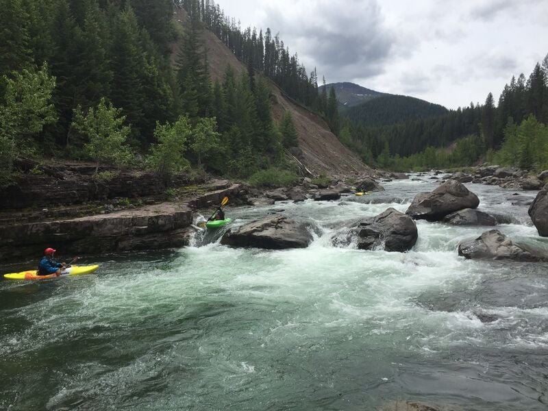
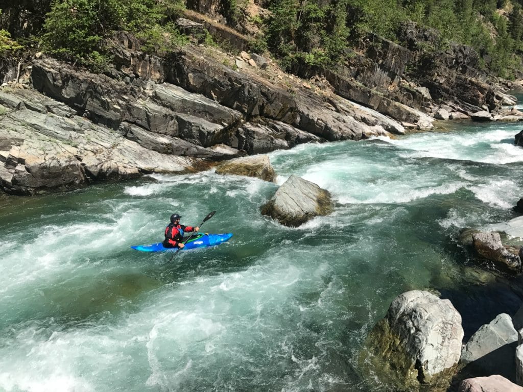
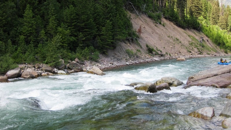
This is the multi-day Wilderness run of the Flathead River National Wild and Scenic River. It begins in the Bob Marshall Wilderness, traverses the Great Bear Wilderness, and the take-out is on the southern border of Glacier National Park. The whole concept of the Wild and Scenic Rivers system has its roots in the Flathead River system. Frank and John Craighead, two wildlife biologists from Montana, found themselves fighting the proposed Spruce Park Dam on the Middle Fork Flathead that would have inundated bear habitat along the river. Through articles in Naturalist in 1955 and Montana Wildlife in 1957, the brothers developed a concept for a system and classification for free-flowing rivers that became the basis for the Wild and Scenic Rivers Act in 1968. The Middle Fork Flathead was designated from its headwaters to the confluence with the North Fork in 1976. Quite the pedigree - and it is more than deserving.
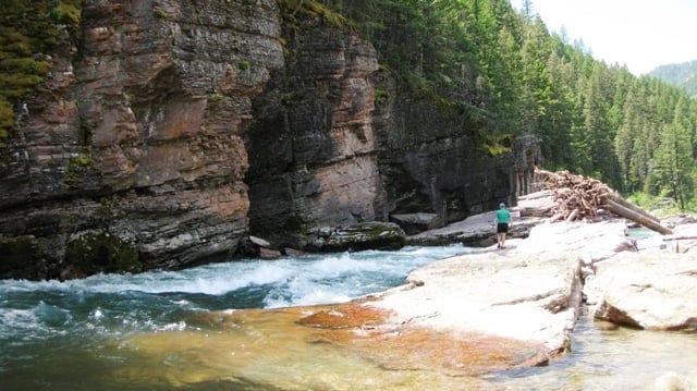
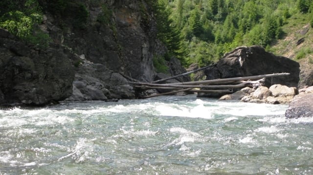
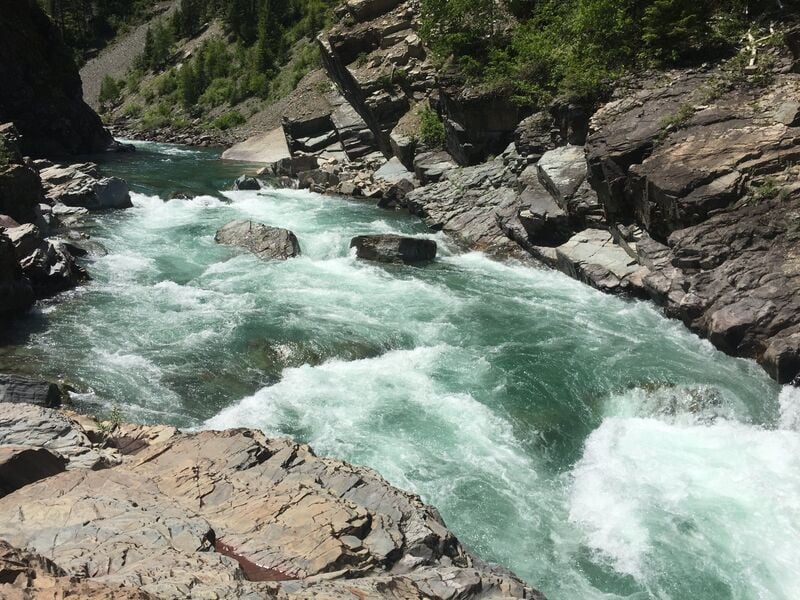
While most visitors choose to fly into Schafer Meadows, kayakers and packrafters can hike or paddle down Granite Creek 6 miles to enjoy the final 18 miles or so of the Middle Fork. Packrafters can also hike in to do the full run by hiking in approximately 14 miles on the Morrison Creek Trail. Another option for a fun day trip is to hike approximately 5 miles up from Bear Creek to run the Spurce Park Series as a day trip. For those flying to the top, flights out of Kalispell, Montana take about 20 minutes to reach Schafer Meadows. Bush planes have gear weight and size limits, so call ahead for reservations and details so you can plan accordingly (you can typically get kayaks under 9' in a Cessna 206). The river is about a 1/4 mile muddy hike from the airstrip. Granite Creek, about 11 miles downstream from Schafer Meadows, is a significant tributary, and flows increase after it joins the main stem near the Granite Cabin making this an option when flows are lower later in the summer. Less than a mile after the cabin marks the Castle Lake trail, a short steep hike up to an alpine lake that is a nice side trip to stretch your legs after a day of boating. Multiple additional creeks enter the mainstem throughout the run, some with waterfalls of varying sizes. Spruce Park Rapid, the last rapid in the series, is the most notable, while others are bony tumblers flowing past rock formations that look like stacks of flapjacks. Overall, this is a spectacularly wild run with gin-clear water, grizzly bears (be sure to hang your food), and eagles. It often feels like snorkeling from a boat because there are so many fish and the water is so clear.
For more information, download the Three Forks of the Flathead Wild & Scenic River Float Guide from the Forest Service or purchase a waterproof copy from the National Forest Map Store.
Check out this low water video of the run below Granite Creek: Wild and Scenic Montana, Episode 3: Middle Fork Flathead River from American Whitewater on Vimeo.
Note: the putin lat/longitude coordinates listed above are at Schafer Meadows (no auto access; horse or plane only); this would be the Upper West Fork Flathead.
*Photo courtesy of, and copyright by,* *Randy Clark*.
This pdf Slideshow is by Mark McKinstry from a 2017 trip.
Rapids in this Run (10)
 Rapid
IV
Rapid
IV
Three Forks Rapid Series
 Rapid
Rapid
Morrison Creek Trailhead
 Rapid
Rapid
Morrison Creek Confluence
 Rapid
Rapid
Granite Creek Trailhead
 Rapid
Rapid
Granite Creek confluence
 Rapid
IV
Rapid
IV
Upper Twenty-Five Mile Rapid
 Rapid
IV
Rapid
IV
Lower Twenty-Five Mile Rapid
 Rapid
III
Rapid
III
Cye Creek Rapid
 Rapid
III
Rapid
III
Lunch Creek Series
 Rapid
IV
Rapid
IV
Spruce Park Rapid Series
Difficulty
Class III-IV
Length
27.5 mi
Gradient
35 ft/mi
Rapids
10
Access Points
Shuttle Info
Most boaters choose to fly into Schafer Meadows airstrip from Kalispell, Montana. Montana Air Adventures offers air shuttle for approximately $450/plane (2019 prices). Reservations fill up, so call in advance. Come to the airstrip early, as all of your passengers and gear must be weighed. Airplanes have weight and space limits, so make sure your gear is as light and compact as possible. Whitewater kayaks do fit, but just barely! The company can advise you, based on your anticipated gear and passengers, on how many planes you will need. Be aware that afternoon thunderstorms can delay your flight, so plan some flexibility in your schedule.
There are multiple take-out points once the river exits the wilderness. At Bear Creek it parallels Highway 2 until it reaches West Glacier, the west entrance to Glacier National Park. Shuttle your pickup vehicle to Bear Creek, Essex, Paola, Cascadilla, or West Glacier, depending on the desired length of your trip, prior to arriving at the airstrip, or arrange for a $100 (2019 prices) vehicle shuttle with Montana Air Adventures.
Difficulty Classes
I Easy
II Novice
III Intermediate
IV Advanced
V Expert/Extreme
VI Unrunnable
Current Conditions
5-Day Forecast
Whitewater data from
American Whitewater
American Whitewater