1- Upper: Highway 23 to Rickman Airfield Road
Linked via: Proximity 91% confidence Synced 6mo ago
Gauge Conditions
Runnable: ? – ? CFS
Approximate reading: This gauge is 3.8 miles away on Stekoa Creek. Use as a general reference only.
Data from American Whitewater & USGS
Run Map
Run Time Estimate
Select put-in and take-out to estimate time.
Unlock Advanced Trip Planning
See wind-adjusted speed maps, forecast planning, and detailed time estimates.
Sign in to generate an AI timing estimate for this run.
Whitewater timing varies with scouting, portages, and group pace. Use as a planning baseline.
Description
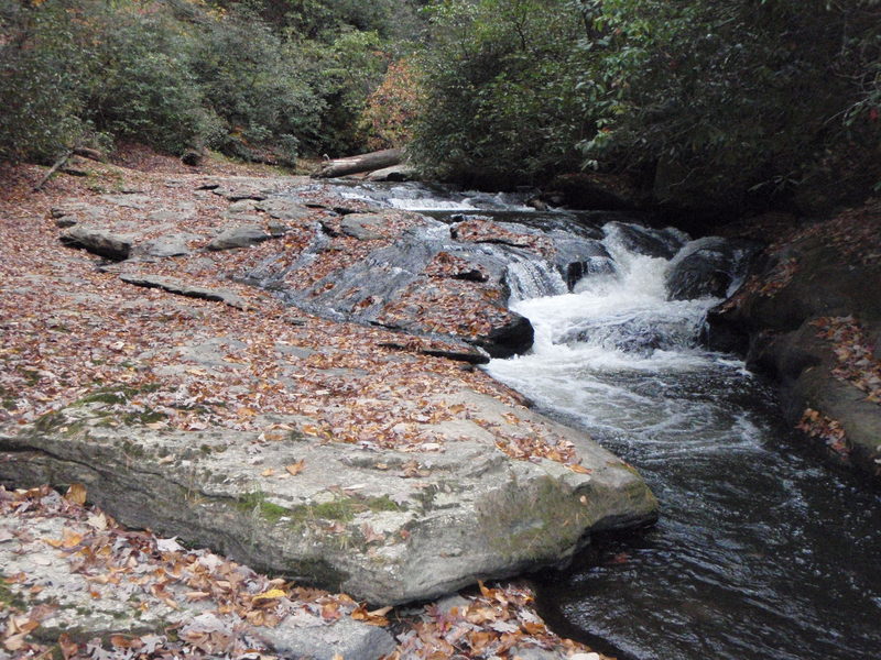
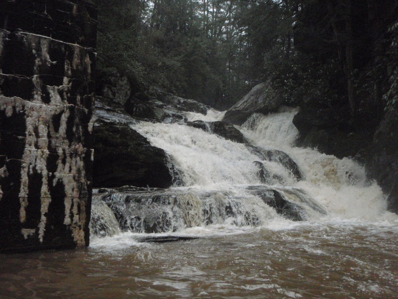
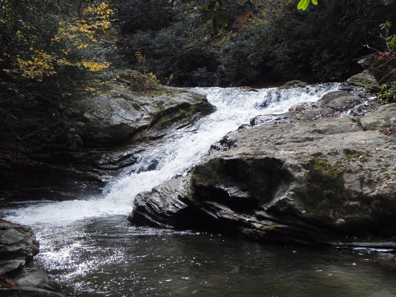
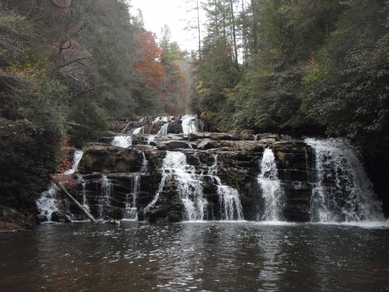
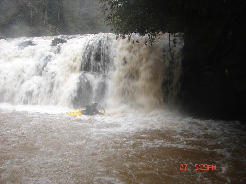
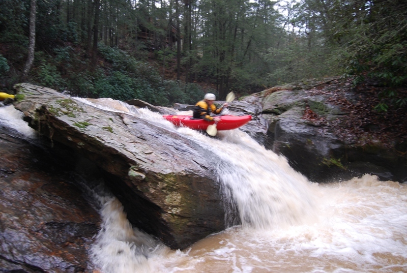
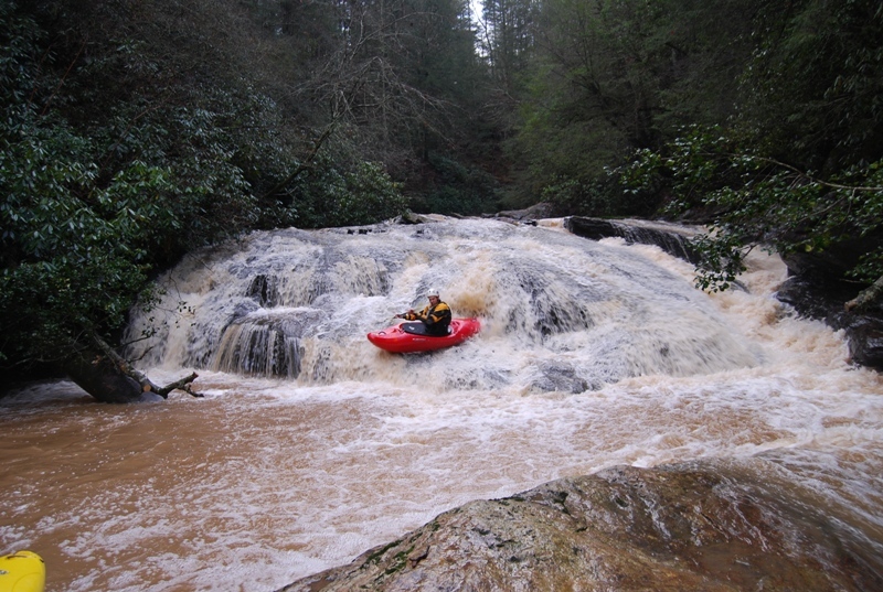
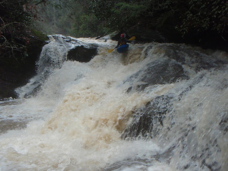
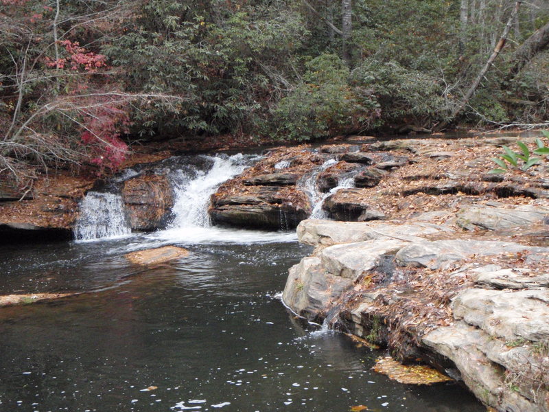
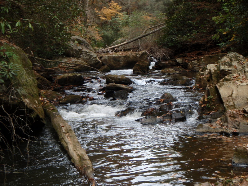
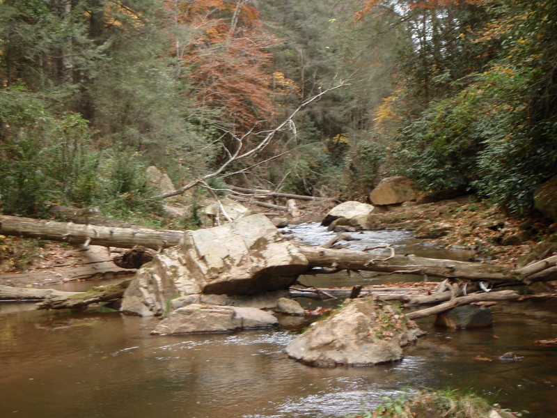
This run from 441 bridge to Rickman Airfield Road Bridge is 2 miles in lenght with a very easy shuttle. The creek at the bridge is flat with one rapid in the class 3-4 range for about .2 miles then picks up as it drops about 200 feet in a mile long stretch where all the big drops are. The river then flattens out for .80 miles of class 1-2 wave trains to the takeout. This is a very fun run if you have the skills and desire to run this beautiful, but very poor water quality gorge. The hardest part of this run is getting your boat to the put-in/portage of Clayton Powerhouse rapid. Once you get your boat to this point you really only have to portage one more time if you have the skills to be running this creek. After putting in below Clayton powerhouse the action starts out with the second hardest rapid on the run. It is a slide that drops about 15 feet then makes a right hand turn down a steep 20 foot slide with a bad piton rock in the center and a hole that can be pretty grabby. When running this try to catch the eddy on the left side above the steep 20 foot slide. After leaving this eddy get as far left as possible to avoid the piton. The river then has some good boogy water, but watch out for trees. There were two riverwide trees down, but I was able to get by both without getting out of my boat as of March 7, 2009. When you come to a distinct horizon line it is time to get to the bank, cause 20-20 is the name of this waterfall and the top 10-15 feet is a vertical drop that lands on a rock shelf. Scout on the left side to see the whole waterfall. If you are portaging the whole waterfall carry on the left, but it is very difficult. If you are going to run the bottom half of 20-20 portage the top half on the right and put in below the first ledge then run the far left side and try to boof cause landing is about 6-8 feet so try not to pencil. After that is a nice class 3 rapid slide then comes the final three drops. The first is Double crack run it like 7 foot trying to drive out towards the right. Right below that is Mean Holly Tree run it center. The last rapid is Clayton Scream Machine which is a great rapid. Start left then center. Very fast and fun. This is a fun run if you run all the rapids except Clayton Powerhouse and the Top of 20-20. If you know you will portage everything but the last three rapids then the run will probably not be worth it, becuase all the portages are very difficult becuase the steep rhodo filled banks of the gorge. This is a good creek if you don't mind the bad water quality. Plus it runs more often than most other creeks in the area. I would recomend not getting on this run if it is your first time if the water is much above 2 or 3 inches cause all scouting and portaging is hard. A good minimum to see the rapids and get to know the run is from -4" to about 1-2".
I If anyone else has ran this section and has any other data or information like names of rapids let me know by posting a comment.
The rapids and ratings are from runs between -4 and 0 inches. Please report your runs and levels and what you thought about the rapids and thier ratings by emailing me at jljames2@catamount.wcu.edu or post on the comment section.
There is about 4 miles of flatwater before things start to drop again. That is covered in the next section of the creek.
Rapids in this Run (1)
Waterfalls (7)
Hazards & Portages (7)
Caution: The following locations may require scouting or portaging. Always check current conditions.
Difficulty
Class IV-V+
Length
1.9 mi
Gradient
125 ft/mi
max 200
Rapids
1
7 Hazards
Access Points
Shuttle Info
Put IN-Take 441 South from Clayton, Georgia and turn left onto Rickman Airfield Road. This is the road before the 441 bridges that cross Stekoa Creek. You can put on either at the bridge, or there is a small pulloff bout 1/4 mile down road on the left. Try not to park many cars because most land is private.
Take out- Follow Rickman Airfield Road down from put-in about 1.3 miles to the bridge that crosses the creek at the bottom. Park in pull off on the right side of road above the bridge.
Difficulty Classes
I Easy
II Novice
III Intermediate
IV Advanced
V Expert/Extreme
VI Unrunnable
Current Conditions
5-Day Forecast
Whitewater data from
American Whitewater
American Whitewater