2. Sprague Road to Cedar Point Road
Linked via: Nhdplus discovery 90% confidence Synced 6mo ago
Gauge Conditions
Runnable: 1,000.0 – 3,000.0 CFS
The runnable range is a wild SWAG and should be used with caution. If you run this, please add a comment or report, so that we can develop a correlation.
Data from American Whitewater & USGS
Run Map
Run Time Estimate
Select put-in and take-out to estimate time.
Unlock Advanced Trip Planning
See wind-adjusted speed maps, forecast planning, and detailed time estimates.
Sign in to generate an AI timing estimate for this run.
Whitewater timing varies with scouting, portages, and group pace. Use as a planning baseline.
Description
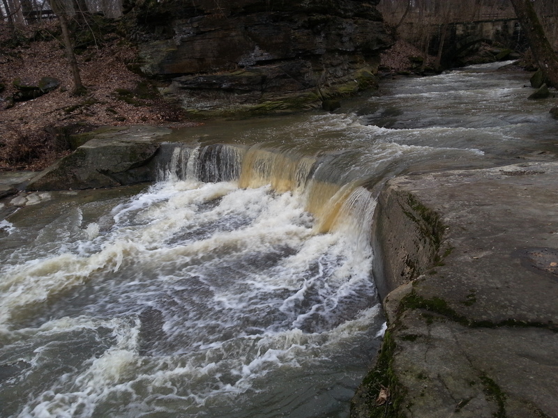
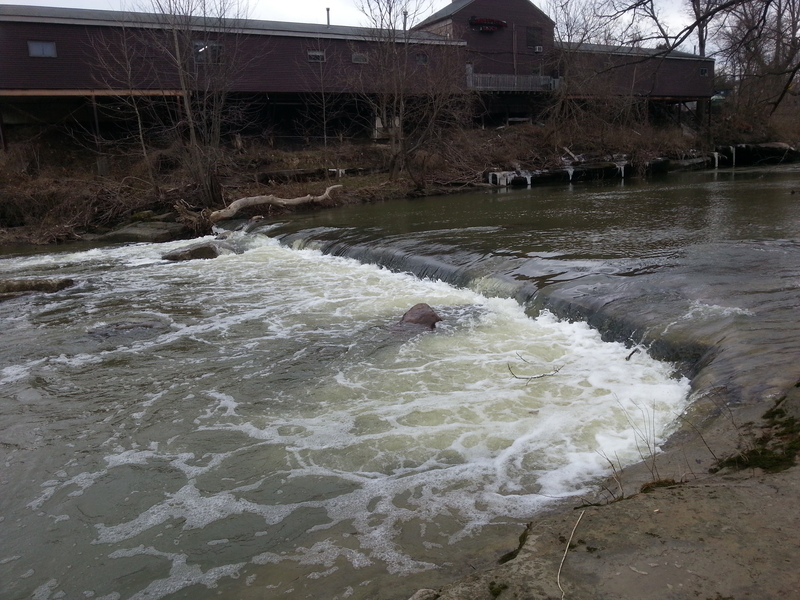
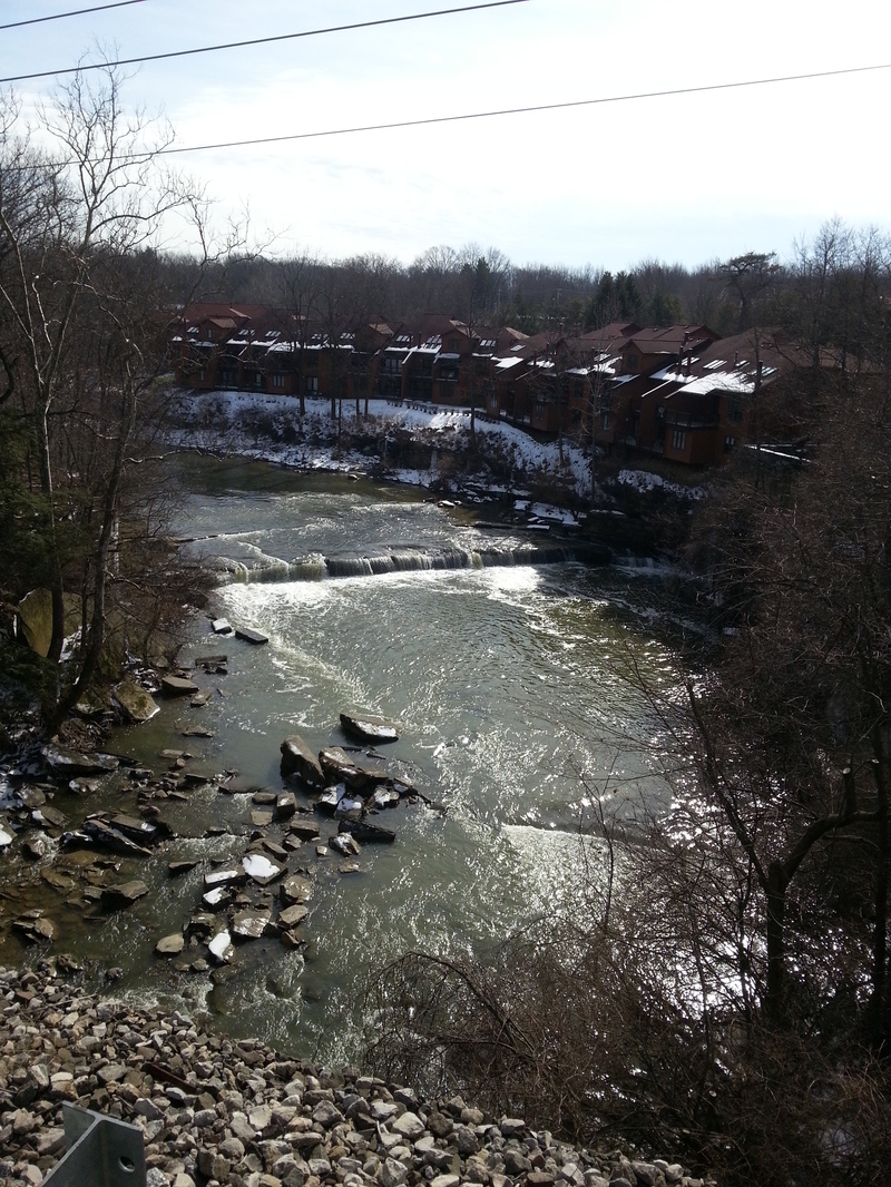
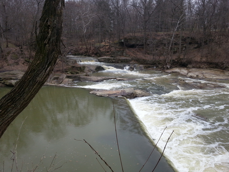
Put-in at Sprague Road, just downstream of a dam. Two miles downstream, two more low-head dams lie about a quarter-mile apart.
Keelhaulers River Rating - 17
ODNR -Boating on Ohio's Streams in Northeast OH
PADDLERS MUST CALL OLMSTED FALLS FIRE DEPARTMENT AT 440-235-3238 BEFORE PADDLING. Tell them the number of paddlers and your launch time.
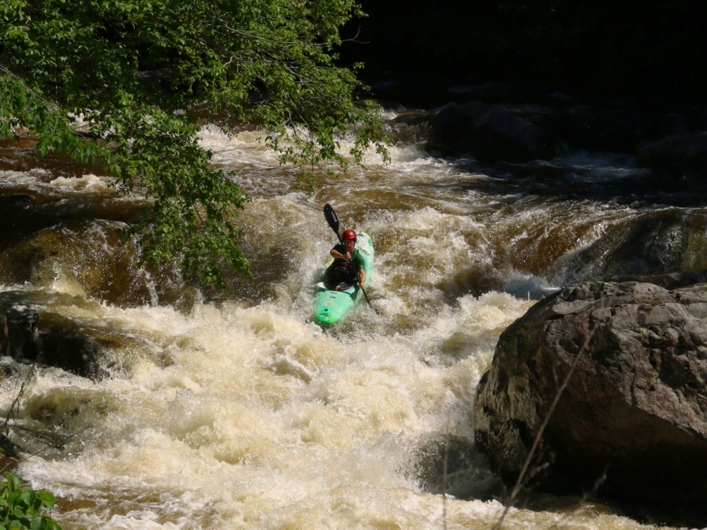
Rapids in this Run (4)
Playspots (1)
Hazards & Portages (3)
Caution: The following locations may require scouting or portaging. Always check current conditions.
Difficulty
Class II-III
Length
5.5 mi
Rapids
4
3 Hazards
Access Points
Difficulty Classes
I Easy
II Novice
III Intermediate
IV Advanced
V Expert/Extreme
VI Unrunnable
Current Conditions
5-Day Forecast
Whitewater data from
American Whitewater
American Whitewater