Gauge Conditions
Runnable: 225.0 – 2,000.0 CFS
Data from American Whitewater & USGS
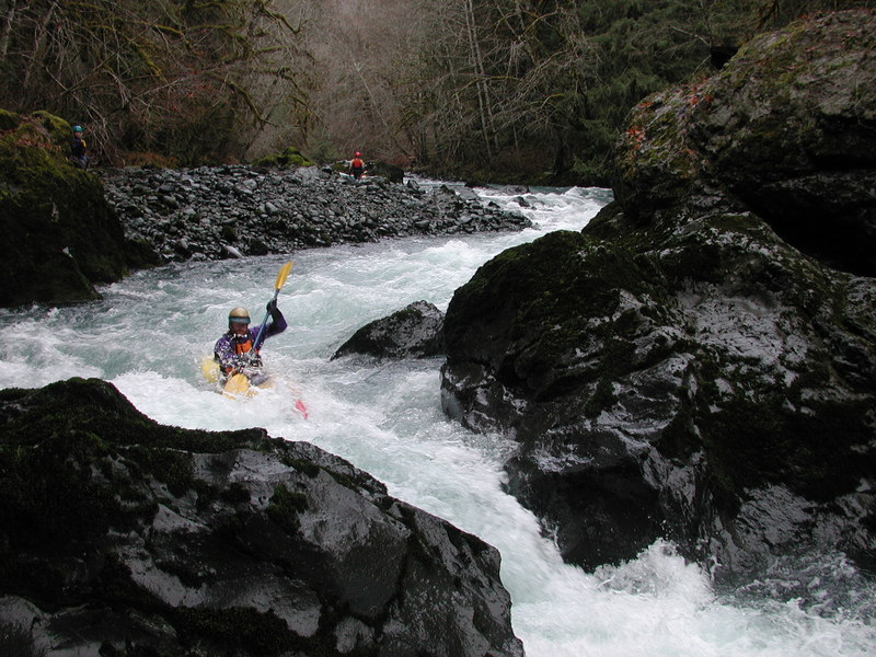
Photo
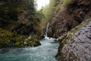
Photo courtesy of American Whitewater
Description
While much of the land along this segment of the run is private property you will find a small parcel of Forest Service land that can be used as an access point. It is a small pull-out at Dosewallips River Road mile 6.3 with a steep carry down to the river. This access is often used by those who want to put-in to run the Pinch before continuing on the lower run. It can also be used as a take-out if the Pinch has river-wide wood hazards.
Location

View Full Run
2. Elkhorn Campground to Six Mile Bridge
Dosewallips
III-IV+
5.4 mi
Current Conditions
5-Day Forecast
Whitewater data from
American Whitewater
American Whitewater