Rapid
MI
Drainage area ~21 square miles.
Sturgeon, W.Br. (Houghton) - Newberry Rd to S.Laird Rd (5.7 miles) (MI)
Gauge Conditions
Runnable: 6.6 – 8.0 FT
Likely too low for areas of gradient to be boatable.
Data from American Whitewater & USGS
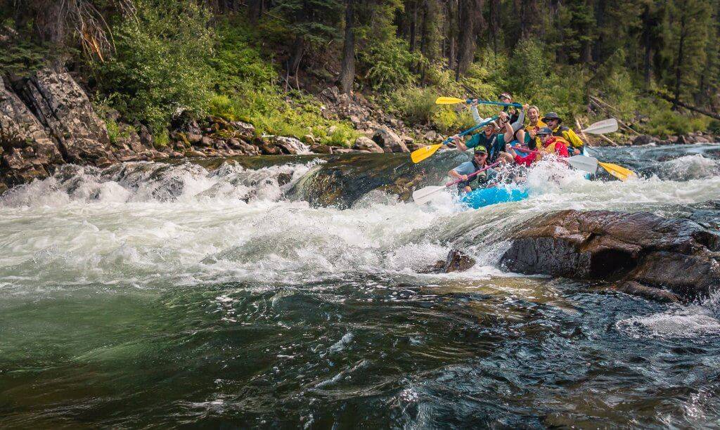
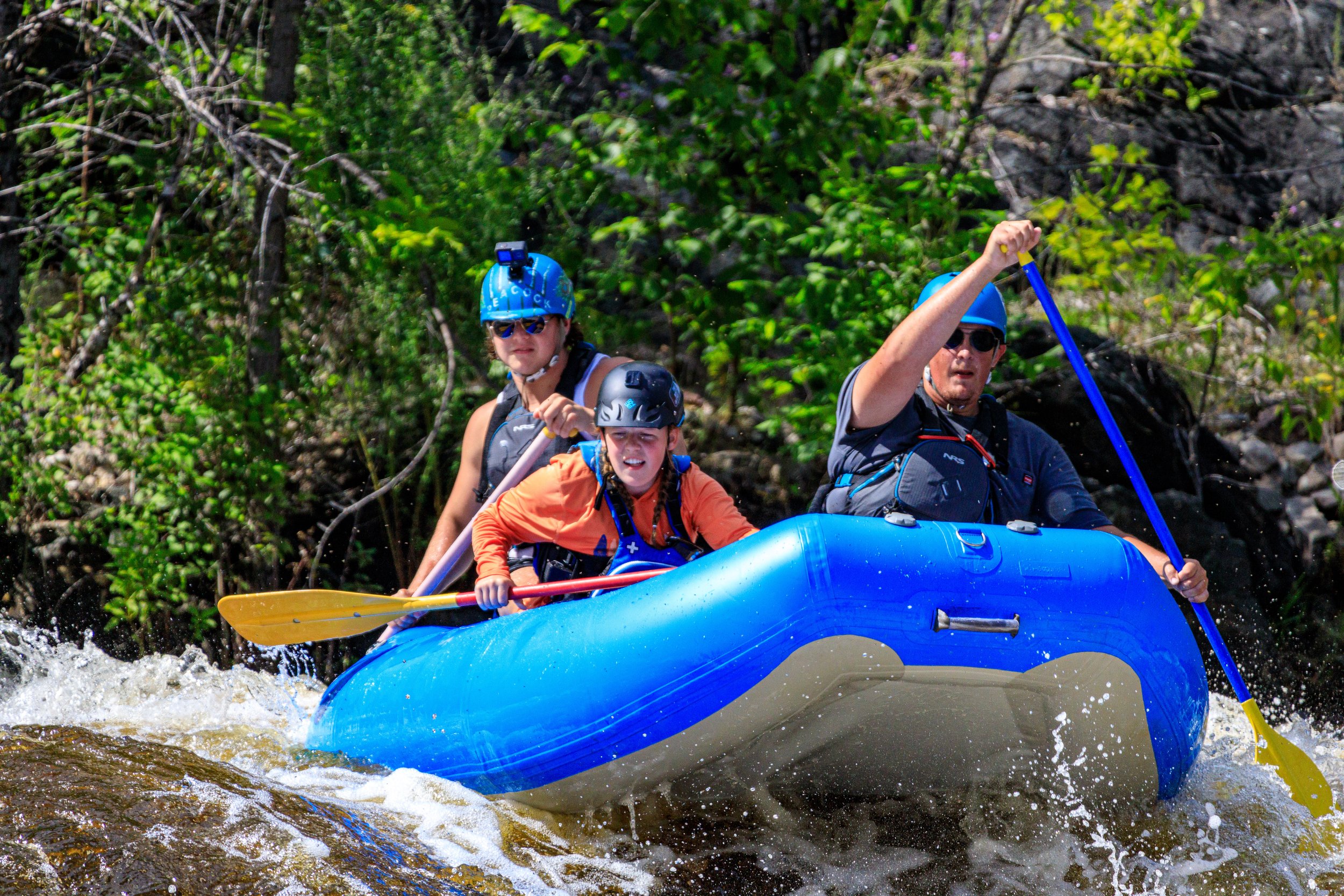
Photo
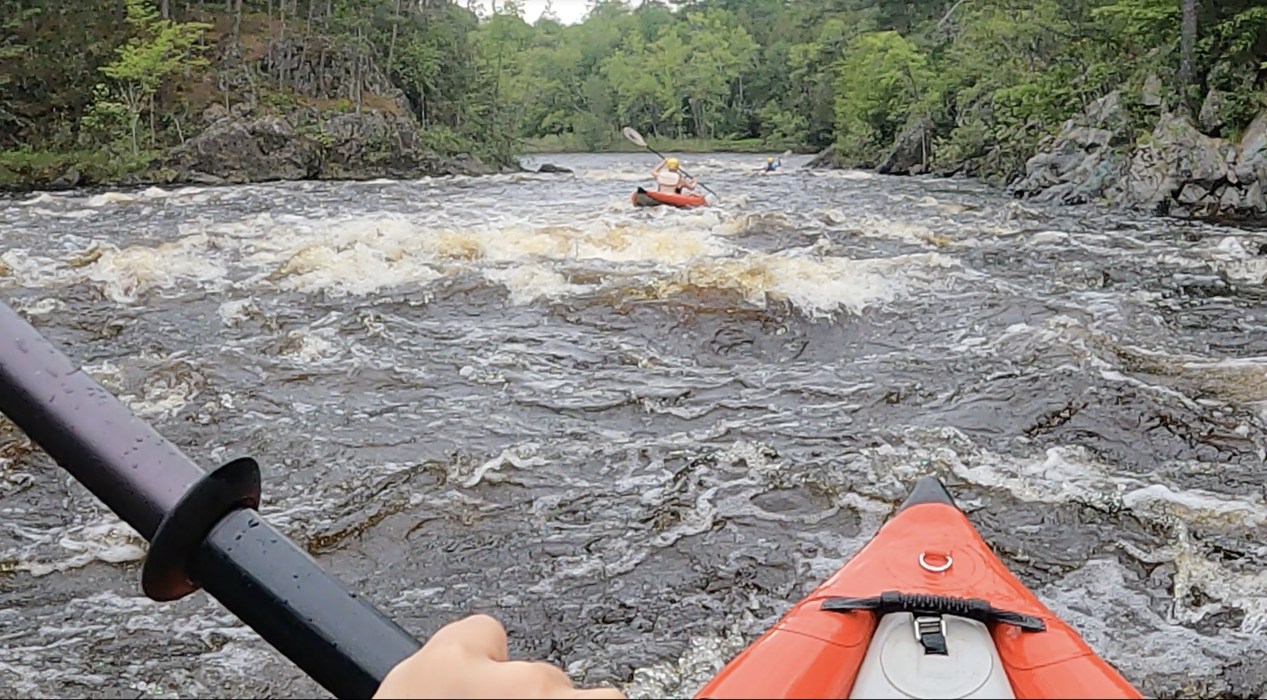
Photo courtesy of American Whitewater
Description
The Sturgeon River's rapid between Newberry and S. Laird Roads presents a challenging stretch through a densely wooded watershed, with potential technical navigation required through multiple tight turns and potential submerged timber. While specific difficulty rating is not provided, paddlers should anticipate potential obstacles and be prepared for quick maneuvering in a relatively narrow 5.7-mile river section with limited visual downstream visibility.
Location
Other Rapids on This Run (18)
Rapid
N/A
Access?
 Rapid
N/A
Rapid
N/A
Put In
Rapid
N/A
First drop sequence
Rapid
N/A
Snagfest may begin here
Rapid
N/A
West Branch Falls?
 Rapid
N/A
Rapid
N/A
Ledge/drop
 Rapid
N/A
Rapid
N/A
Short Ledge
 Rapid
N/A
Rapid
N/A
Short Ledge
Rapid
N/A
Unnamed Creek
 Rapid
N/A
Rapid
N/A
Slide/ledge
 Rapid
N/A
Rapid
N/A
Slide
 Rapid
N/A
Rapid
N/A
Perjury Creek
 Rapid
N/A
Rapid
N/A
Small ledge/wave/rapids
Rapid
N/A
Island
Rapid
N/A
Unnamed Creek
Rapid
N/A
Unnamed Creek
 Rapid
N/A
Rapid
N/A
Greenier Creek
 Rapid
N/A
Rapid
N/A
Take Out
View Full Run
Newberry Rd to S.Laird Rd (5.7 miles)
Sturgeon, W.Br. (Houghton)
I-IV
4.5 mi
Current Conditions
5-Day Forecast
Whitewater data from
American Whitewater
American Whitewater