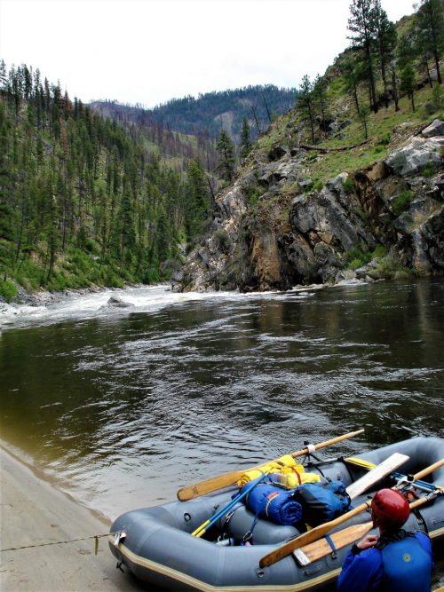
Put-in
CA
Mile-Marker 15 Put-in (Legarde)
Salmon, South Fork - Near 15-Mile Marker to Matthews Creek River Access (CA)
Gauge Conditions
Data from American Whitewater & USGS
Description
Located just upriver and within sight of mile-marker 15, a steep dirt road angles off Cecilville Road to reach a small parking area with a double track path from there to the river. The dirt road can only be accessed if you are driving in the upriver direction, so if you're coming from Cecilville rather than Forks of Salmon, you'll have to go to the pullout out a short ways downstream and swing a U-turn.
Location
Other Rapids on This Run (13)
Rapid
III+
Narrow Gorge Rapid
Rapid
IV+
First Significant Rapid
Rapid
IV
Ledge Hole Rapid
 Rapid
IV
Rapid
IV
Steep Microgorge Rapid
 Rapid
IV
Rapid
IV
Unnamed Rapid
Rapid
III+
Fake Amusement Park
Rapid
V-
Amusement Park
Rapid
IV
Landslide Boulder Garden
Rapid
IV-
Final Gorge Entry Rapid
Rapid
V-
Final Gorge #1
Rapid
IV
Final Gorge #2
Rapid
IV+
Final Gorge #3
Rapid
N/A
Matthews Creek River Access
View Full Run
Near 15-Mile Marker to Matthews Creek River Access
Salmon, South Fork
IV-V
5.6 mi
Current Conditions
5-Day Forecast
Whitewater data from
American Whitewater
American Whitewater