Rapid
MI
USGS Gauge: 192 sq.mi.
Sturgeon (Cheboygan) - Trowbridge Road to Indian River (up to 20.5 miles) (MI)
Gauge Conditions
Runnable: 100.0 – 1,200.0 CFS
Possibly tame whitewater. *HELP YOUR FELLOW BOATERS BY PROVIDING A COMMENT ABOUT GAUGE READING AND BEST RANGES FOR BOATABILITY*
Data from American Whitewater & USGS
Description
USGS lists their gauge "on right bank at Cedar Street in Wolverine, 0.2 mi downstream from West Branch, and 11.7 mi upstream from mouth" and shows "Elevation of gage is 770 ft."
Historical data lists 10% flow exceeds 290 cfs, 90% flow exceeds 158 cfs, giving a 10/90 ratio of ~1.8, confirming that flows are extremely steady (not 'flashy').
Location
Other Rapids on This Run (20)
Rapid
N/A
Put In
Rapid
N/A
Possible Put-in?
Rapid
N/A
Alternate Put-in #1
Rapid
N/A
Trowbridge Road
Rapid
N/A
Interstate 75
Rapid
N/A
Trowbridge Road
Rapid
N/A
Freeway Trail
Rapid
N/A
Sturgeon Valley Campground
Rapid
N/A
Possible obstruction/feature?
Rapid
N/A
Nomisteco Rd
Rapid
N/A
Deadfall?
Playspot
N/A
Confluence with West Branch
Rapid
N/A
Deadfall?
Rapid
N/A
Possible Access
Rapid
N/A
Zig-Zag Snag
Rapid
N/A
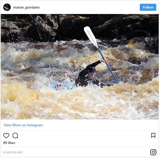
Caught in the act!
Rapid
N/A
Haakwood State Forest Campground
 Rapid
N/A
Rapid
N/A
Rondo Road
Rapid
N/A
North Central State Trailhead
 Rapid
N/A
Rapid
N/A
White Road
View Full Run
Trowbridge Road to Indian River (up to 20.5 miles)
Sturgeon (Cheboygan)
I-II
18.8 mi
Current Conditions
5-Day Forecast
Whitewater data from
American Whitewater
American Whitewater