Rapid
WI
Confluence, Marengo River
Bad - C) Devil's Gate to Elm Hoist Rd (4.3 to 19.5 miles) ** ACCESS ISSUES ** (WI)
Gauge Conditions
Runnable: 300.0 – 1,500.0 CFS
Likely a bit low (or way low) for good whitewater.
Data from American Whitewater & USGS
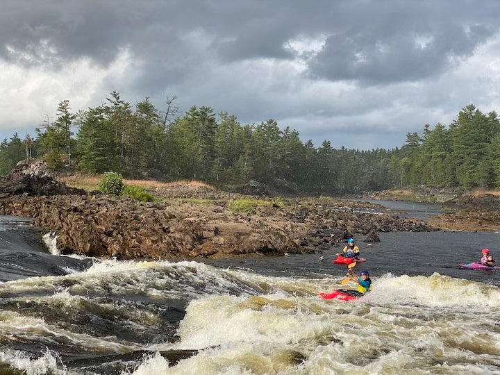
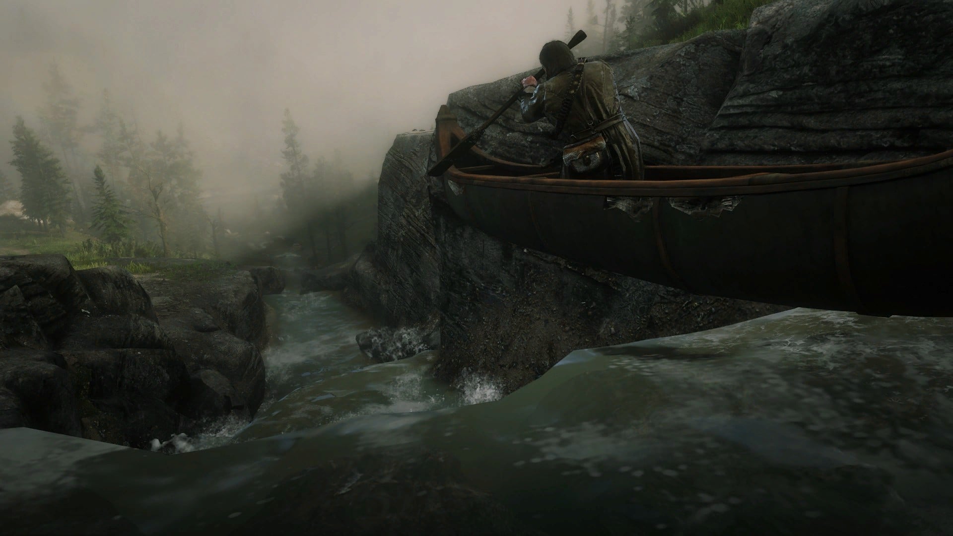
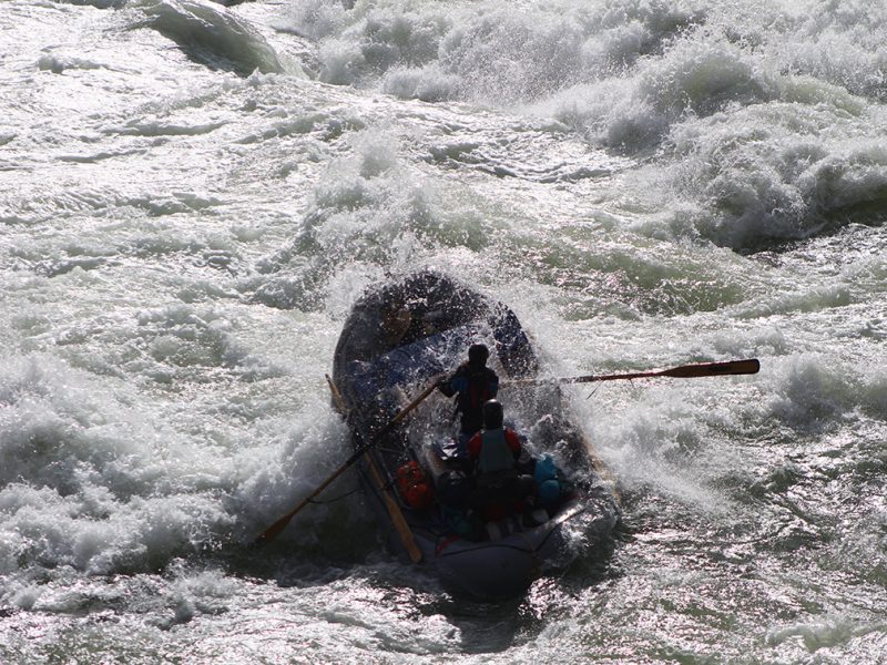
Photo
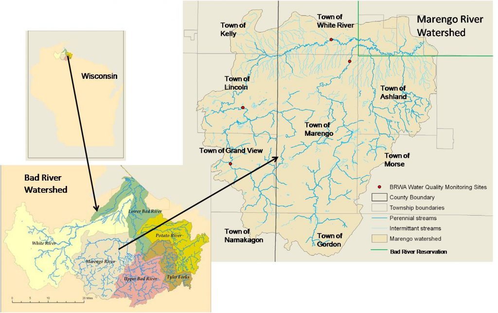
Photo courtesy of American Whitewater
Description
The Marengo River enters from the left. From aerial views, it appears there is a large island at this confluence. Bear off to the right at/before the confluence to cut off some distance.
Downstream, the Bad enters generally broad floodplain where it meanders, lazily, broken ever more seldomly by areas of shoals, riffles, and rips. Mileages from here down are somewhat dependent upon route taken, as some of these meanders may have 'short cuts' (especially at higher flows).
Location
Other Rapids on This Run (18)
 Rapid
N/A
Rapid
N/A
Put In
 Rapid
N/A
Rapid
N/A
Drainage: 213 sq.mi.
 Rapid
N/A
Rapid
N/A
Ledge/wave
Rapid
N/A
Ledge/wave
Rapid
N/A
Ledge/wave
 Rapid
N/A
Rapid
N/A
High Wall
 Rapid
N/A
Rapid
N/A
Slim Islands
Rapid
N/A
High Wall
 Rapid
N/A
Rapid
N/A
Possble 'best' egress
Rapid
N/A
Ledge/wave
 Rapid
N/A
Rapid
N/A
Last evident possible egress
Hazard
N/A
Indian Reservation Boundary
 Rapid
N/A
Rapid
N/A
Boulderbed Resumes
 Rapid
N/A
Rapid
N/A
Longer Boulderbed Rapids
 Rapid
N/A
Rapid
N/A
Possible ledge/wave/hole
 Rapid
N/A
Rapid
N/A
Confluence, Potato River
 Rapid
N/A
Rapid
N/A
Railroad
 Rapid
N/A
Rapid
N/A
Elm Hoist Road: 597 sq.mi.
View Full Run
C) Devil's Gate to Elm Hoist Rd (4.3 to 19.5 miles) ** ACCESS ISSUES **
Bad
I-III
4.1 mi
Current Conditions
5-Day Forecast
Whitewater data from
American Whitewater
American Whitewater