Rapid
WI
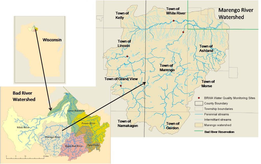
Confluence, Potato River
Bad - C) Devil's Gate to Elm Hoist Rd (4.3 to 19.5 miles) ** ACCESS ISSUES ** (WI)
Gauge Conditions
Runnable: 300.0 – 1,500.0 CFS
Likely a bit low (or way low) for good whitewater.
Data from American Whitewater & USGS
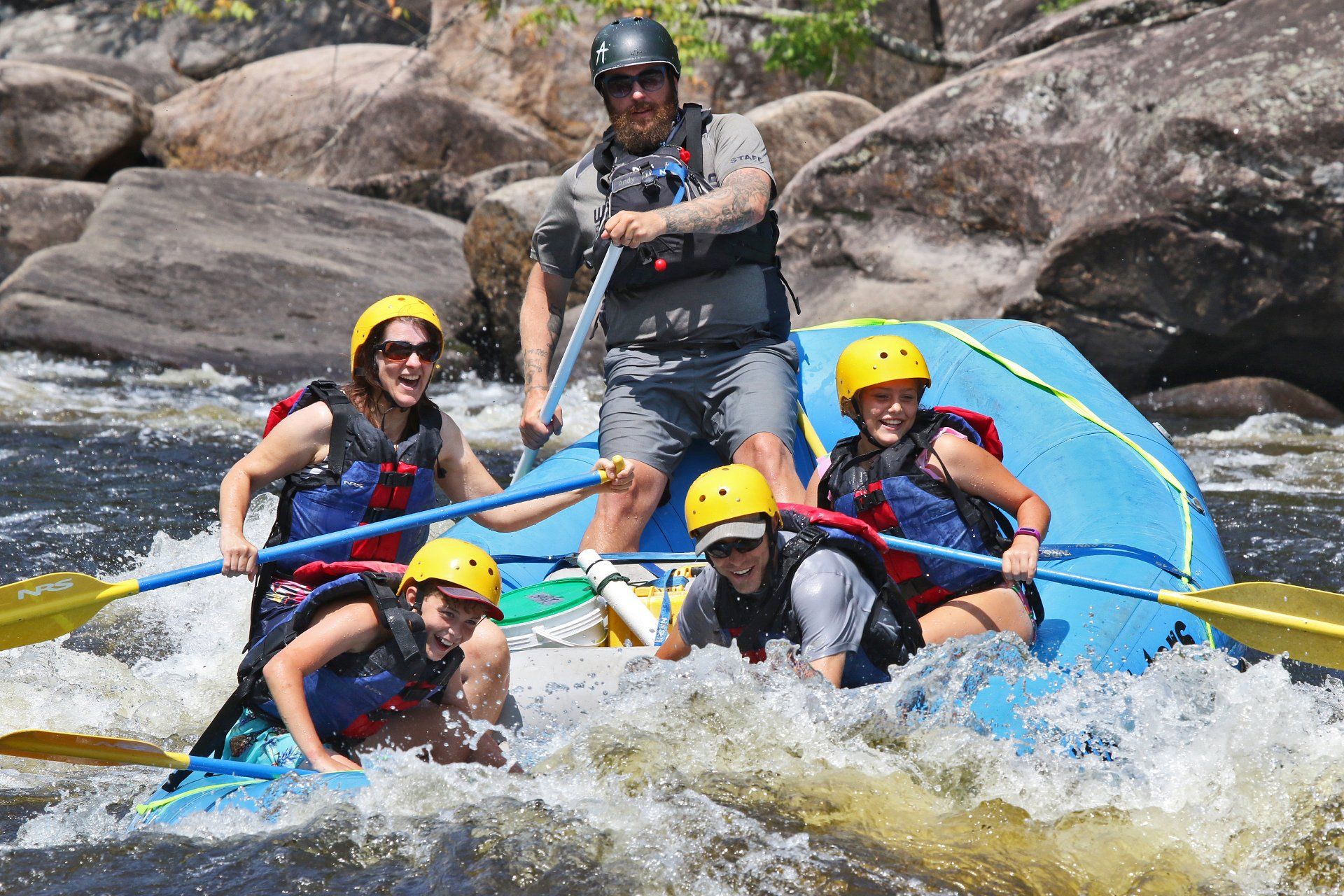
Photo
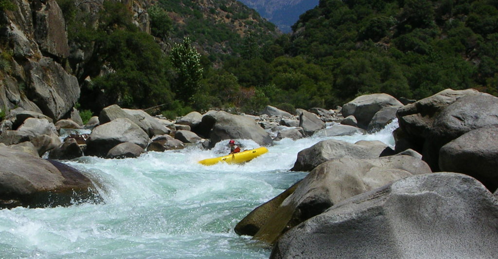
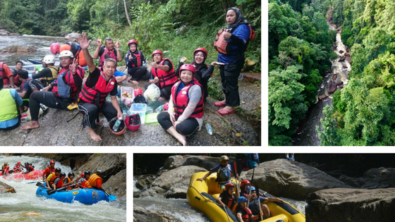
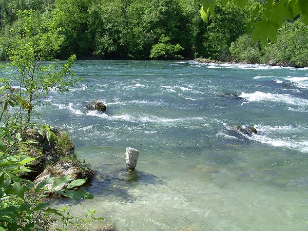
Photo courtesy of American Whitewater
Description
The Confluence rapid on the Bad River presents a complex navigation challenge where multiple water channels converge, potentially creating unpredictable currents and hydraulics. Paddlers must carefully assess water levels and flow conditions, as the rapid's characteristics can change dramatically between high and low water, with potential hidden obstacles and shifting channel dynamics requiring precise boat control and route selection.
Location
Other Rapids on This Run (18)
 Rapid
N/A
Rapid
N/A
Put In
 Rapid
N/A
Rapid
N/A
Drainage: 213 sq.mi.
 Rapid
N/A
Rapid
N/A
Ledge/wave
Rapid
N/A
Ledge/wave
Rapid
N/A
Ledge/wave
 Rapid
N/A
Rapid
N/A
High Wall
 Rapid
N/A
Rapid
N/A
Slim Islands
Rapid
N/A
High Wall
 Rapid
N/A
Rapid
N/A
Possble 'best' egress
Rapid
N/A
Ledge/wave
 Rapid
N/A
Rapid
N/A
Last evident possible egress
Hazard
N/A
Indian Reservation Boundary
 Rapid
N/A
Rapid
N/A
Boulderbed Resumes
 Rapid
N/A
Rapid
N/A
Longer Boulderbed Rapids
 Rapid
N/A
Rapid
N/A
Possible ledge/wave/hole
 Rapid
N/A
Rapid
N/A
Confluence, Marengo River
 Rapid
N/A
Rapid
N/A
Railroad
 Rapid
N/A
Rapid
N/A
Elm Hoist Road: 597 sq.mi.
View Full Run
C) Devil's Gate to Elm Hoist Rd (4.3 to 19.5 miles) ** ACCESS ISSUES **
Bad
I-III
4.1 mi
Current Conditions
5-Day Forecast
Whitewater data from
American Whitewater
American Whitewater