Gauge Conditions
Runnable: ? – ? CFS
Approximate - nearest available gauge. Use as general reference only.
Data from American Whitewater & USGS
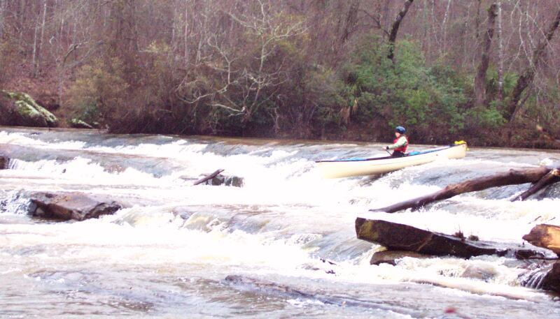
Photo
Photo courtesy of American Whitewater
Description
Drive here second. Don't ask Google how to get here. As the sign indicates, this fork in the shuttle route goes one way toward take-out #1 near the confluence. The other way goes toward take-out #2 on the Flint River.
It's vital to note that Google Maps does not give proper directions to this point. Google will tell you to park on the wrong side of the Flint and swim here.
Location
Other Rapids on This Run (7)
 Rapid
N/A
Rapid
N/A
Put In
 Rapid
N/A
Rapid
N/A
WMA boundary (public land begins here)
 Rapid
N/A
Rapid
N/A
Take Out #1 just above the Flint River confluence
 Rapid
N/A
Rapid
N/A
Take-out #2, on the Flint River, 0.8 miles downstream of the confluence
 Rapid
II+
Rapid
II+
Coleoatchee Creek rapid
 Rapid
N/A
Rapid
N/A
Road to the two take-outs
 Rapid
N/A
Rapid
N/A
Prospective put-in inside the WMA (unconfirmed)
View Full Run
Sunrise/Hendricks Road to Flint
Lazer Creek
I-II
9.9 mi
Current Conditions
5-Day Forecast
Whitewater data from
American Whitewater
American Whitewater