Gauge Conditions
Runnable: ? – ? CFS
Approximate - nearest available gauge. Use as general reference only.
Data from American Whitewater & USGS
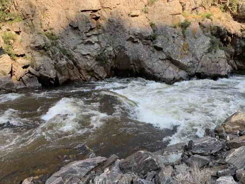
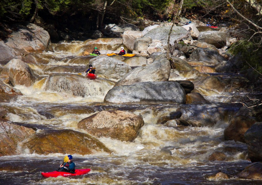
Photo

Photo courtesy of American Whitewater
Description
Ledges presents a complex boulder-strewn descent with multiple potential routes requiring precise navigation and quick decision-making. Paddlers should expect scattered large rocks creating unpredictable hydraulics and potential pin hazards, with the most navigable line typically requiring careful boat positioning and momentum through the upper section. Careful scouting is recommended to identify current-specific hazards and select the most stable route.
Location
Other Rapids on This Run (12)
 Rapid
N/A
Rapid
N/A
Access #1 (Uppermost Possible Putin -- S.Boundary Road/NF360)
 Rapid
N/A
Rapid
N/A
Access #2 (FDR366)
 Rapid
N/A
Rapid
N/A
Rock Garden
 Rapid
N/A
Rapid
N/A
More rock garden
 Rapid
N/A
Rapid
N/A
Rocky Island
 Rapid
N/A
Rapid
N/A
North Country Trail Bridge
 Rapid
N/A
Rapid
N/A
Put In
 Rapid
N/A
Rapid
N/A
Confluence, Loggerhead Creek
 Rapid
N/A
Rapid
N/A
Ledge/wave/holes
 Rapid
N/A
Rapid
N/A
Rocky Jumble
 Rapid
N/A
Rapid
N/A
Confluence, Big Iron
 Rapid
N/A
Rapid
N/A
Take Out
View Full Run
Forest Hwy.360 to White Pine (3.9 - 17 miles)
Big Iron, W.Br.
I-II(III)
15.0 mi
Current Conditions
5-Day Forecast
Whitewater data from
American Whitewater
American Whitewater