Gauge Conditions
Runnable: ? – ? CFS
Approximate - nearest available gauge. Use as general reference only.
Data from American Whitewater & USGS
Photo

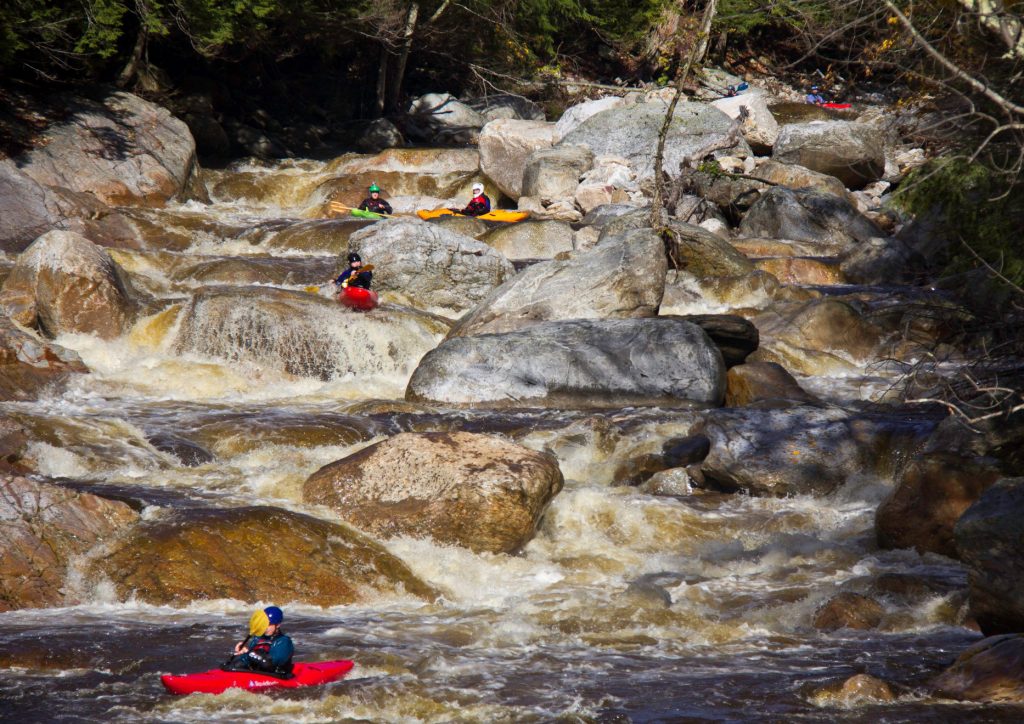
Photo courtesy of American Whitewater
Description
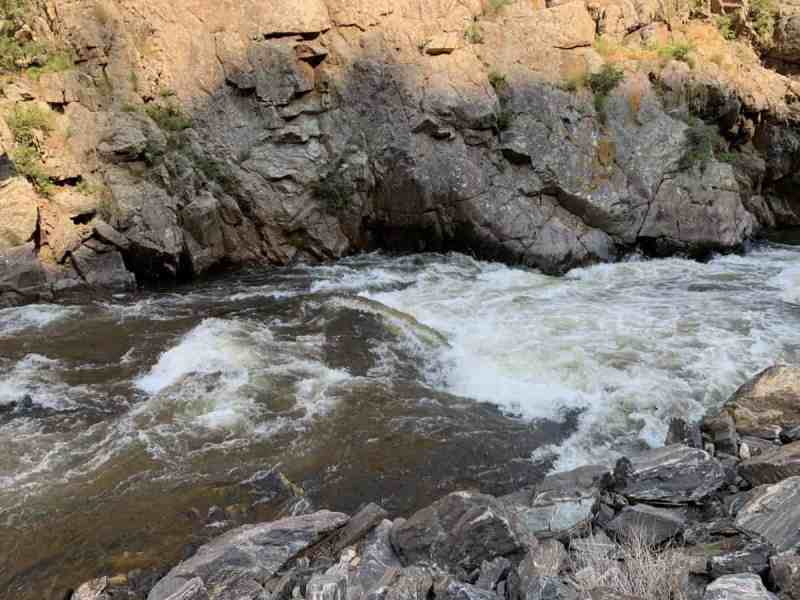
Rocky Island rapid presents a technical navigational challenge with scattered boulder gardens creating multiple potential routes through the constricted channel. Paddlers must carefully read the water and choose a line that avoids undercut rocks and potential pin hazards, with the most straightforward path typically requiring precise maneuvering between mid-stream obstructions. The rapid's complexity increases during lower water levels, demanding heightened awareness and precise boat control.
Location
Other Rapids on This Run (12)
 Rapid
N/A
Rapid
N/A
Access #1 (Uppermost Possible Putin -- S.Boundary Road/NF360)
 Rapid
N/A
Rapid
N/A
Access #2 (FDR366)
 Rapid
N/A
Rapid
N/A
Rock Garden
 Rapid
N/A
Rapid
N/A
More rock garden
 Rapid
N/A
Rapid
N/A
North Country Trail Bridge
 Rapid
N/A
Rapid
N/A
Put In
 Rapid
N/A
Rapid
N/A
Confluence, Loggerhead Creek
 Rapid
N/A
Rapid
N/A
Ledge/wave/holes
 Rapid
N/A
Rapid
N/A
ledges
 Rapid
N/A
Rapid
N/A
Rocky Jumble
 Rapid
N/A
Rapid
N/A
Confluence, Big Iron
 Rapid
N/A
Rapid
N/A
Take Out
View Full Run
Forest Hwy.360 to White Pine (3.9 - 17 miles)
Big Iron, W.Br.
I-II(III)
15.0 mi
Current Conditions
5-Day Forecast
Whitewater data from
American Whitewater
American Whitewater