Rapid River Falls
Rapid - N.Rock Road/38th Road to Bay du Noc (PnP, or up to 27 miles) (MI)
Gauge Conditions
Approximate - nearest available gauge. Use as general reference only.
Photo

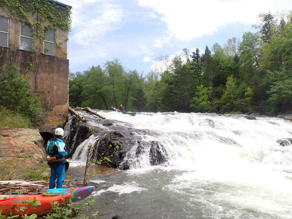
Description
Much more of a 'rapids' than a real 'falls', the river drops over a series of bedrock ledges (none more than a foot-or-two in height). At low-boatable flows, this may be no more than bump-and-scrape class I-II. At moderate flows, expect solid class II, and at times of high flows, this area will have great waves and holes, and likely reach at least a solid class III. Good access in a County Park should allow for a 'park-and-play' at this location.
A USGS sampling site at the S15 bridge immediately downstream lists drainage at this point as 100 square miles.
Drone footage of the falls (and downstream view): https://youtu.be/PoefAJmN3m8
Location


Current Conditions
5-Day Forecast
American Whitewater