Whitewater Map
Explore rapids, waterfalls, playspots, hazards, and portages across the United States
24,753
Total Features
21,352
Rapids
855
Waterfalls
927
Playspots
1,513
Hazards
106
Portages
Click a category above to filter the map and list
Loading...
Map Legend
Rapids
Waterfalls
Playspots
Hazards
Portages
Rivers
New Hampshire 48 features
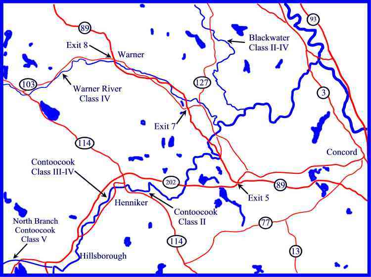
Rivers of the lower Contoocook region
Rapid
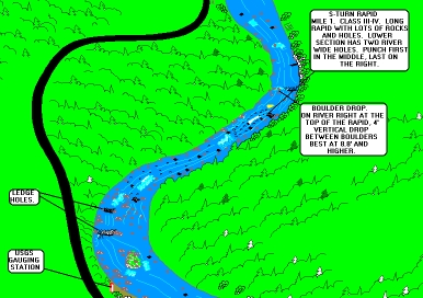
S-turn
Playspot
III+
Take Out
Rapid
N/A
Liberty Farm
Rapid
IV+
Lost Lens
Rapid
V
Rivers of the lower Contoocook region
Rapid
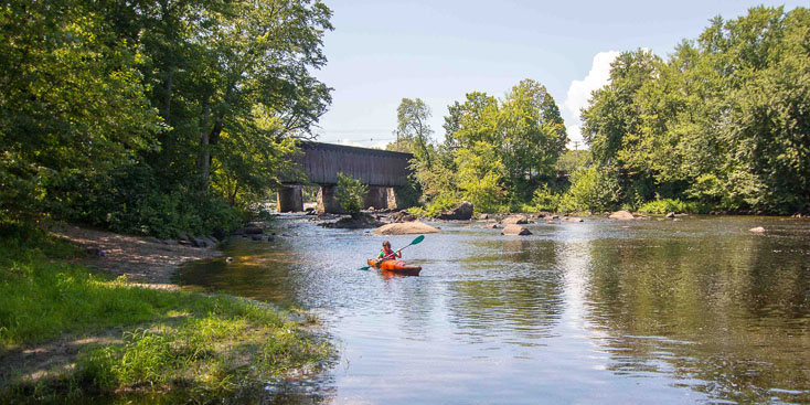
Stone Bridge
Rapid
IV
The Cleaver
Hazard
IV
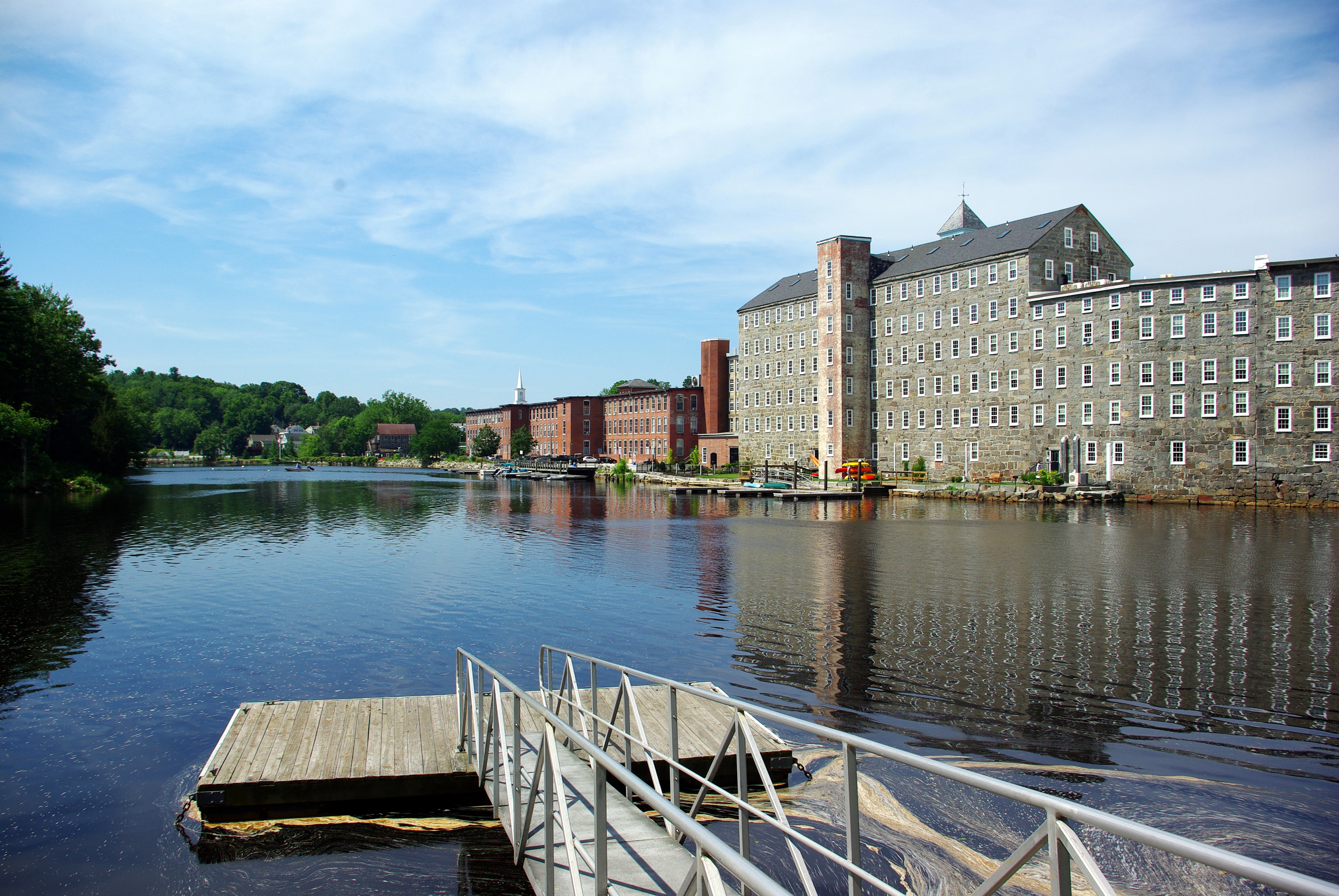
The Mill Race
Rapid
V
Put In
Rapid
N/A
Take Out
Rapid
N/A
Diamond gorge
Rapid
IV

Ellingwood falls
Rapid
IV

Lower Swift Diamond rapids
Rapid
III
New Greenough Pond Road Put In
Rapid
N/A

Take Out Pond Brook road
Rapid
N/A

Put In
Rapid
N/A

Take Out
Rapid
N/A

Put In
Rapid
N/A
Take Out
Rapid
N/A
Map of the Lower Pemi region
Rapid
Lava rapid
Rapid
IV
Middle gorge
Rapid
IV

Put In
Rapid
I
Streeter Ledge
Rapid
III+

Take Out
Rapid
N/A
Upper gorge
Rapid
IV
Map of the Mid Pemi region
Rapid
Map of the Mid Pemi region
Rapid
Isinglass Falls
Waterfall
IV

Put In
Rapid
N/A

Take Out
Rapid
N/A

Put In
Rapid
N/A

Take Out
Rapid
N/A
Put In
Rapid
N/A

Take Out
Rapid
N/A
Barking Boy Falls (aka James City Falls)
Rapid
IV
Double Drop
Rapid
III+
Freeses Pond Dam
Playspot
II+
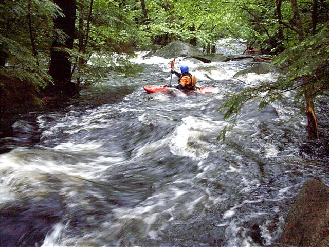
Hairpin Rapid
Rapid
IV+
Low Bridge
Hazard
Lower Put-in
Rapid
Mill Slot
Rapid
II+
Miller Time
Rapid
III+

Miller Time
Rapid
III
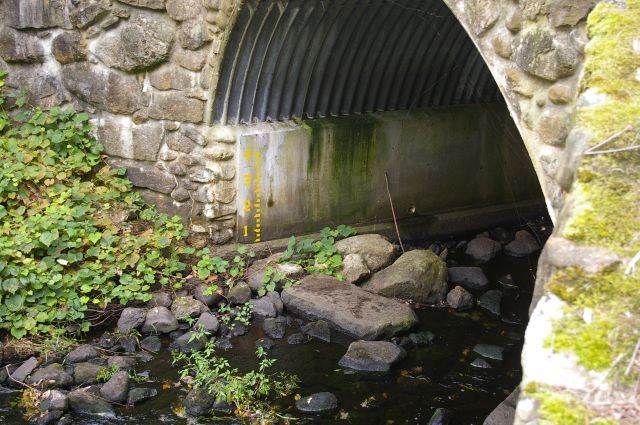
Paddler's Gage
Rapid
Put In
Rapid
N/A
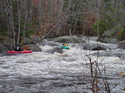
S-Turn Rapid
Rapid
III