K'uc'awa·k
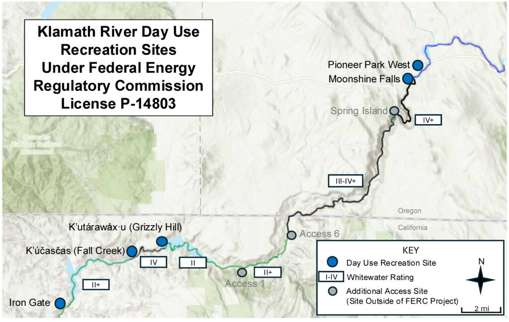
Klamath - 06. K’utárawáx·u / Grizzly Hill Access to K’účasčas / Fall Creek Access (CA)
Gauge Conditions
Photo
Description
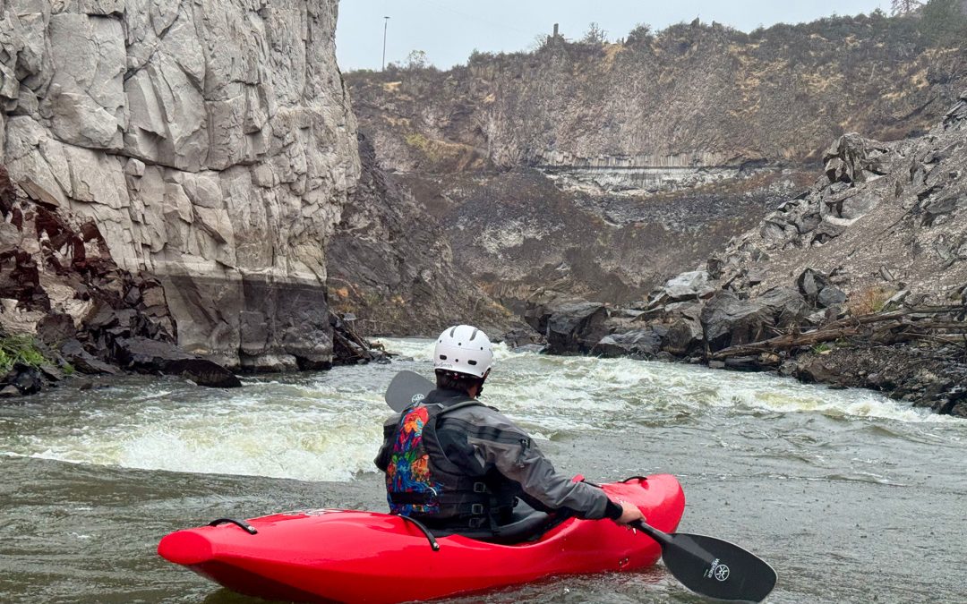
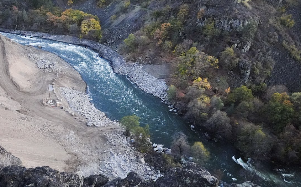
After a stunning flatwater pause as the river arcs around the tip of K'uc'awa·k (KOO-chah-wahk), the prominent rock outcrop on river left, the gradient picks up again. It eases into this rapid for a while before it gets steeper and boulders begin to force meandering lines in order to avoid tight slots or potential pins; river left is the clearer line. The defining feature of K'uc'awa·k comes about halfway though when the current slides along the vertical cliff on river left, richoeting off and over a steep pitch before continuing in constant gradient form for an extended length. It is a long rapid. At lower flows, kayakers and small craft can catch a small corner pocket eddy along K'uc'awa·k's cliff wall, then peel out to complete the drop. The scenery is absolutley stunning in all directions, but don't forget to look back upstream from the bottom and also notice the unique basalt pinnacle on river left. The name for this was rapid was chosen because it is the existing place name and honors Shasta culture and connection to the river.
Location
Other Rapids on This Run (13)
 Rapid
N/A
Rapid
N/A
 Rapid
N/A
Rapid
N/A
 Rapid
III
Rapid
III
 Rapid
III
Rapid
III
 Rapid
N/A
Rapid
N/A
 Rapid
N/A
Rapid
N/A
 Rapid
III+
Rapid
III+
 Rapid
IV-
Rapid
IV-
 Rapid
IV-
Rapid
IV-
 Rapid
N/A
Rapid
N/A
 Rapid
IV
Rapid
IV
 Rapid
N/A
Rapid
N/A
 Rapid
N/A
Rapid
N/A
Current Conditions
5-Day Forecast
American Whitewater