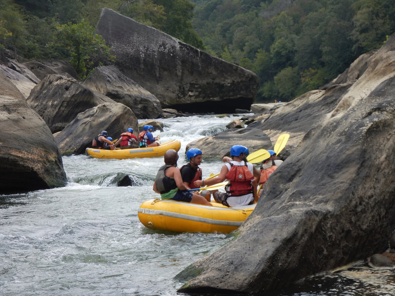
24,753
Total Features
21,352
Rapids
855
Waterfalls
927
Playspots
1,513
Hazards
106
Portages

Click a category above to filter the map and list

Loading...

Map Legend

Rapids
Waterfalls
Playspots
Hazards
Portages
Rivers

Minnesota 27 features

Torgeson Creek

Temperance - A) The Grade/166 to Sawbill Trail/2 (9.75 miles)
Rapid N/A

Two Islands

Temperance - A) The Grade/166 to Sawbill Trail/2 (9.75 miles)
Rapid N/A

USGS sampling site

Temperance - C) Six Hundred Road/166 to Temperance River State Park (8.5 miles)
Rapid N/A

USGS site/Bridge (The Grade / FR165)

Temperance - A) The Grade/166 to Sawbill Trail/2 (9.75 miles)
Rapid N/A

Drainage: 19 sq.mi.

Two Island - Cty 1 to Hwy 61 (4.3 miles)
Rapid N/A
Put In

Put In

Two Island - Cty 1 to Hwy 61 (4.3 miles)
Rapid N/A
Take Out

Take Out

Two Island - Cty 1 to Hwy 61 (4.3 miles)
Rapid N/A

Drainage: ~488 sq.mi.

Vermilion - A) Vermilion Dam to Twomile Creek (5.5 miles)
Rapid N/A

Drainage: ~580 sq.mi.

Vermilion - B) Eightmile Creek to Cty 24 (CCC boat landing) (1.5 miles)
Rapid N/A
Put In

Put In

Vermilion - B) Eightmile Creek to Cty 24 (CCC boat landing) (1.5 miles)
Rapid N/A
Put In

Put In

Vermilion - C) FS491 to CR24 (Crane Lake landing) (4 miles)
Rapid N/A
Put-in

Put-in

Vermilion - A) Vermilion Dam to Twomile Creek (5.5 miles)
Rapid N/A
Take Out

Take Out

Vermilion - C) FS491 to CR24 (Crane Lake landing) (4 miles)
Rapid N/A
Take Out

Take Out

Vermilion - B) Eightmile Creek to Cty 24 (CCC boat landing) (1.5 miles)
Rapid N/A
Take-out

Take-out

Vermilion - A) Vermilion Dam to Twomile Creek (5.5 miles)
Rapid N/A
Put In

Put In

Vermillion (Hastings) - Falls to Old Mill in Hastings (0.5 mile)
Rapid N/A
Take Out

Take Out

Vermillion (Hastings) - Falls to Old Mill in Hastings (0.5 mile)
Rapid N/A

Unnamed Feature

Whiteface - near Kelsey, MN (4.4 miles)
Rapid II
Put In

Put In

Whiteface - near Kelsey, MN (4.4 miles)
Rapid N/A
Take Out

Take Out

Whiteface - near Kelsey, MN (4.4 miles)
Rapid N/A
Possible shoals

Possible shoals

Wild Rice, S.Br. - 220th St.N to 190th St.N (5.66 miles)
Rapid N/A
Put In

Put In

Wild Rice, S.Br. - 220th St.N to 190th St.N (5.66 miles)
Rapid N/A
Scenery

Scenery

Wild Rice, S.Br. - 220th St.N to 190th St.N (5.66 miles)
Rapid N/A
Take Out

Take Out

Wild Rice, S.Br. - 220th St.N to 190th St.N (5.66 miles)
Rapid N/A
Gauge location.

Gauge location.

Yellow Medicine - Hanley Falls to Minnesota River (18.8 miles)
Rapid N/A
Put In

Put In

Yellow Medicine - Hanley Falls to Minnesota River (18.8 miles)
Rapid N/A
Take Out

Take Out

Yellow Medicine - Hanley Falls to Minnesota River (18.8 miles)
Rapid N/A

Missouri 21 features

Put In

Put In

Big Creek - Hwy.K west of Annapolis to Sam A. Baker State Park (19.2 miles)
Rapid N/A
Shut ins

Shut ins

Big Creek - Hwy.K west of Annapolis to Sam A. Baker State Park (19.2 miles)
Rapid II
Take Out

Take Out

Big Creek - Hwy.K west of Annapolis to Sam A. Baker State Park (19.2 miles)
Rapid N/A
USGS gauge location

USGS gauge location

Big Creek - Hwy.K west of Annapolis to Sam A. Baker State Park (19.2 miles)
Rapid N/A
Put In

Put In

Black, East Fork - Johnson's Shut Ins (2 miles)
Rapid N/A
Take Out

Take Out

Black, East Fork - Johnson's Shut Ins (2 miles)
Rapid N/A
Put In

Put In

Blue - Blue Ridge Road to Red Bridge Road (3 miles)
Rapid N/A
Take Out

Take Out

Blue - Blue Ridge Road to Red Bridge Road (3 miles)
Rapid N/A
Put In

Put In

Bourbeuse - Highway 19 to Highway AM (west of Robertsville) (107.6 miles)
Rapid N/A
Take Out

Take Out

Bourbeuse - Highway 19 to Highway AM (west of Robertsville) (107.6 miles)
Rapid N/A
Put In

Put In

Brewers Creek - Highway V to Highway MM (7 miles)
Rapid N/A
Take Out

Take Out

Brewers Creek - Highway V to Highway MM (7 miles)
Rapid N/A
Put In

Put In

Carver Creek - Highway AA to County Road 114 (1 mile)
Rapid N/A
Take Out

Take Out

Carver Creek - Highway AA to County Road 114 (1 mile)
Rapid N/A
Put In

Put In

Castor - (Castor Shut-Ins) Amidon Conservation Area from CR 253 to CR 208 (1.4 miles)
Rapid N/A
Take Out

Take Out

Castor - (Castor Shut-Ins) Amidon Conservation Area from CR 253 to CR 208 (1.4 miles)
Rapid N/A
Put In

Put In

Caulks Creek - Strecker Rd to Chesterfield Bottoms
Rapid N/A
Take Out

Take Out

Caulks Creek - Strecker Rd to Chesterfield Bottoms
Rapid N/A
Put In

Put In

Crane Pond Creek - Crane Lake to County Road 134 (Minimum Rd/Neal Huff Rd) (2.35 miles)
Rapid N/A
Take Out

Take Out

Crane Pond Creek - Crane Lake to County Road 134 (Minimum Rd/Neal Huff Rd) (2.35 miles)
Rapid N/A
Aker's Ferry Access

Aker's Ferry Access

Current - Montauk State Park to Gooseneck
Rapid N/A
« Prev1...211212213214215...516Next »